1900s (20th Century) Maps of Bridgeport, Illinois
Explore 10 historic maps of Bridgeport from the 1900s (20th Century). These maps offer a rare glimpse into what life looked like during the 1900s — showing old roads, neighborhoods, homes, and landmarks that have changed or disappeared over time.
Whether you're researching your family's past, planning a metal detecting trip, or studying how Bridgeport's landscape evolved across the 1900s, these high-resolution maps are a powerful tool for exploring the history of this region.
- Focus on a specific era: All maps on this page are from the 1900s, giving you a focused view of this time period.
- See what’s changed: Compare century-old streets, trails, and buildings to today's modern landscape using overlays and satellite layers.
- Research with precision: Use these maps for genealogy, historical research, land use analysis, or educational projects.
- View, download, or print: Maps are fully viewable online in high resolution, and can be downloaded or printed for your own records.
Start exploring Bridgeport's history through authentic maps from the 1900s. This is your window into the past.
Bridgeport, IL maps
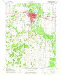
(10)- 1911 Map of Sumner, 1954 Print
 1911 Sumner1954 Print · USGSSoutheast Illinois at the dawn of the twentieth century was a landscape of bustling rail towns and ubiquitous country schools. Genealogists can locate family-named landmarks and long-lost rural centers like Berryville, the Oil Tanks of Bridgeport, and Frogeye School.
 - 1913 Map of Sumner
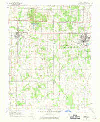
 1913 Sumner1913 Print · USGSThe rural landscape of Lawrence and Richland counties is captured here just before the First World War, centered on the BALTIMORE AND OHIO SOUTHWESTERN rail line. Genealogists can locate numerous rural schools like Frogeye School and Buckhorn School or trace the early Oil Tanks near Bridgeport.2 unique versions available
 - 1915 Map of Vincennes
 1915 Vincennes1915 Print · USGSThe Wabash River valley comes to life in this early twentieth-century survey of the Illinois-Indiana border. Genealogists can trace family roots through numerous rural landmarks like St Francisville, the Sand Barrens School, and Adams Corners.5 unique versions available
 - 1944 Map of Vincennes, 1958 Print
 1944 Vincennes1958 Print · USGSThe Wabash River valley during the mid-1940s reveals a landscape of river-town commerce and rural school districts. Genealogists can trace family roots through numerous sites like St Thomas church, the Bunker Hill School, and the small settlement at Billett.
 - 1956 Map of Vincennes, 1967 Print
 1956 Vincennes1967 Print · USGSSouthern Indiana and the Illinois borderlands are captured here in the mid-fifties, showing the region's dense network of river towns and rail lines. Researchers can trace historic river crossings along the Wabash River or locate landmarks like Wyandotte Cave and Lincoln State Park.4 unique versions available
 - 1957 Map of Vincennes
 1957 Vincennes1957 Print · USGSSouthwest Indiana and the Illinois borderlands come alive in the late 1950s, a period of heavy rail traffic and expanding state forests. Genealogists and historians can trace the riverfronts and rail lines of Vincennes, New Harmony, and the vast Crane Naval Ammunition Depot.
 - 1958 Map of Vincennes
 1958 Vincennes1958 Print · USGSSouthern Indiana and the Illinois borderlands are captured during a mid-century period of heavy rail traffic and military activity. Researchers can trace the sprawling bounds of the Crane Naval Ammunition Depot or locate historic settlements like New Harmony and French Lick.2 unique versions available
 - 1965 Map of Lawrenceville, 1966 Print
 1965 Lawrenceville1966 Print · USGSLawrence County in the mid-1960s reveals a hardworking landscape of rail junctions, industrial refineries, and quiet country churches. Researchers can locate family roots at Hollister Cem, trace the New York Central line, or find vanished schoolhouses like Band Ridge Sch.2 unique versions available
 - 1968 Map of Sumner, 1970 Print
 1968 Sumner1970 Print · USGSLawrence County saw a landscape of steady production and rural community in the late sixties, anchored by the industrial corridor between Sumner and Bridgeport. Researchers can locate numerous family landmarks, from Washington Sch to local cemeteries like Mt Zion Cem and Spring Hill Cem.
 - 1986 Map of Vincennes
 1986 Vincennes1986 Print · USGSThe Wabash River valley in the mid-1980s shows a landscape defined by deep-rooted river towns and heavy industry. Researchers can trace the legacy of regional rail lines like the Conrail system or locate landmarks such as Vincennes University and St Francisville Church.2 unique versions available
End of results
Showing maps 1-10 of 10
Top cities near Bridgeport
- Vincennes historical maps
- Lawrenceville historical maps
- Sumner historical maps
- Allendale historical maps
- Flat Rock historical maps
- Hazleton historical maps
See more
Frequently asked questions
- What are the different types of historical maps available for Bridgeport?
- What is the oldest map of Bridgeport?
- Where can I purchase historical maps of Bridgeport for my home or office?
- Where can I download high-res historical maps of Bridgeport?
- Are there historical topographic maps available for Bridgeport?
- Is there historical aerial imagery available for Bridgeport?
- Where are historical maps of Bridgeport sourced from?