1960s Maps of Wonder Lake, Illinois
Explore 5 historic maps of Wonder Lake from the 1960s. These maps offer a rare glimpse into what life looked like during the 1960s — showing old roads, neighborhoods, homes, and landmarks that have changed or disappeared over time.
Whether you're researching your family's past, planning a metal detecting trip, or studying how Wonder Lake's landscape evolved across the 1960s, these high-resolution maps are a powerful tool for exploring the history of this region.
- Focus on a specific era: All maps on this page are from the 1960s, giving you a focused view of this time period.
- See what’s changed: Compare century-old streets, trails, and buildings to today's modern landscape using overlays and satellite layers.
- Research with precision: Use these maps for genealogy, historical research, land use analysis, or educational projects.
- View, download, or print: Maps are fully viewable online in high resolution, and can be downloaded or printed for your own records.
Start exploring Wonder Lake's history through authentic maps from the 1960s. This is your window into the past.
Wonder Lake, IL maps
(5)- 1963 Map of Rockford
 1963 Rockford1963 Print · USGSThe mid-century industrial corridor along the Rock River is shown here during a period of rapid post-war growth. Researchers can trace the extensive rail lines of the Chicago and North Western or locate local landmarks like the Rockford Ordnance Depot and Holy Hill.
 - 1963 Map of Hebron, 1964 Print
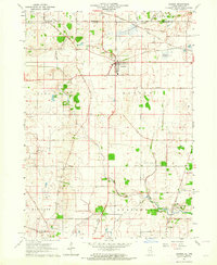 1963 Hebron1964 Print · USGSNorthern McHenry County sits at a crossroads of rail and rural life in the early sixties. Genealogists can trace family-named routes like Jankowski Road or locate ancestors at Linn-Hebron Cem and St Patricks Ch.2 unique versions available
 - 1963 Map of Richmond, 1964 Print
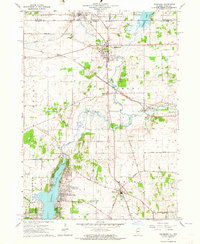 1963 Richmond1964 Print · USGSThe Illinois-Wisconsin borderlands come alive in the early sixties, showing the growth of Wonder Lake alongside established rail towns. Genealogists can trace family names at St Josephs Cem and Carr-Harrison Cem or locate the old Harrison Sch.3 unique versions available
 - 1963 Map of McHenry, 1964 Print
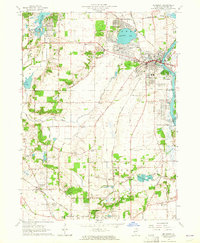 1963 McHenry1964 Print · USGSMcHenry County at the start of the 1960s shows a landscape of lakeside settlements and river-valley farms. Trace family roots at Holcombville Cem or Ridgefield Cem, and locate early landmarks like St Joseph Seminary and the Chicago and North Western rail line.3 unique versions available
 - 1963 Map of Woodstock, 1964 Print
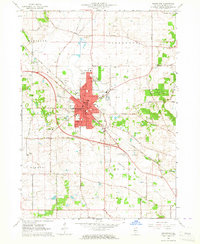 1963 Woodstock1964 Print · USGSWoodstock and the surrounding McHenry County countryside are captured in the early sixties as the city expanded along the Chicago and North Western tracks. Researchers can locate vanished rural landmarks and family burial sites like Scandinavian Cem, Olson Cem, and the Westwood Sch.3 unique versions available
End of results
Showing maps 1-5 of 5
Top cities near Wonder Lake
- Crystal Lake historical maps
- Algonquin historical maps
- Lake in the Hills historical maps
- McHenry historical maps
- Woodstock historical maps
- Cary historical maps
See more
Top neighborhoods of Wonder Lake
Frequently asked questions
- What are the different types of historical maps available for Wonder Lake?
- What is the oldest map of Wonder Lake?
- Where can I purchase historical maps of Wonder Lake for my home or office?
- Where can I download high-res historical maps of Wonder Lake?
- Are there historical topographic maps available for Wonder Lake?
- Is there historical aerial imagery available for Wonder Lake?
- Where are historical maps of Wonder Lake sourced from?