1900s (20th Century) Maps of Rice, Illinois
Explore 6 historic maps of Rice from the 1900s (20th Century). These maps offer a rare glimpse into what life looked like during the 1900s — showing old roads, neighborhoods, homes, and landmarks that have changed or disappeared over time.
Whether you're researching your family's past, planning a metal detecting trip, or studying how Rice's landscape evolved across the 1900s, these high-resolution maps are a powerful tool for exploring the history of this region.
- Focus on a specific era: All maps on this page are from the 1900s, giving you a focused view of this time period.
- See what’s changed: Compare century-old streets, trails, and buildings to today's modern landscape using overlays and satellite layers.
- Research with precision: Use these maps for genealogy, historical research, land use analysis, or educational projects.
- View, download, or print: Maps are fully viewable online in high resolution, and can be downloaded or printed for your own records.
Start exploring Rice's history through authentic maps from the 1900s. This is your window into the past.
Rice, IL maps
(6)- 1924 Map of Pinckneyville, 1958 Print
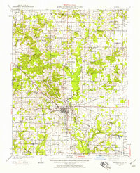 1924 Pinckneyville1958 Print · USGSPerry County at the height of its rail and coal era is captured here, centered on the bustling junction of Pinckneyville. Genealogists can locate dozens of country schools like St Marys School and Slade School, or trace family mines such as Panther Mine.2 unique versions available
 - 1926 Map of Pinckneyville
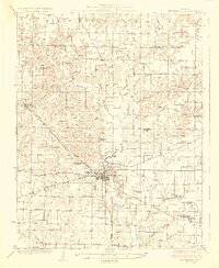 1926 Pinckneyville1926 Print · USGSPerry County at the height of the mid-twenties coal era shows a bustling landscape of rail-connected towns and rural school districts. Genealogists and historians can trace family locations near Pinckneyville at Carr School, Oak Grove Church, and the Victory Coal Mine.2 unique versions available
 - 1958 Map of Belleville, 1973 Print
 1958 Belleville1973 Print · USGSSouthern Illinois during the mid-twentieth century reveals a landscape of industrial growth and massive new reservoirs. Genealogists and historians can trace the paths of the Illinois Central RR through towns like Centralia or locate landmarks such as Emerald Mound and the Looking Glass Prairie.3 unique versions available
 - 1962 Map of Belleville
 1962 Belleville1962 Print · USGSSouthern Illinois in the late fifties reveals a landscape of industrial growth and ancient landmarks before the full expansion of the interstate system. Genealogists can trace family names and rural post offices near Centralia, Salem, and the historic Monks Mound.
 - 1974 Map of Winkle, 1978 Print
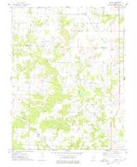 1974 Winkle1978 Print · USGSPerry County and Washington County are captured in the mid-1970s, showing a rural landscape defined by the Illinois Central Gulf railroad. Researchers can locate family landmarks like Pilot Knob Cem, Bethel Ch, and the small settlement of Winkle.
 - 1985 Map of Pinckneyville
 1985 Pinckneyville1985 Print · USGSSouthern Illinois in the mid-eighties shows a landscape of prairie farms, coal extraction, and vital rail corridors. Researchers can trace the rail-side growth of Venedy Station and New Memphis Station or locate landmarks like St Libory Church and Memorial Gardens Cem.2 unique versions available
End of results
Showing maps 1-6 of 6
Top cities near Rice
- Du Quoin historical maps
- Pinckneyville historical maps
- Nashville historical maps
- Okawville historical maps
- Coulterville historical maps
- Percy historical maps
See more
Frequently asked questions
- What are the different types of historical maps available for Rice?
- What is the oldest map of Rice?
- Where can I purchase historical maps of Rice for my home or office?
- Where can I download high-res historical maps of Rice?
- Are there historical topographic maps available for Rice?
- Is there historical aerial imagery available for Rice?
- Where are historical maps of Rice sourced from?