Old Maps of Horton, Illinois for Genealogy
Trace your family roots with 13 historic maps of Horton. These high-res maps reveal old neighborhoods, homesites, landmarks, and streets — helping you uncover where your ancestors lived and how the area evolved over time.
- Explore historic neighborhoods: Identify where your relatives may have lived in the 1800s or 1900s.
- Compare maps over time: Trace the changes in streets, buildings, and landmarks for multi-generational research.
- Perfect for genealogy & ancestry research: Used by family historians and researchers to map out lineage and migration.
These maps are an incredible resource for exploring your personal connection to Horton's past.
Horton, IL maps
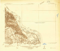
(13)- 1931 Map of Barry
 1931 Barry1931 Print · USGSPike County bottomlands along the Mississippi River are shown here in the late twenties and early thirties, just as drainage projects transformed the landscape. Genealogists and local historians can trace rural school locations like Guss Sch and Munger Sch, or find family burials at Money Cem and Blackjack Cem.
 - 1936 Map of Barry
 1936 Barry1936 Print · USGSThe Mississippi River valley in the mid-1930s reveals a complex network of island chutes and railroad settlements. Genealogists and historians can trace old river crossings like Stouts Ford and find vanished local school districts such as Love Sch and Hawk Creek Sch.2 unique versions available
 - 1944 Map of Barry
 1944 Barry1944 Print · USGSPike County's river-bottoms and bluffs are captured here in the mid-1940s, showing the complex interaction between the river and the rail lines. Genealogists and local historians can trace rural school locations like Wilke Chapel Sch and Buckeye Sch, or explore old landings such as Cincinnati Landing.2 unique versions available
 - 1948 Map of Quincy
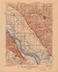
 1948 Quincy1948 Print · USGSThe Mississippi and Illinois River valleys are captured at a post-war crossroads as rail and river travel met the expanding highway system. Genealogists can trace family settlements from Quincy to Hannibal and smaller towns like Vandalia and Jerseyville.2 unique versions available
 - 1956 Map of Quincy, 1967 Print
 1956 Quincy1967 Print · USGSThe river and rail corridors of the Illinois-Missouri border are documented here during the mid-1950s. Researchers can trace historic river landings and regional transit hubs from Quincy and Hannibal to smaller settlements like Meredosia and Roodhouse.3 unique versions available
 - 1978 Map of Rockport
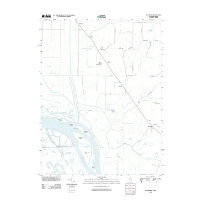
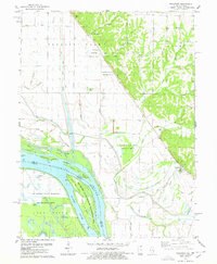 1978 Rockport1978 Print · USGSThe Mississippi River bottomlands in the late seventies reveal an intricate network of drainage ditches and family-owned lands near Rockport. Researchers can trace old cemeteries like Hornback Cem, find the Stillhouse landmark, and explore the islands of the Ted Shanks State Wildlife Management Area.
 - 1986 Map of Quincy
 1986 Quincy1986 Print · USGSThe tri-state border region along the Mississippi River comes into focus during the mid-1980s. Researchers can trace the legacy of river towns and rail hubs like Quincy and Monroe City or locate landmarks such as Mount Olive Cem.2 unique versions available
 - 1991 Map of Rockport, 1995 Print
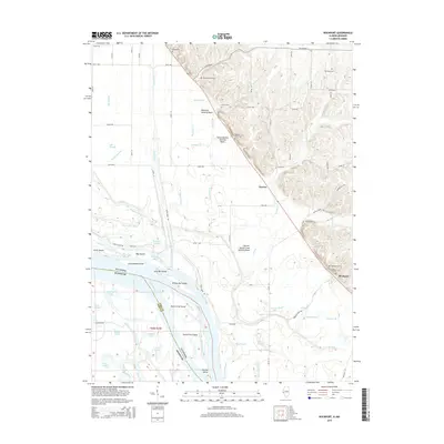
 1991 Rockport1995 Print · USGSThe Mississippi River bottomlands near Rockport appear here in the early nineties, showing a complex network of levees and conservation lands. Trace local family history and rural geography through Brewster Cem, the Stillhouse, and The Sny.
 - 2012 Map of Rockport, 2012 Print
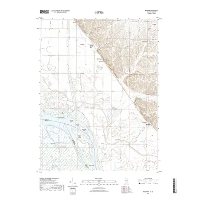
 2012 Rockport2012 Print · USGSCovers Horton, including El Dara, Rockport, and other nearby areas
 - 2015 Map of Rockport, 2015 Print
 2015 Rockport2015 Print · USGSCovers Horton, including El Dara, Rockport, and other nearby areas
 - 2018 Map of Rockport, 2018 Print
 2018 Rockport2018 Print · USGSCovers Horton, including El Dara, Rockport, and other nearby areas
 - 2021 Map of Rockport, 2021 Print
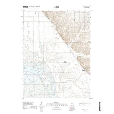 2021 Rockport2021 Print · USGSCovers Horton, including El Dara, Rockport, and other nearby areas
 - 2024 Map of Rockport, 2024 Print
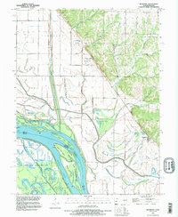
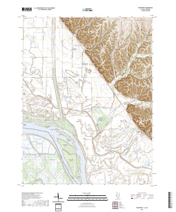 2024 Rockport2024 Print · USGSModern Pike County river life meets deep family roots in this recent survey of the Illinois riverbanks. Researchers can trace land tracts near the Mississippi River and locate secluded family plots like Wallace Farm Cem and Samuel Taylor Cem.
End of results
Showing maps 1-13 of 13
Top cities near Horton
- Bowling Green historical maps
- Pittsfield historical maps
- Louisiana historical maps
- Barry historical maps
- Pleasant Hill historical maps
- Atlas historical maps
See more
Frequently asked questions
- What are the different types of historical maps available for Horton?
- What is the oldest map of Horton?
- Where can I purchase historical maps of Horton for my home or office?
- Where can I download high-res historical maps of Horton?
- Are there historical topographic maps available for Horton?
- Is there historical aerial imagery available for Horton?
- Where are historical maps of Horton sourced from?