Old Maps of Pearl, Illinois
Explore 17 old maps of Pearl, spanning from 1930 to today. These high-resolution historic maps reveal how streets, neighborhoods, landmarks, and natural features evolved over time — perfect for genealogy, metal detecting, research, and local history exploration.
What you can do with these maps:
- See how Pearl changed over time: Compare historical maps to modern-day views to trace roads, homesites, rail lines & more.
- View detailed metadata: Each map includes creators, publishers, year, scale, and archive source.
- Overlay maps with satellite & LiDAR: Visualize the past alongside modern tools to explore terrain & human change.
- Trusted historical sources: Maps sourced from the USGS, Library of Congress, and other archives.
- Access maps your way: View online, download high-res files, or order prints for personal or research use.
Start exploring old maps of Pearl to uncover forgotten places, hidden landmarks, and the deep history beneath your feet.
Pearl, IL maps
(17)- 1930 Map of Pearl
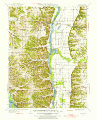
 1930 Pearl1930 Print · USGSThe Illinois River valley in the late 1920s shows a landscape of river-bottom farms and rugged bluff-top settlements. Genealogists can locate family landmarks like Miller Cem, Farmers Ridge Ch, and schools such as Summit Grove Sch or Village Green Sch.3 unique versions available
 - 1948 Map of Quincy
 1948 Quincy1948 Print · USGSThe Mississippi and Illinois River valleys are captured at a post-war crossroads as rail and river travel met the expanding highway system. Genealogists can trace family settlements from Quincy to Hannibal and smaller towns like Vandalia and Jerseyville.2 unique versions available
 - 1950 Map of Pearl, 1956 Print
 1950 Pearl1956 Print · USGSThe Illinois River valley in the mid-1950s reveals a landscape of river-bottom farms and bluff-side settlements. Local researchers can trace family roots through numerous rural landmarks like Farmers Ridge Ch, Miller Cem, and Robley Sch.
 - 1956 Map of Quincy, 1967 Print
 1956 Quincy1967 Print · USGSThe river and rail corridors of the Illinois-Missouri border are documented here during the mid-1950s. Researchers can trace historic river landings and regional transit hubs from Quincy and Hannibal to smaller settlements like Meredosia and Roodhouse.3 unique versions available
 - 1980 Map of Pearl East, 1981 Print
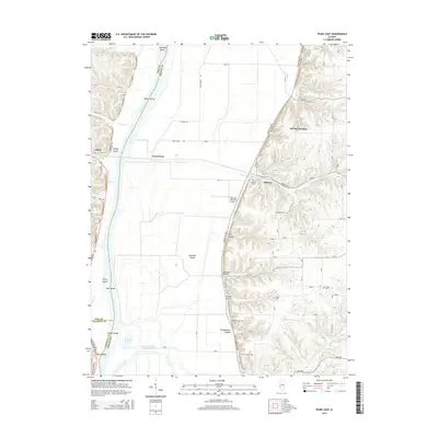
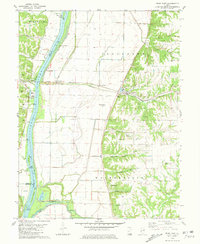 1980 Pearl East1981 Print · USGSGreene County bottomlands and bluffs come alive in this early 1980s survey of the Illinois River valley. Genealogists can trace family burial sites like Likely Cem and Kinser Cem while historians follow the Illinois Central Gulf rail line through Hillview.
 - 1980 Map of Pearl West, 1981 Print
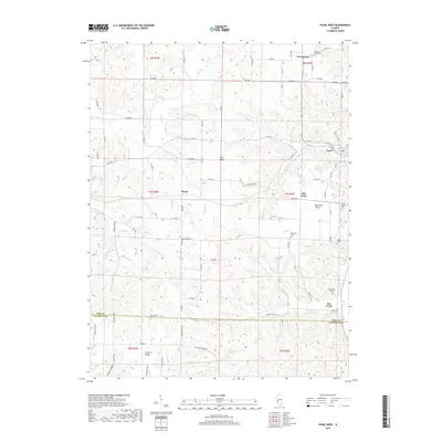
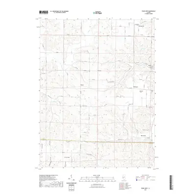
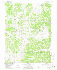 1980 Pearl West1981 Print · USGSThe Pike and Calhoun county line comes alive in this late twentieth-century study of the ridges and hollows near the Illinois River. Genealogists and historians can trace family ties at McConnell Cem and Hess Cem or locate the site of Old Pearl.
 - 1985 Map of Jerseyville
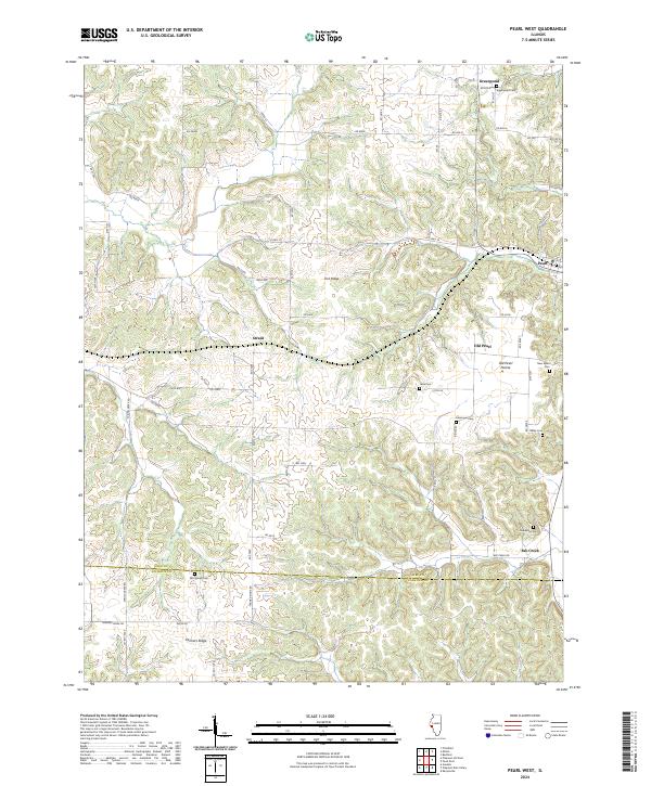
 1985 Jerseyville1985 Print · USGSThe confluence of the Illinois and Mississippi rivers defines this 1980s landscape of fertile bottomlands and rail-hub towns. Genealogists and historians can trace the foundations of communities like Jerseyville and White Hall alongside the Oak Grove Cem and St Mary Church.2 unique versions available
 - 2012 Map of Pearl West, 2012 Print
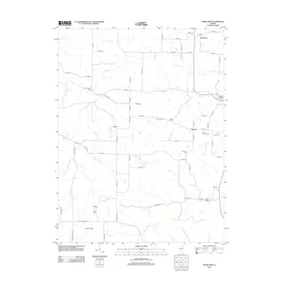 2012 Pearl West2012 Print · USGSCovers Pearl, including Greenpond, Straut, and other nearby areas
 - 2012 Map of Pearl East, 2012 Print
 2012 Pearl East2012 Print · USGSCovers Pearl, including Hillview, Grand Pass, and other nearby areas
 - 2015 Map of Pearl West, 2015 Print
 2015 Pearl West2015 Print · USGSCovers Pearl, including Greenpond, Straut, and other nearby areas
 - 2015 Map of Pearl East, 2015 Print
 2015 Pearl East2015 Print · USGSCovers Pearl, including Hillview, Grand Pass, and other nearby areas
 - 2018 Map of Pearl West, 2018 Print
 2018 Pearl West2018 Print · USGSCovers Pearl, including Greenpond, Straut, and other nearby areas
 - 2018 Map of Pearl East, 2018 Print
 2018 Pearl East2018 Print · USGSCovers Pearl, including Hillview, Grand Pass, and other nearby areas
 - 2021 Map of Pearl West, 2021 Print
 2021 Pearl West2021 Print · USGSCovers Pearl, including Greenpond, Straut, and other nearby areas
 - 2021 Map of Pearl East, 2021 Print
 2021 Pearl East2021 Print · USGSCovers Pearl, including Hillview, Grand Pass, and other nearby areas
 - 2024 Map of Pearl West, 2024 Print
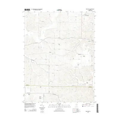
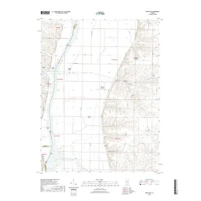
 2024 Pearl West2024 Print · USGSPike and Calhoun counties are captured here in the contemporary era, showing the transition from the river bluffs to the prairie. Researchers can locate numerous family burial sites like Kessinger Cem and Hess Cem or trace the rural routes connecting Straut and Farmers Ridge.
 - 2024 Map of Pearl East, 2024 Print
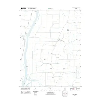
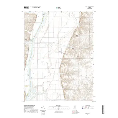
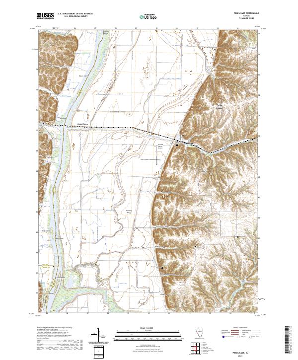 2024 Pearl East2024 Print · USGSThis part of the Illinois River valley shows a landscape of bluffs and bottomlands in the 2020s. Researchers can locate family-named burial sites like Bridgewater Cem and Sweeten Cem or trace the geography of the Hartwell Ranch and McClay Orchard.
End of results
Showing maps 1-17 of 17
Top cities near Pearl
- Pittsfield historical maps
- Carrollton historical maps
- White Hall historical maps
- Winchester historical maps
- Patterson historical maps
- Montezuma historical maps
See more
Frequently asked questions
- What are the different types of historical maps available for Pearl?
- What is the oldest map of Pearl?
- Where can I purchase historical maps of Pearl for my home or office?
- Where can I download high-res historical maps of Pearl?
- Are there historical topographic maps available for Pearl?
- Is there historical aerial imagery available for Pearl?
- Where are historical maps of Pearl sourced from?