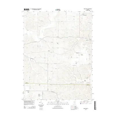
2015 Map of Pearl West
USGS Topo · Published 2015About this map
Old Pearl and the nearby Old Pearl Prairie anchor this rural landscape in eastern Pike County near the Calhoun County line. The terrain is defined by a dense network of watercourses, including the meandering Bay Creek and Hill Creek, which carve through the elevations of Tick Ridge. Small settlements like Straut and Greenpond are connected by a grid of local roads, such as County Highway 10 and Bee Creek Road. Genealogists will find a significant concentration of family and community burial grounds, including the Green Pond Cemetery, McConnell Cemetery, and Kessinger Cemetery, marking the long-established agricultural heritage of this Mississippi River valley hinterland.
Find a feature on this map
54 named features on this map. Tap any name to fly to it.
Don’t see what you’re looking for? This feature index may not catch every label — zoom into the map to look around manually.
Map Details
Editions of this 2015 Pearl West Map
This is the sole edition of this map. No revisions or reprints were ever made.
Other maps of this area

1924 · Griggsville
USGS Topo · 1:62,500

1926 · Griggsville
USGS Topo · 1:62,500

1926 · Pittsfield
USGS Topo · 1:62,500

1930 · Pearl
USGS Topo · 1:62,500

1930 · Nebo
USGS Topo · 1:62,500

1934 · Nebo
USGS Topo · 1:48,000

1942 · Nebo
USGS Topo · 1:62,500

1948 · Quincy
USGS Topo · 1:250,000

1950 · Pearl
USGS Topo · 1:62,500

1956 · Quincy
USGS Topo · 1:250,000