
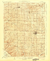
1926 Map of Pittsfield
USGS Topo · Published 1926About this map
Pittsfield serves as the central hub of Pike County in the mid-1920s, showing a well-established grid of streets and institutional landmarks like the County Infirmary. The landscape is defined by the Wabash railroad, which arcs across the northern and eastern sections of the county, connecting smaller hamlets like Baylis, New Salem, and Maysville Sta. to the broader regional economy. This era represents a peak for the rural educational system, with nearly every section of land supported by its own local schoolhouse, such as the Starkey School, Kurtwright School, and Teneriffe School.
Find a feature on this map
73 named features on this map. Tap any name to fly to it.
Don’t see what you’re looking for? This feature index may not catch every label — zoom into the map to look around manually.
Map Details
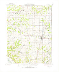
Editions of this 1926 Pittsfield Map
3 editions found
Other maps of this area

1890 · Louisiana
USGS Topo · 1:125,000

1924 · Griggsville
USGS Topo · 1:62,500

1925 · Liberty
USGS Topo · 1:62,500

1926 · Griggsville
USGS Topo · 1:62,500

1926 · Mt Sterling
USGS Topo · 1:62,500

1927 · Liberty
USGS Topo · 1:62,500

1928 · Meredosia
USGS Topo · 1:62,500

1929 · Mt Sterling
USGS Topo · 1:62,500

1930 · Pearl
USGS Topo · 1:62,500

1930 · Nebo
USGS Topo · 1:62,500