
1924 Map of Griggsville
USGS Topo · Published 1959About this map
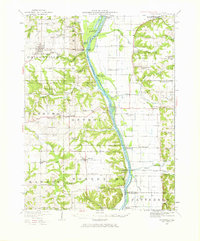
Griggsville stands as a primary hub of western Illinois commerce in the early 1920s, anchored by the Wabash RR that cuts across the northern landscape through Valley City and across the Illinois River. This survey captures the region's dense network of rural school districts, including uniquely named sites like Brush College School, Coon Island School, and Tollgate School. The river valley is a hive of activity with Naples, Florence, and the Ferry landing serving as vital points of connection between Pike and Scott counties.
Find a feature on this map
77 named features on this map. Tap any name to fly to it.
Don’t see what you’re looking for? This feature index may not catch every label — zoom into the map to look around manually.
Map Details
Editions of this 1924 Griggsville Map
2 editions found
Other maps of this area

1924 · Winchester
USGS Topo · 1:48,000

1924 · Roodhouse
USGS Topo · 1:62,500

1926 · Griggsville
USGS Topo · 1:62,500

1926 · Pittsfield
USGS Topo · 1:62,500

1926 · Winchester
USGS Topo · 1:62,500

1926 · Roodhouse
USGS Topo · 1:62,500

1926 · Mt Sterling
USGS Topo · 1:62,500

1928 · Meredosia
USGS Topo · 1:62,500

1929 · Mt Sterling
USGS Topo · 1:62,500

1929 · Arenzville
USGS Topo · 1:62,500