Old Maps of New Grand Chain, Illinois for Hiking & Exploration
Hike through history with 40 historic maps of New Grand Chain. Explore old trails, ghost towns, and forgotten backroads — perfect for outdoor adventurers and local explorers.
- Rediscover forgotten places: Map out old mining camps, roads, and footpaths that no longer exist on modern maps.
- Layer with modern tools: Combine with LiDAR or satellite views to plan hikes through historical terrain.
- Made for exploration: Popular among hikers, overlanders, and local history lovers.
Use these maps to find adventure and explore the hidden past of New Grand Chain.
New Grand Chain, IL maps
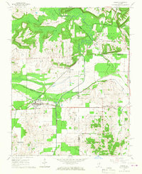
(40)- 1918 Map of Vienna, 1943 Print
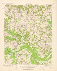
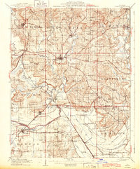 1918 Vienna1943 Print · USGSJohnson and Massac Counties appear here during the height of the steam rail era, centered on the crossroads of VIENNA. Local historians can trace old rural schoolhouses like Taylor School, family sites at Oliver Cemetery, and early settlements such as Ganntown and Samoth.
 - 1919 Map of Vienna
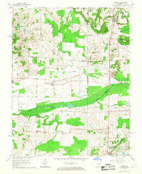
 1919 Vienna1919 Print · USGSSouthern Illinois during the late teens reveals a landscape defined by extensive drainage engineering and a high density of rural schools. Genealogists can trace family roots at Oliver Cemetery or locate early rural schoolhouses like Peach School and Whiteside School.
 - 1920 Map of Dongola, 1953 Print
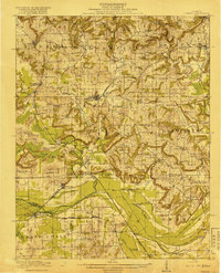
 1920 Dongola1953 Print · USGSSouthern Illinois at the close of the 1910s reveals a landscape of river-bottom farms and busy rail junctions. Genealogists can trace family roots through dozens of local landmarks like Beech Grove School, Joppa Junction, and the State Hospital.3 unique versions available
 - 1923 Map of Dongola
 1923 Dongola1923 Print · USGSSouthern Illinois in the early twenties reveals a landscape of marshy river bottoms and upland family farms. Researchers can trace ancestral locations through dozens of named rural sites like St Johns Church, Egypt School, and Hoppa Junction.2 unique versions available
 - 1931 Map of Cairo, 1954 Print
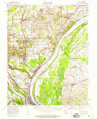
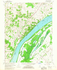
 1931 Cairo1954 Print · USGSSouthern Illinois and western Kentucky meet at the great river confluence during the late 1920s and early 1930s. Genealogists can trace family footprints through numerous rural landmarks like Pleasant Hill Sch, the National Cem, and the riverfront at Mound City.2 unique versions available
 - 1933 Map of Cairo
 1933 Cairo1933 Print · USGSThe tri-state confluence of the Ohio and Mississippi rivers comes alive in the early 1930s, showing the vital rail and river hubs of Cairo and Mound City. Genealogists can pinpoint rural life through dozens of named sites like Bethlehem Ch, Rife Sch, and the National Cem.3 unique versions available
 - 1939 Map of Cairo, 1945 Print
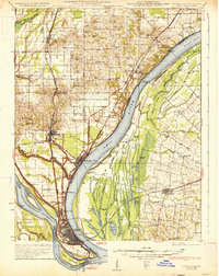
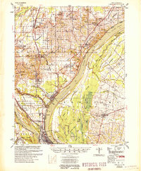
 1939 Cairo1945 Print · USGSThe confluence of the great American rivers in the late 1930s shows an era defined by massive levee engineering and rail-to-river commerce. Genealogists and historians can trace the footprint of riverfront communities like Mound City and Urbandale or locate family schools such as Valley Recluse Sch and Ohio Sch.
 - 1942 Map of Vienna, 1958 Print
 1942 Vienna1958 Print · USGSSouthern Illinois hill country and the Cache River lowlands are shown here during the early 1940s, highlighting a landscape of rail-connected towns and rural school districts. Researchers can trace family roots through numerous sites like Oliver Cemetery, Tall Tree School, and the Crossroads Store.2 unique versions available
 - 1949 Map of Paducah
 1949 Paducah1949 Print · USGSThe confluence of the Ohio, Mississippi, Tennessee, and Cumberland rivers at the close of the 1940s reveals a region bound by water and rail. Researchers can trace historic river landings, timberlands in the Shawnee National Forest, and the coal-mining infrastructure around West Frankfort and Herrin.2 unique versions available
 - 1950 Map of Paducah
 1950 Paducah1950 Print · USGSThe confluence of the great midwestern rivers defines this mid-century landscape at the intersection of Illinois, Kentucky, and Missouri. Genealogists and historians can trace the rail-and-river economy through the hubs of Paducah, Cairo, and Metropolis or locate family roots near the Wildcat Hills.
 - 1953 Map of Cairo, 1959 Print
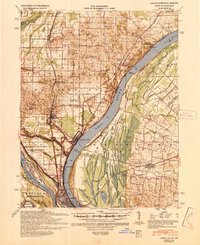
 1953 Cairo1959 Print · USGSThe confluence of the Ohio and Mississippi Rivers is captured here in the mid-1950s, showing a landscape defined by floodgates and rail lines. Researchers can trace the layout of Cairo, find family plots at Hazelwood Cem, or locate landmarks like the National Cemetery and Cairo Airport.3 unique versions available
 - 1954 Map of Paducah
 1954 Paducah1954 Print · USGSSouthern Illinois and Western Kentucky intersect at the great river confluences during this mid-century era of rail and river industry. Genealogists and historians can trace family roots and commerce through river towns like Cairo, Metropolis, and Golconda, or along the tracks of the Illinois Central Railroad.2 unique versions available
 - 1954 Map of Olmsted, 1955 Print
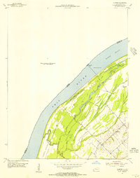 1954 Olmsted1955 Print · USGSThe Ohio River borderlands at the mid-century reveal a landscape of river navigation and bottomland farming. Genealogists and historians can trace the settlement of Oscar and its local landmarks like Oscar Ch, New Hope Ch, and Lock and Dam No 53.
 - 1955 Map of Cairo
 1955 Cairo1955 Print · USGSThe confluence of the great rivers at the southern tip of Illinois is captured here in the mid-1950s. Trace the vital rail hubs of Cairo, explore the grounds of the National Cemetery, and locate vanished rural schools like America Sch and Bryan Sch.
 - 1961 Map of Paducah
 1961 Paducah1961 Print · USGSThe Lower Ohio Valley at mid-century is a landscape defined by its great rivers and newly formed reservoirs. Researchers can trace the riverfronts of Paducah and Metropolis, or locate smaller settlements like Old Shawneetown and Cave in Rock along the banks.2 unique versions available
 - 1964 Map of Paducah
 1964 Paducah1964 Print · USGSThe river-and-rail corridor of Southern Illinois and Western Kentucky is captured here during the height of the mid-century industrial era. Genealogists and researchers can trace local landmarks across several counties, from the rail yards of Paducah to the waters of Crab Orchard Lake and Kentucky Reservoir.2 unique versions available
 - 1966 Map of Karnak, 1967 Print
 1966 Karnak1967 Print · USGSThe confluence of three counties in southern Illinois comes alive in this mid-sixties survey, showcasing a landscape defined by the drainage of the Cache River. Trace the rail lines of the New York Central through Karnak or locate family sites like Miller Cem and West Eden Ch.3 unique versions available
 - 1966 Map of Cypress, 1967 Print
 1966 Cypress1967 Print · USGSSouthern Illinois river bottoms and rail lines come alive in the mid-1960s as the Chicago and Eastern Illinois railroad threads through these three-county borderlands. Genealogists can trace family roots through sites like Masonic Cem, Century Sch, and the unique Charcoal Ovens near White Hill.
 - 1967 Map of Olmsted, 1968 Print
 1967 Olmsted1968 Print · USGSThe Ohio River corridor comes alive in this 1960s survey of the Illinois-Kentucky border, showing the river-and-rail economy of the day. Genealogists can locate family sites like Lyerly Cem and Bethlehem Cem or trace the New York Central tracks through Olmsted.2 unique versions available
 - 1984 Map of Cape Girardeau, 1985 Print
 1984 Cape Girardeau1985 Print · USGSThe tri-state junction of Missouri, Illinois, and Kentucky in the mid-1980s was a bustling corridor defined by its massive river systems and complex rail lines. Researchers can trace the paths of the Missouri Pacific RR, explore the Shawnee National Forest, or locate small settlements like Marble Hill and Advance.
 - 1984 Map of Paducah, 1986 Print
 1984 Paducah1986 Print · USGSThe river-driven economy of western Kentucky and southern Illinois is captured here in the mid-eighties, showing the massive impact of the Kentucky Lake and Lake Barkley reservoirs. Genealogists and historians can trace rail lines like the Illinois Central Gulf RR and explore sites from Fort Massac State Park to the Kentucky State Penitentiary.
 - 1986 Map of Cape Girardeau
 1986 Cape Girardeau1986 Print · USGSThe Missouri-Illinois-Kentucky borderlands come into focus in the mid-1980s as the river-and-rail economy shapes the landscape near the Great Rivers confluence. Researchers can trace historic rail lines and old settlements like Gordonville, New Hamburg, and the Trail of Tears State Park.
 - 1986 Map of Paducah, 1987 Print
 1986 Paducah1987 Print · USGSThe tri-river confluence of the Ohio, Tennessee, and Cumberland rivers is captured here in the mid-1980s during a period of established river power and industry. Researchers can trace local heritage through landmarks like Friendship Church, the Smithland Locks and Dam, and the Illinois Central Gulf RR.
 - 1987 Map of Paducah, 1988 Print
 1987 Paducah1988 Print · USGSThe Lower Ohio Valley and the Illinois Ozarks come alive in this late twentieth-century regional survey. Genealogists and local historians can trace river-town roots and state park landmarks from Metropolis to Cape Girardeau and Trail of Tears State Park.
 - 2010 Map of Olmsted, 2010 Print
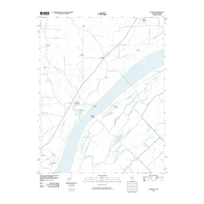 2010 Olmsted2010 Print · USGSCovers New Grand Chain, including Olmsted, America, and other nearby areas
Showing maps 1-25 of 40
Top cities near New Grand Chain
- Anna historical maps
- Cairo historical maps
- Vienna historical maps
- La Center historical maps
- Mounds historical maps
- Dongola historical maps
See more
Top neighborhoods of New Grand Chain
Frequently asked questions
- What are the different types of historical maps available for New Grand Chain?
- What is the oldest map of New Grand Chain?
- Where can I purchase historical maps of New Grand Chain for my home or office?
- Where can I download high-res historical maps of New Grand Chain?
- Are there historical topographic maps available for New Grand Chain?
- Is there historical aerial imagery available for New Grand Chain?
- Where are historical maps of New Grand Chain sourced from?