Old Maps of Springfield, Illinois for Academic Research
Study the evolution of Springfield with 55 high-resolution historic maps. Whether you're teaching, researching, or modeling changes in land use, these maps provide essential visual documentation of urban, environmental, and geographic change.
- Analyze long-term change: Track patterns in development, transportation, and natural features.
- Ideal for environmental or urban studies: Support academic projects with primary historical map data.
- Use in the classroom or lab: Educators and researchers rely on these maps to bring historical context to life.
These maps are a powerful tool for teaching, research, and visualizing how Springfield has changed over the decades.
Springfield, IL maps
(55)- 1907 Map of Springfield
 1907 Springfield1907 Print · USGSSpringfield and the Sangamon River valley are captured here in the early twentieth century as the region thrived on coal, rail, and state government. Researchers can locate ancestral sites at Camp Lincoln, Calvary Cemetery, and the State Fair Grounds.2 unique versions available
 - 1909 Map of Tallula
 1909 Tallula1909 Print · USGSCentral Illinois at the turn of the century shows a landscape defined by the Sangamon River and a dense rail network. Researchers can trace the early footprints of Pleasant Plains, Tallula, and Berlin, as well as several smaller stops along the Chicago and Alton RR.3 unique versions available
 - 1922 Map of Divernon, 1957 Print
 1922 Divernon1957 Print · USGSThe Sangamon County prairie in the early twenties was a landscape of bustling rail towns and one-room schoolhouses. Genealogists can trace family roots through dozens of local landmarks like Cotton Hill Academy, Stout Church, and the Illinois Traction System.
 - 1924 Map of Divernon
 1924 Divernon1924 Print · USGSSangamon County at the height of its rail-and-river era shows a landscape where agriculture and industry met along the South Fork Sangamon River. Researchers can trace the roots of vanished rural life through dozens of local landmarks like the Cotton Hill Academy, Zenobia, and Irwins Park.2 unique versions available
 - 1924 Map of Waverly
 1924 Waverly1924 Print · USGSCentral Illinois at the height of the rail era shows a landscape dotted with country schoolhouses and bustling farming hubs. Trace the path of the Illinois Traction and locate family sites near Mound Seminary School or McClain Church.2 unique versions available
 - 1926 Map of Waverly
 1926 Waverly1926 Print · USGSIn the mid-1920s, this portion of central Illinois was a bustling intersection of steam railroads and electric interurbans. Genealogists can trace the rural communities of Waverly, New Berlin, and Loami, alongside dozens of local landmarks like Rohrer Church and the Highwater Mark School.2 unique versions available
 - 1930 Map of Springfield
 1930 Springfield1930 Print · USGSSpringfield and its surrounding farming townships are seen here in the late twenties, captured as a vital crossroads of rail and road. Genealogists can locate family-named landmarks like Derry Farm and over two dozen country schools, including Crankneck Sch and American Hill Sch.3 unique versions available
 - 1940 Map of Tallula, 1956 Print
 1940 Tallula1956 Print · USGSCentral Illinois during the late thirties and early forties reveals a landscape of river-bluff history and active rail towns. Genealogists can trace family connections in Tallula, Salisbury, and Berlin, or locate the historic New Salem State Park.2 unique versions available
 - 1940 Map of Springfield, 1959 Print
 1940 Springfield1959 Print · USGSSpringfield and its surrounding townships appear here as a bustling pre-war rail and aviation center. Researchers can trace family roots through numerous rural schools like Locate Lane Sch or historical sites like Lindbergh Air Mail Field and Camp Butler Cem.2 unique versions available
 - 1950 Map of Springfield West
 1950 Springfield West1950 Print · USGSPost-war Springfield exhibits a complex network of railroads and civic institutions at the midpoint of the century. Trace family roots at Oak Ridge Cem or locate historic landmarks like the Lincoln Tomb and State Capitol.
 - 1950 Map of Springfield East
 1950 Springfield East1950 Print · USGSEast of the Illinois capital in the mid-twentieth century, a complex rail and river network shaped the landscape. Genealogists can trace family names through rural landmarks like St James Sch, Taylor Cem, and the U S Naval Training Sta.
 - 1958 Map of Decatur, 1971 Print
 1958 Decatur1971 Print · USGSCentral Illinois in the mid-twentieth century shows a landscape defined by industrial rail hubs and the creation of large reservoirs. Researchers can trace historic corridors like the Penn Central or locate landmarks such as Lincoln Log Cabin State Park and Lake Springfield.3 unique versions available
 - 1961 Map of New City
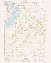 1961 New City1961 Print · USGSSangamon County at the start of the 1960s reveals a landscape balancing suburban growth near Southlawn with the rural traditions of Cotton Hill. Researchers can locate historic family sites like Brunk Cem, the village of New City, and the Baltimore and Ohio rail line.3 unique versions available
 - 1961 Map of Decatur
 1961 Decatur1961 Print · USGSCentral Illinois in the late fifties was a bustling corridor of rail lines and prairie commerce centered on the state capital. Genealogists and historians can trace the intricate connections between Springfield, Decatur, and dozens of smaller settlements like Nokomis and Arcola.2 unique versions available
 - 1961 Map of Chatham, 1962 Print
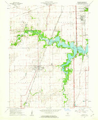 1961 Chatham1962 Print · USGSIn the early sixties, the area south of Springfield was a network of emerging suburbs and vital rail corridors centered around Chatham. Genealogists and historians can trace family landmarks like Stout Cem, local education at Glenwood Sch, and a rare Covered Bridge over Sugar Creek.3 unique versions available
 - 1965 Map of Springfield West, 1966 Print
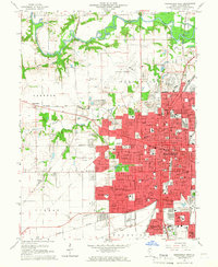 1965 Springfield West1966 Print · USGSMid-century Springfield is shown here as a bustling state capital and rail center during a period of significant suburban expansion. Researchers can pinpoint Lincolns Tomb, trace the many rail lines like the Illinois Terminal, and find dozens of local landmarks from the Illini Country Club to Oak Ridge Cemetery.3 unique versions available
 - 1965 Map of Springfield East, 1966 Print
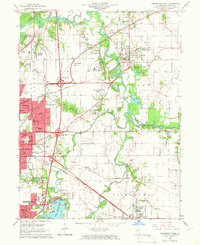 1965 Springfield East1966 Print · USGSThe eastern edges of Springfield and the Sangamon River valley are captured here in the mid-1960s during a period of infrastructure growth. Genealogists and local historians can trace family locations at Camp Butler Cem, find the rural Bissell Cem, or locate the historic St Johns Sanitarium.4 unique versions available
 - 1971 Map of Farmingdale, 1973 Print
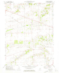 1971 Farmingdale1973 Print · USGSSangamon County remains a vital rail and farming corridor in the early seventies, centered on the village of Farmingdale. Researchers can locate historic landmarks like the Covered Bridge, New Salem Ch, and the Farmingdale Sch.
 - 1976 Map of Farmingdale, 1978 Print
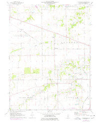 1976 Farmingdale1978 Print · USGSSangamon County farmland in the mid-1970s is shown in transition as rail corridors like the Baltimore and Ohio cross the prairie. Researchers can trace family history through sites like Farmingdale Cem, Riddle Hill, and the Farmingdale Sch.
 - 1981 Map of Loami, 1982 Print
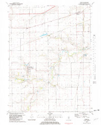 1981 Loami1982 Print · USGSSangamon County’s rural townships are documented here in the early eighties as a network of rail-side hamlets and family cemeteries. Trace the historical footprints of Loami and Curran, or locate heritage sites like Sulphur Springs Cem and Shelton Cem.
 - 1985 Map of Springfield
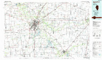 1985 Springfield1985 Print · USGSCentral Illinois during the mid-eighties shows a landscape of growing state capital influence and deep historical roots. Genealogists and historians can trace family sites near Oak Ridge Cem or follow the path of the Sangamon River past Williamsville and Riverton.2 unique versions available
 - 1998 Map of Chatham, 2000 Print
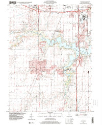 1998 Chatham2000 Print · USGSSangamon County near the end of the century shows a blend of suburban growth and lakeside recreation. Researchers can trace local landmarks like St Bernard Cem, the Covered Bridge on Sugar Creek, and the National Guard Depot.
 - 1998 Map of Springfield East, 2000 Print
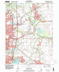 1998 Springfield East2000 Print · USGSThe eastern edges of the Illinois capital were well-established by the late nineties, balancing industry with expansive public parks. Genealogists and historians can trace the grounds of Camp Butler Cem, the St Johns Sanitarium, and the rail lines of the Illinois Central RR.
 - 1998 Map of New City, 2000 Print
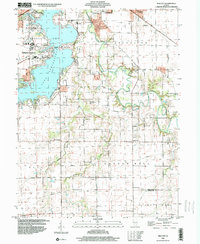 1998 New City2000 Print · USGSCentral Illinois during the late nineties shows a landscape of suburban growth and traditional farming. Genealogists can trace family names at Mottarville Cem or locate the rural crossroads of New City and Beamington near the Sangamon River.
 - 1998 Map of Springfield West, 2000 Print
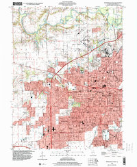 1998 Springfield West2000 Print · USGSSpringfield and its surrounding suburbs are shown in extensive detail during the late nineties as the capital city’s footprint expanded. Genealogists and historians can locate burials at Oak Ridge Cemetery, trace the Illinois Central RR, and explore the layout of Camp Lincoln.
Showing maps 1-25 of 55
Top cities near Springfield
- Woodside historical maps
- Chatham historical maps
- Auburn historical maps
- Sherman historical maps
- Riverton historical maps
- Rochester historical maps
See more
Top neighborhoods of Springfield
- Arlington Heights historical maps
- Devereux Heights historical maps
- Coleman historical maps
- Archer historical maps
- Hawthorne Place historical maps
- Southlawn historical maps
See more
Frequently asked questions
- What are the different types of historical maps available for Springfield?
- What is the oldest map of Springfield?
- Where can I purchase historical maps of Springfield for my home or office?
- Where can I download high-res historical maps of Springfield?
- Are there historical topographic maps available for Springfield?
- Is there historical aerial imagery available for Springfield?
- Where are historical maps of Springfield sourced from?