Old Maps of Raynor Park, Joliet
Explore 15 old maps of Raynor Park, spanning from 1892 to today. These high-resolution historic maps reveal how streets, neighborhoods, landmarks, and natural features evolved over time — perfect for genealogy, metal detecting, research, and local history exploration.
What you can do with these maps:
- See how Raynor Park changed over time: Compare historical maps to modern-day views to trace roads, homesites, rail lines & more.
- View detailed metadata: Each map includes creators, publishers, year, scale, and archive source.
- Overlay maps with satellite & LiDAR: Visualize the past alongside modern tools to explore terrain & human change.
- Trusted historical sources: Maps sourced from the USGS, Library of Congress, and other archives.
- Access maps your way: View online, download high-res files, or order prints for personal or research use.
Start exploring old maps of Raynor Park to uncover forgotten places, hidden landmarks, and the deep history beneath your feet.
Raynor Park, Joliet maps
(15)- 1892 Map of Joliet
 1892 Joliet1892 Print · USGSWill County at the end of the nineteenth century was a bustling intersection of canal trade and heavy rail. Genealogists can trace the early streets of Joliet and Lockport or locate long-standing rural landmarks like Caton Farm and Grinton.6 unique versions available
 - 1923 Map of Joliet
 1923 Joliet1923 Print · USGSJoliet and the Des Plaines River valley are shown here in the 1920s, a hub of heavy industry and vital shipping canals. Genealogists and local historians can trace family roots through numerous country schools like Spaulding School, the Du Page Church, and the expansive State Penitentiary Farm.5 unique versions available
 - 1954 Map of Joliet, 1955 Print
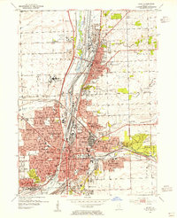 1954 Joliet1955 Print · USGSThe industrial heart of the Des Plaines River corridor comes alive in the mid-1950s. Trace the complex rail and canal networks through Lockport and Joliet, finding historic landmarks like Stateville State Prison and Lewis College.
 - 1954 Map of Joliet, 1960 Print
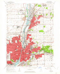
 1954 Joliet1960 Print · USGSMid-century Joliet and Plainfield are captured here during a period of heavy industrial and transit growth. Researchers can trace the alignment of the Lincoln Highway and find localized details like the State Prison Farm and Caton Farm.
 - 1958 Map of Aurora, 1969 Print
 1958 Aurora1969 Print · USGSNorthern Illinois in the late fifties shows a landscape of powerful river industry and expanding transport corridors. Genealogists and historians can trace the development of Aurora and Joliet or locate sites like the Elwood Ordnance Plant and Starved Rock.3 unique versions available
 - 1961 Map of Aurora
 1961 Aurora1961 Print · USGSNorthern Illinois at the height of the post-war era reveals a landscape of massive industrial works and thriving river towns. Genealogists and historians can trace the paths of the Lincoln Highway or locate long-standing landmarks like the Green River Ordnance Plant and Starved Rock State Park.
 - 1962 Map of Joliet, 1963 Print
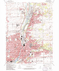
 1962 Joliet1963 Print · USGSGreater Joliet and Lockport are captured here in the early sixties, centered on the vital industrial corridor of the Des Plaines River. Researchers can trace the layouts of Stateville State Prison, the historic Illinois and Michigan Canal, and local neighborhoods like Lidice.3 unique versions available
 - 1985 Map of Aurora, 1989 Print
 1985 Aurora1989 Print · USGSNortheastern Illinois is captured in the mid-1980s as suburban growth began to bridge the gap between the Fox River cities and the outer prairies. Researchers can trace the development of Naperville and Aurora or locate rural landmarks like Fairview Cem and the Illinois and Michigan Canal.
 - 1993 Map of Joliet, 1994 Print
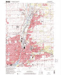
 1993 Joliet1994 Print · USGSJoliet and Lockport are shown at a peak of industrial and institutional development in the early 1990s. Researchers can trace historic cemeteries like Mt Olivet Cemetery or the footprints of the Stateville Correctional Center and the Lockport Locks.
 - 1998 Map of Joliet, 2001 Print
 1998 Joliet2001 Print · USGSJoliet and Lockport are shown at a peak of industrial and suburban development in the late nineties. Trace the canal-side heritage of the Joliet Steel Works and landmarks like Stateville Correctional Center or Brandon Locks.
 - 2012 Map of Joliet, 2012 Print
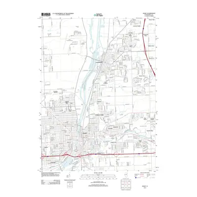 2012 Joliet2012 Print · USGSCovers Raynor Park, including Joliet, Romeoville, and other nearby areas
 - 2015 Map of Joliet, 2015 Print
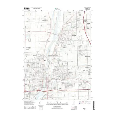 2015 Joliet2015 Print · USGSCovers Raynor Park, including Joliet, Romeoville, and other nearby areas
 - 2018 Map of Joliet, 2018 Print
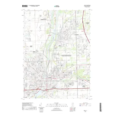 2018 Joliet2018 Print · USGSCovers Raynor Park, including Joliet, Romeoville, and other nearby areas
 - 2021 Map of Joliet, 2021 Print
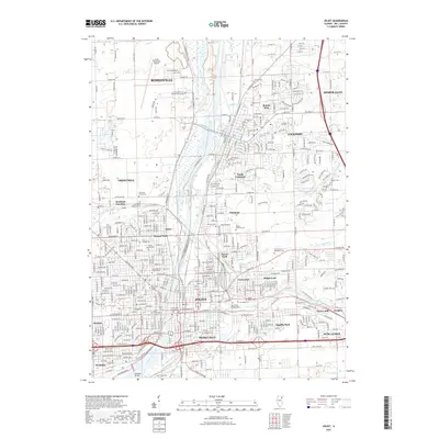 2021 Joliet2021 Print · USGSCovers Raynor Park, including Joliet, Romeoville, and other nearby areas
 - 2024 Map of Joliet, 2024 Print
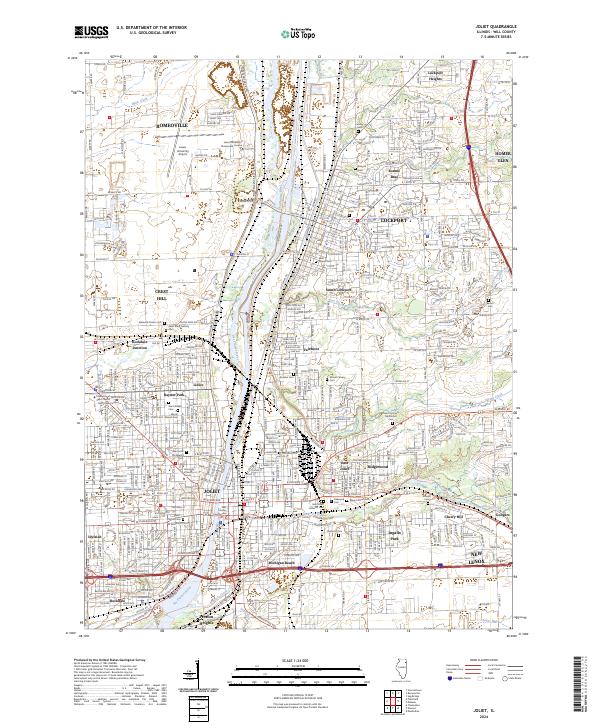 2024 Joliet2024 Print · USGSJoliet and the Des Plaines River valley are captured here in the early twenty-first century, showing the intersection of heavy river industry and suburban expansion. Genealogists and historians can locate numerous burial sites and landmarks like Stateville Prison Cem, the Will County Courthouse, and the campus of Lewis University.
End of results
Showing maps 1-15 of 15
Top cities near Raynor Park
- Chicago historical maps
- Aurora historical maps
- Joliet historical maps
- Naperville historical maps
- Bolingbrook historical maps
- Orland Park historical maps
See more
Frequently asked questions
- What are the different types of historical maps available for Raynor Park?
- What is the oldest map of Raynor Park?
- Where can I purchase historical maps of Raynor Park for my home or office?
- Where can I download high-res historical maps of Raynor Park?
- Are there historical topographic maps available for Raynor Park?
- Is there historical aerial imagery available for Raynor Park?
- Where are historical maps of Raynor Park sourced from?