1960s Maps of Herrin, Illinois
Explore 6 historic maps of Herrin from the 1960s. These maps offer a rare glimpse into what life looked like during the 1960s — showing old roads, neighborhoods, homes, and landmarks that have changed or disappeared over time.
Whether you're researching your family's past, planning a metal detecting trip, or studying how Herrin's landscape evolved across the 1960s, these high-resolution maps are a powerful tool for exploring the history of this region.
- Focus on a specific era: All maps on this page are from the 1960s, giving you a focused view of this time period.
- See what’s changed: Compare century-old streets, trails, and buildings to today's modern landscape using overlays and satellite layers.
- Research with precision: Use these maps for genealogy, historical research, land use analysis, or educational projects.
- View, download, or print: Maps are fully viewable online in high resolution, and can be downloaded or printed for your own records.
Start exploring Herrin's history through authentic maps from the 1960s. This is your window into the past.
Herrin, IL maps
(6)- 1961 Map of Paducah
 1961 Paducah1961 Print · USGSThe Lower Ohio Valley at mid-century is a landscape defined by its great rivers and newly formed reservoirs. Researchers can trace the riverfronts of Paducah and Metropolis, or locate smaller settlements like Old Shawneetown and Cave in Rock along the banks.2 unique versions available
 - 1963 Map of Johnston City, 1964 Print
 1963 Johnston City1964 Print · USGSSouthern Illinois coal country is in full operation during the early 1960s, showing a landscape shaped by rail and extraction. Researchers can trace the heritage of Johnston City and smaller hamlets like Dog Walk or locate family plots at Moake Cem and Fergus Cem.2 unique versions available
 - 1963 Map of West Frankfort, 1966 Print
 1963 West Frankfort1966 Print · USGSSouthern Illinois coal country is caught at a mid-century peak in this survey of Franklin and Williamson counties. Researchers can trace vanished rail spurs, family-named plots like Rea Cem, and mining sites from the Orient No 5 Mine to White Ash.
 - 1964 Map of Paducah
 1964 Paducah1964 Print · USGSThe river-and-rail corridor of Southern Illinois and Western Kentucky is captured here during the height of the mid-century industrial era. Genealogists and researchers can trace local landmarks across several counties, from the rail yards of Paducah to the waters of Crab Orchard Lake and Kentucky Reservoir.2 unique versions available
 - 1966 Map of Crab Orchard Lake, 1967 Print
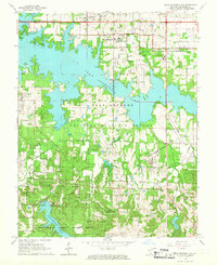 1966 Crab Orchard Lake1967 Print · USGSWilliamson County in the mid-sixties reveals a landscape shaped by massive water projects and the legacy of the coal industry. Trace ancestral roots at Community Cem or McCown Cem, and explore the rail network through the Illinois Central Railroad.4 unique versions available
 - 1968 Map of Herrin, 1970 Print
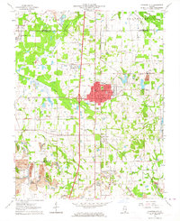
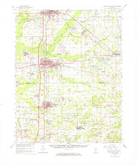
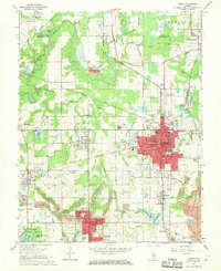 1968 Herrin1970 Print · USGSSouthern Illinois coal country is in full operation during the late sixties, showing the rail-dependent growth of Herrin and Carterville. Researchers can trace the industrial footprint of Mine Dumps and defunct rail spurs alongside local sites like San Carlo Cemetery and Dewmaine.2 unique versions available
End of results
Showing maps 1-6 of 6
Top cities near Herrin
- Carbondale historical maps
- Marion historical maps
- West Frankfort historical maps
- Benton historical maps
- Du Quoin historical maps
- Carterville historical maps
See more
Top neighborhoods of Herrin
Frequently asked questions
- What are the different types of historical maps available for Herrin?
- What is the oldest map of Herrin?
- Where can I purchase historical maps of Herrin for my home or office?
- Where can I download high-res historical maps of Herrin?
- Are there historical topographic maps available for Herrin?
- Is there historical aerial imagery available for Herrin?
- Where are historical maps of Herrin sourced from?