1990s Maps of Winnebago County, Illinois
Explore 5 historic maps of Winnebago County from the 1990s. These maps offer a rare glimpse into what life looked like during the 1990s — showing old roads, neighborhoods, homes, and landmarks that have changed or disappeared over time.
Whether you're researching your family's past, planning a metal detecting trip, or studying how Winnebago County's landscape evolved across the 1990s, these high-resolution maps are a powerful tool for exploring the history of this region.
- Focus on a specific era: All maps on this page are from the 1990s, giving you a focused view of this time period.
- See what’s changed: Compare century-old streets, trails, and buildings to today's modern landscape using overlays and satellite layers.
- Research with precision: Use these maps for genealogy, historical research, land use analysis, or educational projects.
- View, download, or print: Maps are fully viewable online in high resolution, and can be downloaded or printed for your own records.
Start exploring Winnebago County's history through authentic maps from the 1990s. This is your window into the past.
Winnebago County, IL maps
(5)- 1993 Map of Rockford North
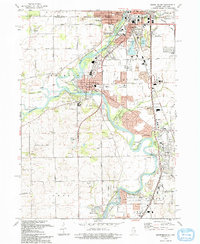
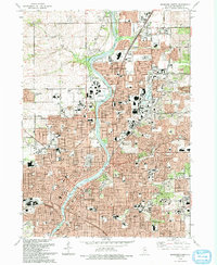 1993 Rockford North1993 Print · USGSThe Rock River valley in the early nineties shows the northward expansion of Rockford into Loves Park. Researchers can trace historic cemeteries like Cedar Bluff Cemetery, the sprawling Rockford College campus, and the Chicago and North Western rail line.
 - 1993 Map of Caledonia
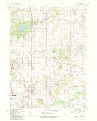 1993 Caledonia1993 Print · USGSThe Winnebago-Boone county line in the early nineties shows the suburban expansion of Rockford toward the rail-centered villages of Caledonia and Argyle. Researchers can trace family history at Davis Cem or locate the old White Swan Sch and Grange Hall.
 - 1993 Map of Belvidere NW
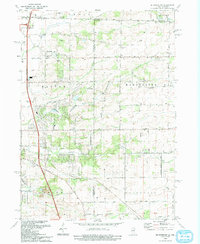 1993 Belvidere NW1993 Print · USGSNorthern Illinois and southern Wisconsin meet in the early nineties, showing a landscape of family farms and creek valleys. Genealogists can locate Pinnacle Hill Cem, Scotch Cem, and the old Wyman School.
 - 1993 Map of Rockford South
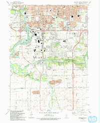 1993 Rockford South1993 Print · USGSThe Rockford suburbs and the Kishwaukee riverfront are captured here in the early nineties, showing a mix of industrial expansion and preserved forest land. Researchers can trace local institutions like Starkey Cem and New Milford alongside the Chicago and North Western rail lines.
 - 1993 Map of South Beloit
 1993 South Beloit1993 Print · USGSNear the state line in the early nineties, this area showcases the evolving riverfront communities of South Beloit and Rockton. Researchers can trace local institutions like the Floberg Home for Children and schools such as Hononegah High Sch.
End of results
Showing maps 1-5 of 5
Top cities of Winnebago County
Frequently asked questions
- What are the different types of historical maps available for Winnebago County?
- What is the oldest map of Winnebago County?
- Where can I purchase historical maps of Winnebago County for my home or office?
- Where can I download high-res historical maps of Winnebago County?
- Are there historical topographic maps available for Winnebago County?
- Is there historical aerial imagery available for Winnebago County?
- Where are historical maps of Winnebago County sourced from?