Old Maps of Winnebago County, Illinois for Genealogy
Trace your family roots with 132 historic maps of Winnebago County. These high-res maps reveal old neighborhoods, homesites, landmarks, and streets — helping you uncover where your ancestors lived and how the area evolved over time.
- Explore historic neighborhoods: Identify where your relatives may have lived in the 1800s or 1900s.
- Compare maps over time: Trace the changes in streets, buildings, and landmarks for multi-generational research.
- Perfect for genealogy & ancestry research: Used by family historians and researchers to map out lineage and migration.
These maps are an incredible resource for exploring your personal connection to Winnebago County's past.
Winnebago County, IL maps
(132)- 1893 Map of Brodhead
 1893 Brodhead1893 Print · USGSSouthern Wisconsin is captured in the late nineteenth century as rail lines and river valleys shaped the landscape. Genealogists and historians can trace early village sites like Brodhead, Magnolia Station, and Orford along the Chicago Milwaukee and Saint Paul Railroad.5 unique versions available
 - 1917 Map of Kings, 1969 Print
 1917 Kings1969 Print · USGSNorthern Illinois agriculture and rail lines meet south of Rockford during the early twentieth century. Genealogists can trace rural family roots through dozens of district schools like Black Walnut School and the rail junctions of Davis Junction and Holcomb.
 - 1918 Map of Rockford
 1918 Rockford1918 Print · USGSWinnebago County at the end of the Great War reveals a landscape where the river-and-rail economy was in full swing. Genealogists and historians can trace family-named schools like Dickenson School and Eddy School, or locate the Winnebago County Boys Reform School.3 unique versions available
 - 1918 Map of Belvidere
 1918 Belvidere1918 Print · USGSBoone County and the Kishwaukee River valley are captured here in the final year of the Great War. Researchers can trace dozens of rural school sites like Quailtrap School or locate family roots near Argyle and the Scotch Cemetery.
 - 1918 Map of Kings
 1918 Kings1918 Print · USGSThe Rock River valley served as a massive military and rail hub during the First World War. Local historians can trace the early layout of Camp Grant and dozens of country schools like Killbuck School and Maple Corners School.3 unique versions available
 - 1918 Map of Kirkland
 1918 Kirkland1918 Print · USGSNorthern Illinois prairie lands are shown here during the height of the steam rail era. You can trace early family roots through dozens of rural landmarks like Bloods Point School, Gunn School, and the junction at Kirkland.4 unique versions available
 - 1922 Map of Oregon, 1967 Print
 1922 Oregon1967 Print · USGSNorthern Illinois at the start of the twenties reveals a landscape of thriving rail towns and numerous one-room schoolhouses. Genealogists can trace family footprints at Wessels School, Ebenezer Church, and early village sites like Adeline and Egan.
 - 1924 Map of Oregon
 1924 Oregon1924 Print · USGSOgle County's rural landscape is captured here in the early twenties, showing a network of river-valley settlements and busy rail lines. Researchers can trace family history through numerous landmarks like the German Valley PO and station, St Thomas Church, and Mount Morris.3 unique versions available
 - 1932 Map of Pecatonica
 1932 Pecatonica1932 Print · USGSThe Pecatonica River valley at the start of the 1930s shows a landscape of busy rail towns and a remarkable density of rural schoolhouses. Genealogists can locate family landmarks like Woodruff Corners, Pioneer Cem, and the Twelvemile Grove Ch.3 unique versions available
 - 1936 Map of Pecatonica
 1936 Pecatonica1936 Print · USGSNorthern Illinois agriculture and river life thrive in the 1930s along the winding Pecatonica River and the Wisconsin border. Genealogists can trace hundreds of rural homes and a dense grid of schoolhouses including College Sch, Irish Grove Sch, and Twelvemile Grove Ch.2 unique versions available
 - 1938 Map of Rockford, 1954 Print
 1938 Rockford1954 Print · USGSWinnebago County at the end of the Depression shows a landscape shaped by river valleys and a dense network of country schoolhouses. You can trace early twentieth-century rural life through landmarks like Holland Spring, the Winnebago County Boys Reform School, and the Rockford and Interurban rail line.3 unique versions available
 - 1944 Map of Belvidere
 1944 Belvidere1944 Print · USGSNorthern Illinois at the height of the Second World War shows a landscape defined by rail-fed farming villages and dozens of country schoolhouses. Genealogists can trace family footprints near Scotch Church, the Fairgrounds, and settlements like Poplar Grove.2 unique versions available
 - 1949 Map of Camp Grant
 1949 Camp Grant1949 Print · USGSThe industrial and military landscape south of Rockford is captured here shortly after the war, when Camp Grant still shaped the riverfront. Trace the routes of three major railroads and find vanished local landmarks like New Milford Sta and Blackhawk Sch.
 - 1949 Map of Rockford
 1949 Rockford1949 Print · USGSMid-century Rockford and the Rock River valley appear here in a period of rapid post-war growth and industrial strength. Researchers can trace historic family locations through numerous sites like Harlem Ch, Machesney Landing Field, and West High Sch.2 unique versions available
 - 1954 Map of Rockford
 1954 Rockford1954 Print · USGSThe Rock River valley and the Illinois-Wisconsin borderlands are captured here in the mid-1950s during a period of robust industrial and agricultural activity. Genealogists and historians can trace rail-era corridors like the Illinois Central RR and locate landmarks from Big Foot Prairie to Lake Geneva.
 - 1955 Map of Rockford
 1955 Rockford1955 Print · USGSThe Rock River valley and southern Wisconsin dairy country are shown here in the mid-fifties as the region's manufacturing centers grew. Genealogists and historians can trace the paths of the Chicago and North Western RR and Illinois Central RR through hubs like Rockford and Beloit.
 - 1958 Map of Rockford, 1974 Print
 1958 Rockford1974 Print · USGSNorthern Illinois and southern Wisconsin are shown here in the mid-twentieth century as rail-dependent industrial towns began to interface with growing lakefront communities. Genealogists can trace family roots through settlements like Saylesville and Tess Corners or locate historical landmarks like the Rockford Ordnance Depot.4 unique versions available
 - 1959 Map of Winnebago, 1960 Print
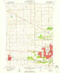 1959 Winnebago1960 Print · USGSWinnebago County at the end of the fifties shows the city of Rockford stretching west toward the rural townships. Genealogists and local historians can trace family locations through several rural schools like Stiles Sch and burial sites including Willwood Cemetery and Prospect Cem.
 - 1959 Map of South Beloit, 1960 Print
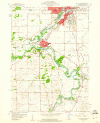 1959 South Beloit1960 Print · USGSThe Rock River valley at the Illinois-Wisconsin border shows a landscape of growing towns and industrial gravel works in the late fifties. Genealogists can trace rural school locations like Sand Prairie Sch and Lovejoy Sch or the rail lines of the Chicago and North Western.
 - 1962 Map of Brodhead West, 1964 Print
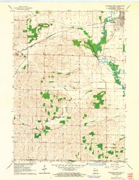 1962 Brodhead West1964 Print · USGSBrodhead and the Sugar River valley are shown in the early 1960s as the regional rail and river network supported a busy agricultural landscape. Researchers can locate vanished landmarks like Poplar Grove Sch, trace the Chicago Milwaukee St Paul and Pacific rail line, and find family names at Clarence Cem or Oakley.3 unique versions available
 - 1962 Map of Brodhead East, 1964 Print
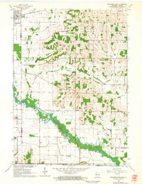 1962 Brodhead East1964 Print · USGSSouthern Wisconsin dairy country and the Rock County borderlands come to life in this early 1960s survey. Researchers can trace the path of the Chicago Milwaukee St Paul and Pacific railroad or locate local landmarks like Barr Sch and Greenwood Cemetery.2 unique versions available
 - 1962 Map of Brodhead, 1964 Print
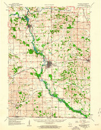 1962 Brodhead1964 Print · USGSSouthern Wisconsin at the start of the sixties reveals a thriving network of rail-side towns and river valleys. Genealogists and local historians can trace family roots at Greenwood Cem, locate the Peebles Sch, or follow the old Chicago and North Western line.2 unique versions available
 - 1963 Map of Rockford
 1963 Rockford1963 Print · USGSThe mid-century industrial corridor along the Rock River is shown here during a period of rapid post-war growth. Researchers can trace the extensive rail lines of the Chicago and North Western or locate local landmarks like the Rockford Ordnance Depot and Holy Hill.
 - 1968 Map of Cherry Valley, 1970 Print
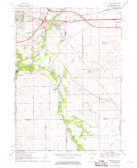 1968 Cherry Valley1970 Print · USGSNorthern Illinois agriculture meets the growing industrial corridors of Winnebago and Boone counties in the late sixties. Genealogists and local historians can trace family-named routes and landmarks like Arlington Memorial Park Cem, Flora Ch, and the rail stops at Irene or Perryville.3 unique versions available
 - 1970 Map of Caledonia, 1972 Print
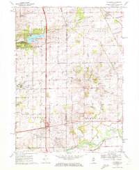 1970 Caledonia1972 Print · USGSCaledonia and the northern outskirts of Rockford are captured in the early 1970s as suburban growth met rural prairie. Genealogists can locate Guilford Union Cem, Orth Cem, and Bell Sch among the family-named roads and gravel works.2 unique versions available
Showing maps 1-25 of 132
Top cities of Winnebago County
Frequently asked questions
- What are the different types of historical maps available for Winnebago County?
- What is the oldest map of Winnebago County?
- Where can I purchase historical maps of Winnebago County for my home or office?
- Where can I download high-res historical maps of Winnebago County?
- Are there historical topographic maps available for Winnebago County?
- Is there historical aerial imagery available for Winnebago County?
- Where are historical maps of Winnebago County sourced from?