Old Maps of Perryville, Indiana for Academic Research
Study the evolution of Perryville with 10 high-resolution historic maps. Whether you're teaching, researching, or modeling changes in land use, these maps provide essential visual documentation of urban, environmental, and geographic change.
- Analyze long-term change: Track patterns in development, transportation, and natural features.
- Ideal for environmental or urban studies: Support academic projects with primary historical map data.
- Use in the classroom or lab: Educators and researchers rely on these maps to bring historical context to life.
These maps are a powerful tool for teaching, research, and visualizing how Perryville has changed over the decades.
Perryville, IN maps
(10)- 1953 Map of Muncie, 1966 Print
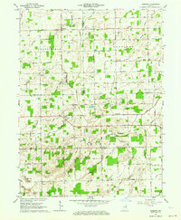
 1953 Muncie1966 Print · USGSIndiana and Ohio borderlands thrive in the early fifties, showing a landscape defined by manufacturing cities and an intensive railroad network. Genealogists can trace family roots across the Indiana-Ohio line through Muncie, Celina, and Portland via the Pennsylvania railroad.5 unique versions available
 - 1956 Map of Muncie
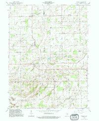
 1956 Muncie1956 Print · USGSEastern Indiana and western Ohio are shown at a peak of rail-driven industry in the mid-fifties. Genealogists and rail historians can trace the paths of the Pennsylvania RR through Muncie or locate landmarks like Lake Saint Marys (Grand Lake Reservoir) and Frances Slocum State Forest.
 - 1962 Map of Domestic, 1964 Print
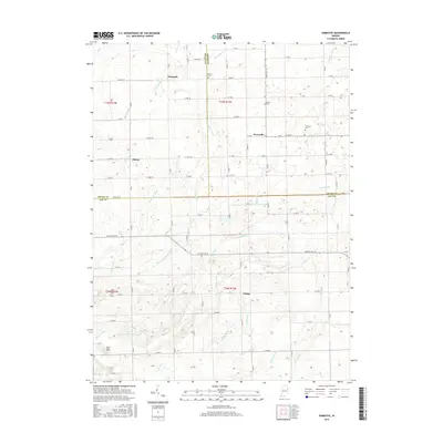
 1962 Domestic1964 Print · USGSIndiana’s borderlands between Wells, Adams, and Jay Counties are mapped here in the early sixties as agricultural drainage transformed the landscape. Genealogists can trace family sites at Alberson Cemetery or locate old schoolhouses like Township School near Poling.
 - 1986 Map of Wabash
 1986 Wabash1986 Print · USGSThe Wabash Valley and surrounding Indiana farm country are captured here in the mid-eighties, showing a landscape reshaped by major reservoirs. Genealogists and local historians can trace the paths of the Old Indian Trail and the industrial reach of the Conrail line through towns like Lagro and Warren.2 unique versions available
 - 1992 Map of Domestic, 1995 Print
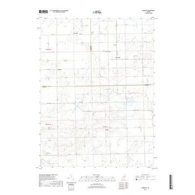
 1992 Domestic1995 Print · USGSJay and Wells County crossroads are captured here in the early nineties, showing a landscape shaped by rural industry and drainage engineering. Genealogists can locate family sites near Domestic, Perryville, and the West Grove Cem or trace the early Oil Wells near Twin Hills.
 - 2010 Map of Domestic, 2010 Print
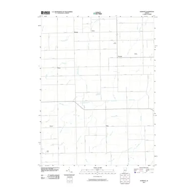 2010 Domestic2010 Print · USGSCovers Perryville, including Poling, Phenix, and other nearby areas
 - 2013 Map of Domestic, 2013 Print
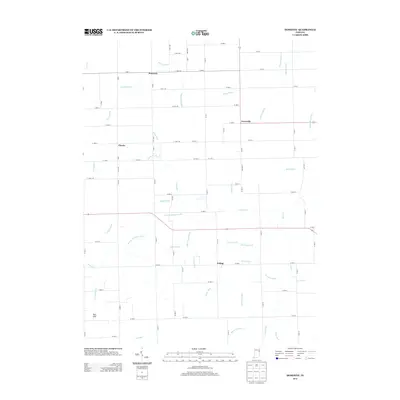 2013 Domestic2013 Print · USGSCovers Perryville, including Poling, Phenix, and other nearby areas
 - 2016 Map of Domestic, 2016 Print
 2016 Domestic2016 Print · USGSCovers Perryville, including Poling, Phenix, and other nearby areas
 - 2019 Map of Domestic, 2019 Print
 2019 Domestic2019 Print · USGSCovers Perryville, including Poling, Phenix, and other nearby areas
 - 2022 Map of Domestic, 2022 Print
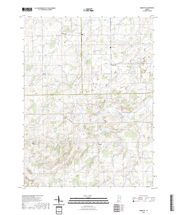 2022 Domestic2022 Print · USGSJay County's rural agricultural landscape and drainage history are on full display in this modern survey of the Indiana countryside. Researchers can trace the heritage of local families at Hartford Cem and Alberson Cem or explore the wetlands near Loblolly Cr.
End of results
Showing maps 1-10 of 10
Top cities near Perryville
- Bluffton historical maps
- Decatur historical maps
- Portland historical maps
- Berne historical maps
- Geneva historical maps
- Nottingham historical maps
See more
Frequently asked questions
- What are the different types of historical maps available for Perryville?
- What is the oldest map of Perryville?
- Where can I purchase historical maps of Perryville for my home or office?
- Where can I download high-res historical maps of Perryville?
- Are there historical topographic maps available for Perryville?
- Is there historical aerial imagery available for Perryville?
- Where are historical maps of Perryville sourced from?