Old Maps of Brown County, Indiana for Hiking & Exploration
Hike through history with 88 historic maps of Brown County. Explore old trails, ghost towns, and forgotten backroads — perfect for outdoor adventurers and local explorers.
- Rediscover forgotten places: Map out old mining camps, roads, and footpaths that no longer exist on modern maps.
- Layer with modern tools: Combine with LiDAR or satellite views to plan hikes through historical terrain.
- Made for exploration: Popular among hikers, overlanders, and local history lovers.
Use these maps to find adventure and explore the hidden past of Brown County.
Brown County, IN maps
(88)- 1942 Map of Franklin
 1942 Franklin1942 Print · USGSCentral Indiana during the early years of the war shows a landscape of established rail towns and growing military installations. Genealogists can trace family names across small settlements like Nineveh, Bean Blossom, and Helmsburg, or locate the Indiana University Observatory.
 - 1946 Map of Belmont, 1960 Print
 1946 Belmont1960 Print · USGSMid-century Brown County is captured here at a time when remote ridge-top cemeteries and rural schoolhouses still defined the local geography. Genealogists can locate family sites like Brummet Cem, the T C Steele Memorial, and the West Toll House.2 unique versions available
 - 1947 Map of Nashville, 1960 Print
 1947 Nashville1960 Print · USGSBrown County’s intricate ridges and hollows are captured here in the late 1940s, showing the early bounds of the state park and national forest. Researchers can locate vanished landmarks like Clark Sch, the crossroads at Gnaw Bone, and the high point of Weed Patch Hill.
 - 1947 Map of Elkinsville, 1961 Print
 1947 Elkinsville1961 Print · USGSBrown County and Monroe County are captured just after the war, showing the rural way of life along the forks of Salt Creek. Researchers can trace the layout of Elkinsville and Maumee, locating old landmarks like Chambers Bridge and Bethel Ch.
 - 1947 Map of Franklin, 1964 Print
 1947 Franklin1964 Print · USGSMid-century Johnson County is captured here during a period of significant military activity and established civic life. Genealogists and local historians can locate Franklin College, the Prisoner of War Camp at Camp Atterbury, and numerous rural sites like Lick Spring Church and Hopewell Cem.
 - 1948 Map of New Bellsville
 1948 New Bellsville1948 Print · USGSBartholomew and Brown County rural life and military expansion meet in the late 1940s. Genealogists and local historians can trace schoolhouse sites like Sprague Sch and family burial grounds including Dobbs Cem and Haislup Cem.
 - 1948 Map of Waymansville
 1948 Waymansville1948 Print · USGSBartholomew and Jackson counties appear here just after the war, showing a landscape of ridge-top schools and creek-bottom settlements. Researchers can trace the rural legacy of Waymansville and find local landmarks like Ohio Chapel, Taylor Chapel, and the St Paul Sch.2 unique versions available
 - 1948 Map of Nineveh
 1948 Nineveh1948 Print · USGSBartholomew and Johnson counties are captured here just after the war, when the landscape was defined by the massive Camp Atterbury Military Reservation. Genealogists and historians can trace the foundations of Nineveh and find significant sites like the Prisoner-of-War Cem and St Johns Ch.3 unique versions available
 - 1948 Map of Hindustan
 1948 Hindustan1948 Print · USGSThe Morgan and Monroe county borders were a landscape of deep hollows and high ridges during the late nineteen-forties. Genealogists and hikers can trace old forest homesteads and landmarks like Stepp Cem, Honey Creek Sch, and the Hindustan settlement.3 unique versions available
 - 1948 Map of Fruitdale
 1948 Fruitdale1948 Print · USGSNear the border of Johnson and Brown counties in the late 1940s, this area shows a landscape of ridge-top roads and tucked-away hollows. Genealogists can trace family names through landmarks like Duncan Cem, Spearsville Sch, and the Illinois Central rail line.3 unique versions available
 - 1948 Map of Morgantown, 1956 Print
 1948 Morgantown1956 Print · USGSThe Morgan and Brown County borderlands come to life in the late 1940s, showing the ridge-and-hollow terrain south of Morgantown. Researchers can trace the Illinois Central railroad through Helmsburg or locate rural landmarks like Mt Zion Ch and Bear Creek Cem.
 - 1949 Map of Nashville
 1949 Nashville1949 Print · USGSNashville and the surrounding Brown County ridges are captured here in the late 1940s. Genealogists can trace family names through landmarks like Seelmaer Hill, local schools such as Mt Liberty Sch, and the unique crossroads of Gnaw Bone.2 unique versions available
 - 1950 Map of Belmont
 1950 Belmont1950 Print · USGSThe Brown County hill country in 1950 shows a landscape of ridge-top roads and secluded valley settlements. Genealogists can trace family names at the T C Steele Memorial, Duncan Ch, and Brummet Cem among the deep hollows.
 - 1950 Map of Morgantown
 1950 Morgantown1950 Print · USGSMid-century Morgan and Brown Counties are shown here at a time when the Illinois Central railroad still linked small rural timber and farming hamlets. Trace family roots and vanished landmarks near Helmsburg, Needmore, and the Bear Creek Cem.2 unique versions available
 - 1950 Map of Franklin
 1950 Franklin1950 Print · USGSMid-century Johnson County and Brown County come into focus here, showing the expansion of settlements and military infrastructure during the post-war years. Researchers can trace the layout of the Camp Atterbury Military Reservation, locate family names at Greenlawn Cemetery, or find vanished landmarks like the Prisoner of War Camp.2 unique versions available
 - 1950 Map of Elkinsville
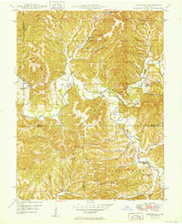 1950 Elkinsville1950 Print · USGSBrown County's rugged ridge-and-hollow terrain is captured here at mid-century, just as the local forest preserves were maturing. Genealogists and hikers can trace old family sites like Elkinsville Cem, Maumee Sch, and the Hickory Ridge Lookout Tower.
 - 1953 Map of Indianapolis, 1965 Print
 1953 Indianapolis1965 Print · USGSCentral Indiana and the Illinois borderlands are captured in the mid-sixties, showing the growth of Indianapolis and its industrial rail corridors. Genealogists and historians can trace the development of outlying towns like Zionsville or Beech Grove and find landmarks such as Atterbury AAF and Turkey Run State Park.4 unique versions available
 - 1956 Map of Indianapolis
 1956 Indianapolis1956 Print · USGSCentral Indiana in the mid-fifties is captured during a period of industrial growth and military presence. Genealogists and historians can trace the rail networks of the New York Central or locate regional landmarks like Fort Benjamin Harrison and Camp Atterbury.
 - 1956 Map of Story, 1957 Print
 1956 Story1957 Print · USGSThe hills of Brown and Jackson counties are captured here in the mid-1950s, showing a landscape of deep ridges and creek bottoms. Researchers can trace the Old Indian Treaty Boundary Line and locate local landmarks like Kirk Hill Ch and Story.2 unique versions available
 - 1957 Map of Indianapolis
 1957 Indianapolis1957 Print · USGSCentral Indiana in the mid-fifties is captured here as a crossroads of major rail lines and nascent federal highways. Genealogists and historians can trace family-named ridges like Poplar Ridge or locate strategic sites like Camp Atterbury and Speedway.2 unique versions available
 - 1961 Map of Morgantown, 1963 Print
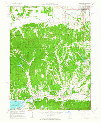 1961 Morgantown1963 Print · USGSThe wooded highlands of Brown and Morgan counties are captured here in the early sixties as rural life centered on the rail corridor. Trace family history through landmarks like Mt Zion Ch, the Williams Cem, and the village of Helmsburg.5 unique versions available
 - 1961 Map of Nashville, 1963 Print
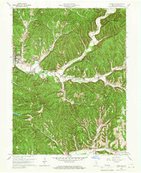 1961 Nashville1963 Print · USGSThe hills of Brown County are captured here in the early sixties, showing the integration of forest preserves and small rural crossroads. Researchers can locate family landmarks like Reeves Cem, historic St Agnes Ch, and the curious settlement of Gnaw Bone.5 unique versions available
 - 1961 Map of Hindustan, 1963 Print
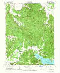 1961 Hindustan1963 Print · USGSIn the early sixties, this area of Monroe County was defined by the expansion of the Morgan-Monroe State Forest and the newly formed Lake Lemon. Researchers can trace the Old Indian Treaty Boundary and locate local landmarks like Hindustan, Stepp Cem, and the Wheeler Mission Campground.5 unique versions available
 - 1962 Map of Indianapolis
 1962 Indianapolis1962 Print · USGSCentral Indiana and the Illinois borderlands are captured here in the early sixties, showing the region's dense rail networks and growing urban centers. Genealogists and historians can locate family-named landmarks and institutions like Crown Hill Cem, Indiana University, and the Indianapolis Motor Speedway.
 - 1962 Map of New Bellsville, 1964 Print
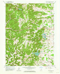 1962 New Bellsville1964 Print · USGSBartholomew County and the eastern edge of Brown County are shown in the early sixties as recreational lakes and military lands reshaped the rural landscape. Researchers can locate family cemeteries like Haislup Cem and Dobbs Cem, or trace early settlements from New Bellsville to Ogilville.5 unique versions available
Showing maps 1-25 of 88
Top cities of Brown County
Frequently asked questions
- What are the different types of historical maps available for Brown County?
- What is the oldest map of Brown County?
- Where can I purchase historical maps of Brown County for my home or office?
- Where can I download high-res historical maps of Brown County?
- Are there historical topographic maps available for Brown County?
- Is there historical aerial imagery available for Brown County?
- Where are historical maps of Brown County sourced from?