2020s Maps of Cass County, Indiana
Explore 14 historic maps of Cass County from the 2020s. These maps offer a rare glimpse into what life looked like during the 2020s — showing old roads, neighborhoods, homes, and landmarks that have changed or disappeared over time.
Whether you're researching your family's past, planning a metal detecting trip, or studying how Cass County's landscape evolved across the 2020s, these high-resolution maps are a powerful tool for exploring the history of this region.
- Focus on a specific era: All maps on this page are from the 2020s, giving you a focused view of this time period.
- See what’s changed: Compare century-old streets, trails, and buildings to today's modern landscape using overlays and satellite layers.
- Research with precision: Use these maps for genealogy, historical research, land use analysis, or educational projects.
- View, download, or print: Maps are fully viewable online in high resolution, and can be downloaded or printed for your own records.
Start exploring Cass County's history through authentic maps from the 2020s. This is your window into the past.
Cass County, IN maps
(14)- 2022 Map of Logansport, 2022 Print
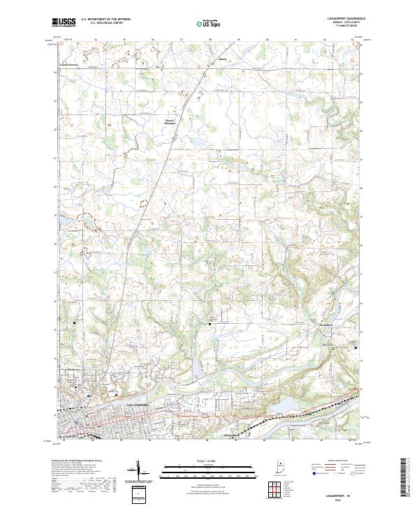 2022 Logansport2022 Print · USGSThe confluence of the Wabash and Eel Rivers in the early 2020s reveals the enduring structure of this Indiana transit hub. Researchers can trace ancestral sites across a landscape dotted with the Horney Cem, Mount Hope Cem, and the riverfront community of Miami Bend.
 - 2022 Map of Burrows, 2022 Print
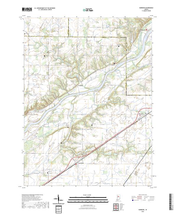 2022 Burrows2022 Print · USGSThe Wabash River valley in Carroll and Cass counties is shown here during a period of modern stability. Researchers can trace the historic Wabash and Erie Canal and locate numerous burial sites like the Independent Order of Odd Fellows Cem and Brown Church Cem.
 - 2022 Map of Grass Creek, 2022 Print
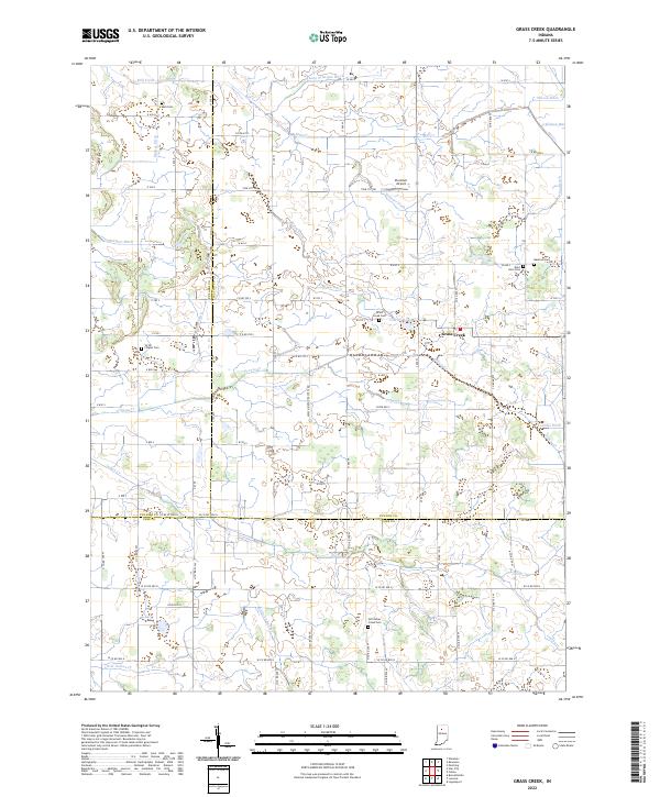 2022 Grass Creek2022 Print · USGSThe tri-county borderlands of Fulton, Pulaski, and Cass counties are documented here in the early twenty-first century. Genealogists and local historians can locate several family and community burial sites like Victor Chapel Cemetery and Bauman Cemetery.
 - 2022 Map of Young America, 2022 Print
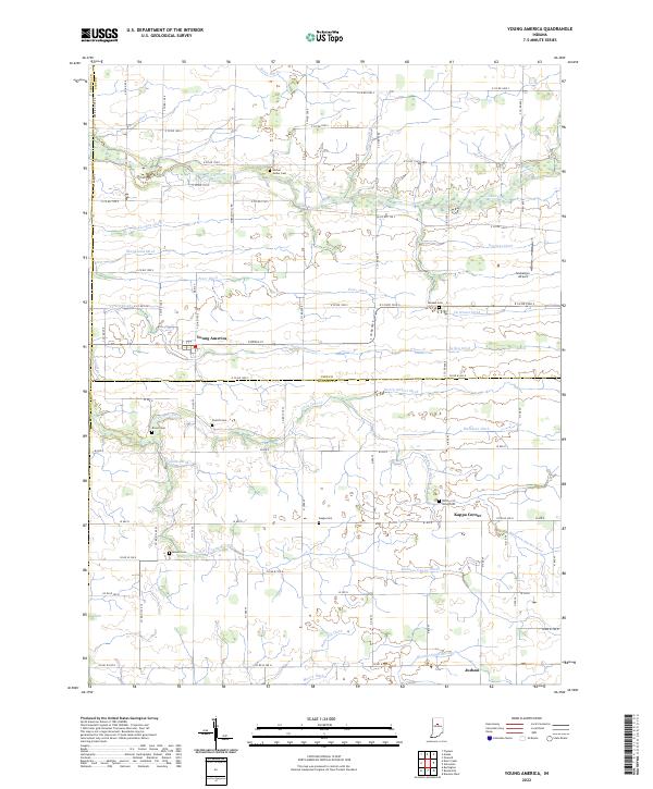 2022 Young America2022 Print · USGSIndiana farmland at the border of Cass and Howard Counties is mapped here in fine detail, showing the rural grid system and local water management. Genealogists can locate several family cemeteries, including Mound Cem, Pickett Cem, and Kappa Cem near Young America.
 - 2022 Map of Macy, 2022 Print
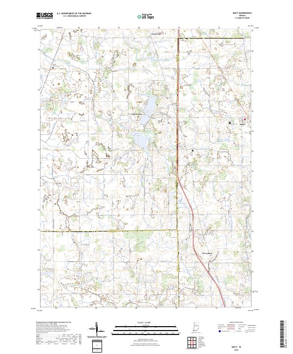 2022 Macy2022 Print · USGSThe borderlands of Fulton, Miami, and Cass counties are documented here in the early 2020s, showing the enduring rural character of North-Central Indiana. Researchers can trace local heritage through sites like Plainview Cem, the lakeside community of Nyona Lake, and the historic Nickle Plate Rail Trl.
 - 2022 Map of Burnettsville, 2022 Print
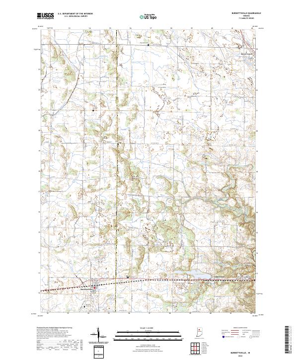 2022 Burnettsville2022 Print · USGSThe borderlands of White and Cass counties are revealed here in the 2020s, showcasing a highly developed agricultural landscape structured by historic ditches and creeks. Researchers can trace family sites at Thompson Cem and Burnetts Creek Cem or locate early settlements like Royal Center and Burnettsville.
 - 2022 Map of Twelve Mile, 2022 Print
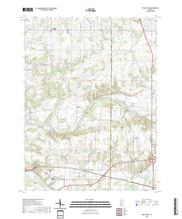 2022 Twelve Mile2022 Print · USGSThe rural crossing of Cass and Miami Counties is documented here in the early twenty-first century, showing a landscape defined by the Eel River and Wabash River. Researchers can trace family history through numerous sites like Mount Carmel Cem, Eel River Chapel Cem, and the settlement of Twelve Mile.
 - 2022 Map of Clymers, 2022 Print
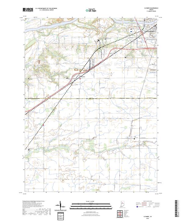 2022 Clymers2022 Print · USGSThe Wabash River valley south of Logansport is captured here in the early twenty-first century, revealing a landscape of managed farmland and small rural communities. Researchers can locate family burial sites like Shideler Cem and Porter Cem or trace the historic path of the Wabash and Erie Canal.
 - 2022 Map of Fulton, 2022 Print
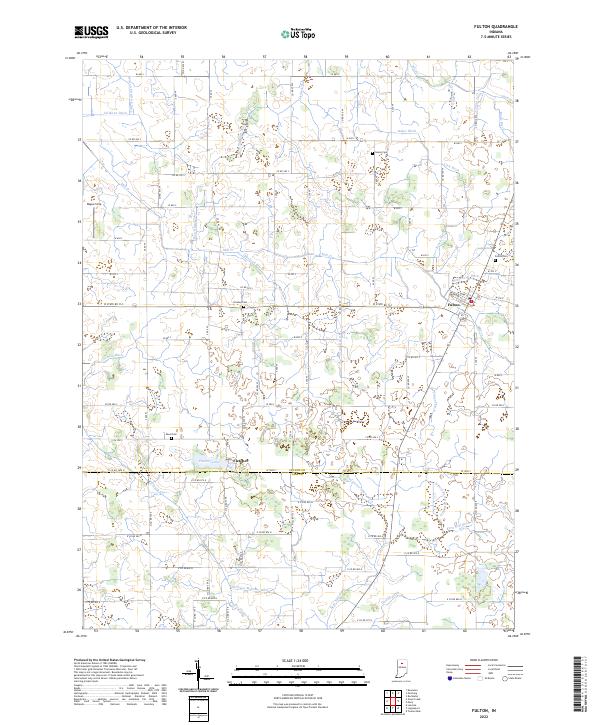 2022 Fulton2022 Print · USGSFulton and the surrounding farmsteads of north-central Indiana are shown here in their modern agricultural context. Genealogists and local historians can locate family-named landmarks and resting places including Fulton Cem, Reed Cem, and the waters of Fletcher Lake.
 - 2022 Map of Anoka, 2022 Print
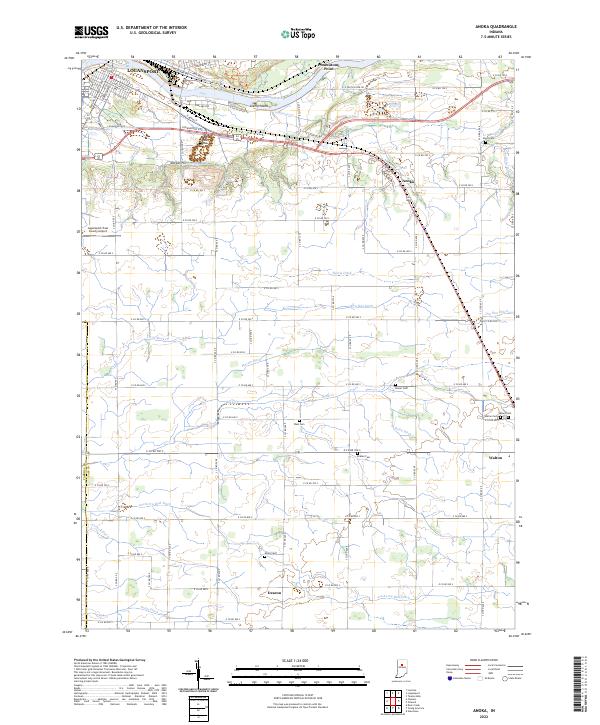 2022 Anoka2022 Print · USGSSoutheast of Logansport in the 2020s, this area reveals a deep rural landscape of family-named cemeteries and agricultural drainage networks. Researchers can trace ancestral roots at Walton Cem and Ramer Cem or explore the river terrain of Potawatomi Point.
 - 2022 Map of Galveston, 2022 Print
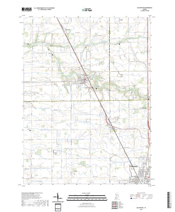 2022 Galveston2022 Print · USGSThe rural crossroads of Cass and Miami counties are captured in this modern survey, showing the agricultural heart of north-central Indiana. Genealogists and local researchers can trace family-named drainage ditches and historic burial sites like Patterson Cem and Old Galveston Cem.
 - 2022 Map of Star City, 2022 Print
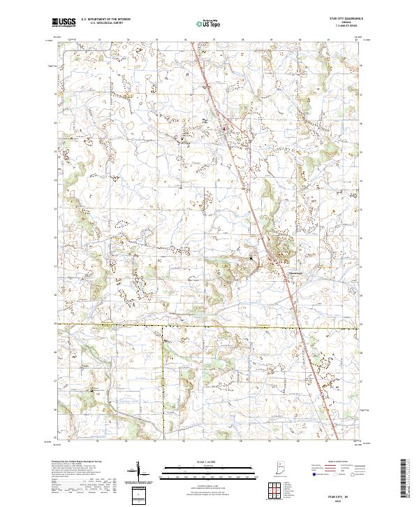 2022 Star City2022 Print · USGSIndiana's agricultural heartland is documented here in the early 2020s at the junction of three counties. Local historians can trace family roots through Star City West Cem and Mount Pleasant Cem, or follow the drainage history of Indian Creek and Stout Gise Ditch.
 - 2022 Map of Onward, 2022 Print
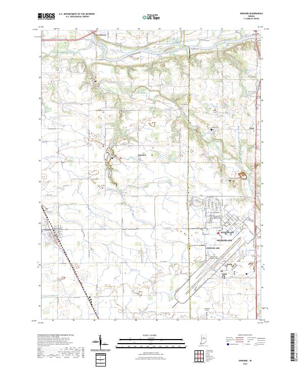 2022 Onward2022 Print · USGSThe rural Cass County landscape is captured here in the early 2020s, a region defined by the intersection of traditional agriculture and the massive Grissom AFB. Researchers can trace old family lines at Bowyer Cemetery or locate the small town centers of Onward and Walton.
 - 2022 Map of Lucerne, 2022 Print
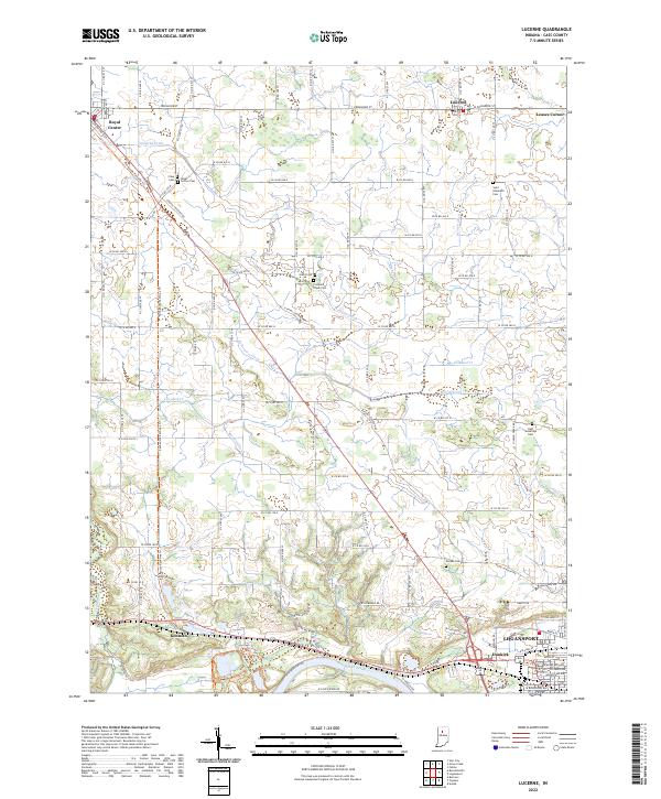 2022 Lucerne2022 Print · USGSNorth of the Wabash River in the early 2020s, this area shows a landscape of agricultural drainage and quiet crossroads. Trace family history at Saint Elizabeth Cem or follow the historic rail corridor along the Panhandle Pathway Trl through Royal Center.
End of results
Showing maps 1-14 of 14
Top cities of Cass County
- Logansport historical maps
- Galveston historical maps
- Royal Center historical maps
- Onward historical maps
Frequently asked questions
- What are the different types of historical maps available for Cass County?
- What is the oldest map of Cass County?
- Where can I purchase historical maps of Cass County for my home or office?
- Where can I download high-res historical maps of Cass County?
- Are there historical topographic maps available for Cass County?
- Is there historical aerial imagery available for Cass County?
- Where are historical maps of Cass County sourced from?