Old Maps of Lawrenceburg, Lawrenceburg Township for Metal Detecting
Plan your next treasure hunt with 30 historic maps of Lawrenceburg. Find old homesites, ghost towns, trails, and gathering spots that may be lost to time — perfect for identifying promising metal detecting locations.
- Locate forgotten sites: Uncover places like long-lost settlements, abandoned rail lines, or gathering spots.
- Plan better hunts: Use map overlays combined with LiDAR or satellite views to narrow in on historically rich areas.
- Made for detectorists: Thousands of hobbyists use these maps to discover relics, coins, and hidden history.
Use these historic maps to boost your research and find new opportunities beneath the surface of Lawrenceburg.
Lawrenceburg, Lawrenceburg Township maps
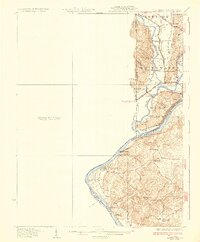
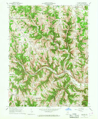
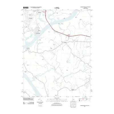
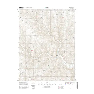
(30)- 1915 Map of Lawrenceburg
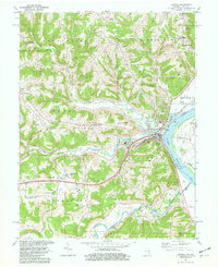
 1915 Lawrenceburg1915 Print · USGSThe tri-state river junction between Indiana, Ohio, and Kentucky is captured just before the first World War during a peak era of rail expansion. Researchers can trace the legacy of local transit through Simmonson Station, the Suspension Bridge, and the tracks of the Electric line.
 - 1928 Map of Lawrenceburg, 1962 Print
 1928 Lawrenceburg1962 Print · USGSThe tri-state river valley at the end of the Roaring Twenties shows a landscape shaped by the Ohio River and bustling rail junctions. Researchers can trace historic ferries like the Lawrenceburg Ferry and find family-named landmarks like Commissary Corner or the Bullittsburg Ch.
 - 1932 Map of Lawrenceburg
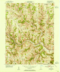
 1932 Lawrenceburg1932 Print · USGSThe tri-state confluence of Indiana, Ohio, and Kentucky comes alive in this early 1930s survey of the river valleys. Genealogists can trace family roots through rural landmarks like Eighteenmile House, Bullittsville Ch, and the Woolper Sch.3 unique versions available
 - 1943 Map of Aurora
 1943 Aurora1943 Print · USGSDearborn County as it appeared in the early 1940s shows a landscape where river commerce and rail lines defined the growth of Aurora. Genealogists and local historians can trace rural schoolhouses like Worley Sch, country churches such as Mt Tabor Ch, and the original Baltimore and Ohio rail route.2 unique versions available
 - 1943 Map of Guilford
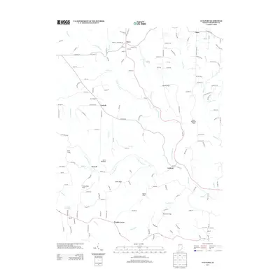
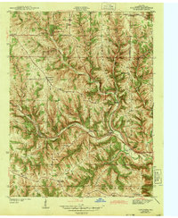 1943 Guilford1943 Print · USGSDearborn County's rural townships are shown here during the early war years, when life centered on ridge-top farms and valley villages. Researchers can trace family sites at Logan Cem, the remote Collier Sch, and the riverside hub of Guilford.2 unique versions available
 - 1943 Map of Lawrenceburg
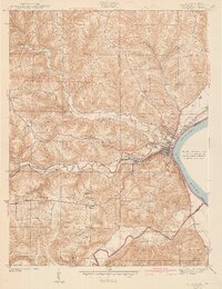
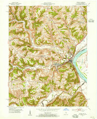
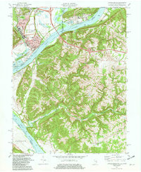
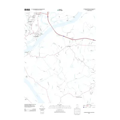
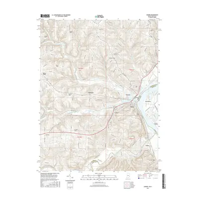
 1943 Lawrenceburg1943 Print · USGSThe Indiana-Kentucky-Ohio tri-state border comes alive in this wartime-era survey of the Ohio River valley. Researchers can trace the rail-side growth of Lawrenceburg and Greendale or locate family plots in the Greendale Cem.
 - 1953 Map of Aurora, 1955 Print
 1953 Aurora1955 Print · USGSThe Ohio River valley near Aurora was a bustling corridor of rail and river commerce in the early 1950s. Genealogists and local historians can locate early landmarks such as the Riverview Cemetery and trace the paths of the Baltimore and Ohio railroad through Wilmington.2 unique versions available
 - 1953 Map of Guilford, 1955 Print
 1953 Guilford1955 Print · USGSDearborn County's rural townships and creek-side settlements are captured here in the early fifties. Local historians can locate vanished landmarks like the Pelley Sch and family burial sites including Collier Cem and Huber-Briggs Cem.
 - 1953 Map of Cincinnati, 1965 Print
 1953 Cincinnati1965 Print · USGSThe Ohio River valley and the industrial heartland of Indiana and Ohio are captured here during the mid-century peak of rail and river commerce. Genealogists and historians can trace connections between Cincinnati and outlying military sites like Camp Atterbury and Bakalar AFB.3 unique versions available
 - 1957 Map of Cincinnati
 1957 Cincinnati1957 Print · USGSThe Ohio River valley and its surrounding highlands thrived during the mid-fifties industrial peak, centered on the bustling Cincinnati and Dayton metropolitan hubs. Researchers can trace the extensive rail networks and military sites like Wright-Patterson AFB and Camp Atterbury.
 - 1966 Map of Aurora, 1967 Print
 1966 Aurora1967 Print · USGSThe Ohio River valley and the busy Baltimore and Ohio rail line dominate the Dearborn County landscape during the mid-sixties. Genealogists and local historians can locate the old community of Wilmington, the industrial docks at Aurora, and historic sites like Mt Sinai Ch.
 - 1966 Map of Guilford, 1968 Print
 1966 Guilford1968 Print · USGSSoutheast Indiana during the mid-sixties reveals a landscape of high ridges and deep creek valleys anchored by historic rural parishes. Genealogists and local historians can trace family roots through the Huber Boggs Cem or locate old school sites like Manchester Sch and North Dearborn High Sch.2 unique versions available
 - 1981 Map of Aurora, 1982 Print
 1981 Aurora1982 Print · USGSThe Indiana-Kentucky borderlands come alive in this early 1980s survey of the riverfront corridor between Aurora and Lawrenceburg. Researchers can trace the path of the Baltimore and Ohio Railroad and locate rural landmarks like Mt Tabor Ch and Kirschs Corner.2 unique versions available
 - 1981 Map of Lawrenceburg, 1982 Print
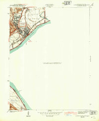
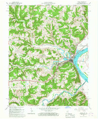
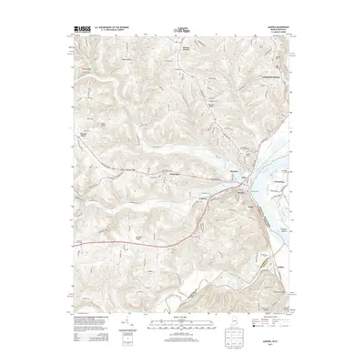
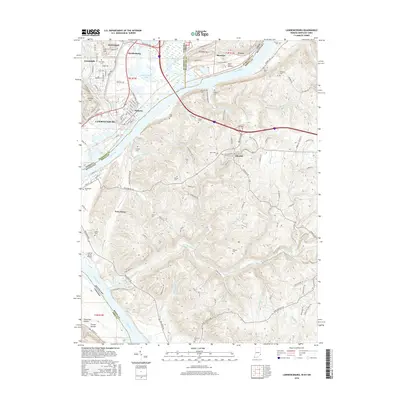
 1981 Lawrenceburg1982 Print · USGSThe tri-state junction of Indiana, Kentucky, and Ohio is captured here in the early eighties as the river economy matured. Researchers can trace family history through numerous burial sites like Greendale Cem and Petersburg Cem or locate the old Courthouse in Lawrenceburg.3 unique versions available
 - 1986 Map of Cincinnati
 1986 Cincinnati1986 Print · USGSGreater Cincinnati and its tri-state surrounds are captured here in the mid-eighties as suburban growth reached into the neighboring hills and river valleys. Researchers can trace the development of transit hubs like Greater Cincinnati International Airport and historic sites such as Spring Grove Cemetery.3 unique versions available
 - 2010 Map of Aurora, 2010 Print
 2010 Aurora2010 Print · USGSCovers Lawrenceburg, including Aurora, Buffalo, and other nearby areas
 - 2010 Map of Guilford, 2010 Print
 2010 Guilford2010 Print · USGSCovers Lawrenceburg, including Logan, Lawrenceburg Township, and other nearby areas
 - 2010 Map of Lawrenceburg, 2010 Print
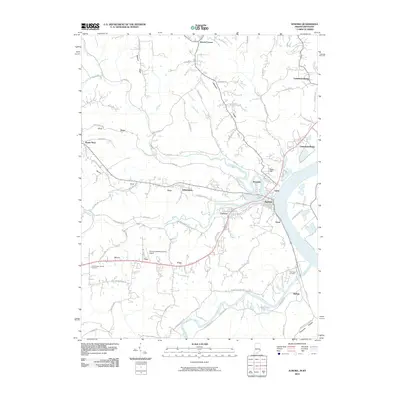
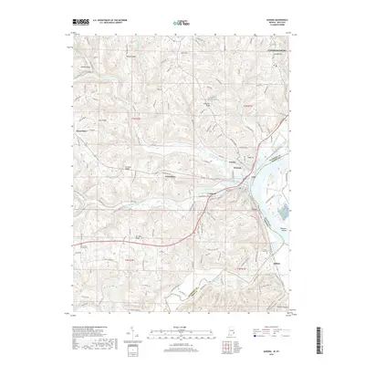
 2010 Lawrenceburg2010 Print · USGSCovers Lawrenceburg, including Burlington, Greendale, and other nearby areas
 - 2013 Map of Guilford, 2013 Print
 2013 Guilford2013 Print · USGSCovers Lawrenceburg, including Logan, Lawrenceburg Township, and other nearby areas
 - 2013 Map of Lawrenceburg, 2013 Print
 2013 Lawrenceburg2013 Print · USGSCovers Lawrenceburg, including Burlington, Greendale, and other nearby areas
 - 2013 Map of Aurora, 2013 Print
 2013 Aurora2013 Print · USGSCovers Lawrenceburg, including Aurora, Buffalo, and other nearby areas
 - 2016 Map of Lawrenceburg, 2016 Print
 2016 Lawrenceburg2016 Print · USGSCovers Lawrenceburg, including Burlington, Greendale, and other nearby areas
 - 2016 Map of Guilford, 2016 Print
 2016 Guilford2016 Print · USGSCovers Lawrenceburg, including Logan, Lawrenceburg Township, and other nearby areas
 - 2016 Map of Aurora, 2016 Print
 2016 Aurora2016 Print · USGSCovers Lawrenceburg, including Aurora, Buffalo, and other nearby areas
 - 2019 Map of Aurora, 2019 Print
 2019 Aurora2019 Print · USGSCovers Lawrenceburg, including Aurora, Buffalo, and other nearby areas
Showing maps 1-25 of 30
Top cities near Lawrenceburg
- Cincinnati historical maps
- Florence historical maps
- Burlington historical maps
- Harrison historical maps
- Ross Township historical maps
- Union historical maps
See more
Top neighborhoods of Lawrenceburg
Frequently asked questions
- What are the different types of historical maps available for Lawrenceburg?
- What is the oldest map of Lawrenceburg?
- Where can I purchase historical maps of Lawrenceburg for my home or office?
- Where can I download high-res historical maps of Lawrenceburg?
- Are there historical topographic maps available for Lawrenceburg?
- Is there historical aerial imagery available for Lawrenceburg?
- Where are historical maps of Lawrenceburg sourced from?