Old Maps of Greensburg, Indiana for Genealogy
Trace your family roots with 16 historic maps of Greensburg. These high-res maps reveal old neighborhoods, homesites, landmarks, and streets — helping you uncover where your ancestors lived and how the area evolved over time.
- Explore historic neighborhoods: Identify where your relatives may have lived in the 1800s or 1900s.
- Compare maps over time: Trace the changes in streets, buildings, and landmarks for multi-generational research.
- Perfect for genealogy & ancestry research: Used by family historians and researchers to map out lineage and migration.
These maps are an incredible resource for exploring your personal connection to Greensburg's past.
Greensburg, IN maps
(16)- 1942 Map of Columbus
 1942 Columbus1942 Print · USGSBartholomew and Shelby counties are shown during the early years of the war, as military installations and rail lines reshaped the rural Indiana landscape. Genealogists can trace family-named sites and established communities like St Louis Crossing, Hope, and the sprawling Camp Atterbury.
 - 1953 Map of Cincinnati, 1965 Print
 1953 Cincinnati1965 Print · USGSThe Ohio River valley and the industrial heartland of Indiana and Ohio are captured here during the mid-century peak of rail and river commerce. Genealogists and historians can trace connections between Cincinnati and outlying military sites like Camp Atterbury and Bakalar AFB.3 unique versions available
 - 1957 Map of Cincinnati
 1957 Cincinnati1957 Print · USGSThe Ohio River valley and its surrounding highlands thrived during the mid-fifties industrial peak, centered on the bustling Cincinnati and Dayton metropolitan hubs. Researchers can trace the extensive rail networks and military sites like Wright-Patterson AFB and Camp Atterbury.
 - 1958 Map of Greensburg, 1959 Print
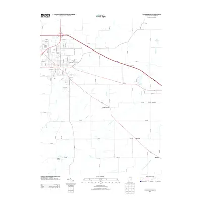
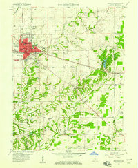 1958 Greensburg1959 Print · USGSGreensburg and the surrounding Indiana countryside are captured here in the late fifties as the town grew along the rail and road lines. Researchers can find numerous family-named landmarks and rural burial grounds like Antioch Cem and Sand Creek Cem.4 unique versions available
 - 1958 Map of Forest Hill, 1959 Print
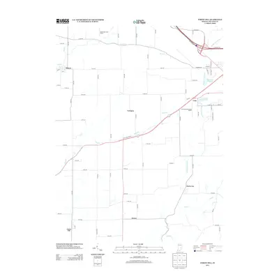
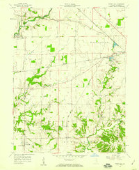 1958 Forest Hill1959 Print · USGSDecatur County's rural townships are captured in the late fifties as small crossroads settlements like Ewington and Harris City thrived along the New York Central railroad. Researchers can trace family history through numerous landmarks including Forsythe Cem, Columbia Cem, and the County Home.4 unique versions available
 - 1986 Map of Greensburg
 1986 Greensburg1986 Print · USGSSoutheastern Indiana in the mid-eighties shows a balance of growing industrial centers and deeply rooted rural communities. Family historians can trace landmarks like the Highland Center School, South Park Cemetery, and the Bartholomew County Courthouse among the river forks.2 unique versions available
 - 2010 Map of Forest Hill, 2010 Print
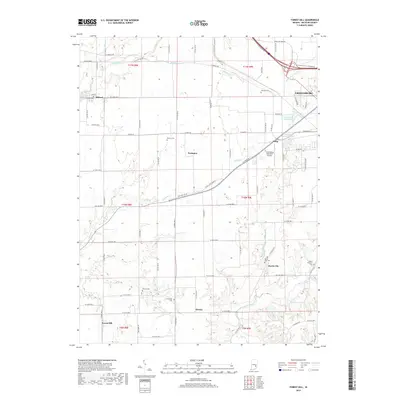
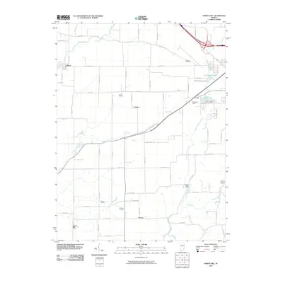 2010 Forest Hill2010 Print · USGSCovers Greensburg, including Milford, Horace, and other nearby areas
 - 2010 Map of Greensburg, 2010 Print
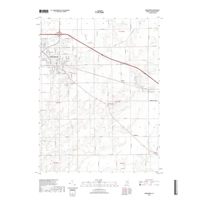
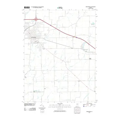 2010 Greensburg2010 Print · USGSCovers Greensburg, including Slabtown, Smyrna, and other nearby areas
 - 2013 Map of Forest Hill, 2013 Print
 2013 Forest Hill2013 Print · USGSCovers Greensburg, including Milford, Horace, and other nearby areas
 - 2013 Map of Greensburg, 2013 Print
 2013 Greensburg2013 Print · USGSCovers Greensburg, including Slabtown, Smyrna, and other nearby areas
 - 2016 Map of Forest Hill, 2016 Print
 2016 Forest Hill2016 Print · USGSCovers Greensburg, including Milford, Horace, and other nearby areas
 - 2016 Map of Greensburg, 2016 Print
 2016 Greensburg2016 Print · USGSCovers Greensburg, including Slabtown, Smyrna, and other nearby areas
 - 2019 Map of Forest Hill, 2019 Print
 2019 Forest Hill2019 Print · USGSCovers Greensburg, including Milford, Horace, and other nearby areas
 - 2019 Map of Greensburg, 2019 Print
 2019 Greensburg2019 Print · USGSCovers Greensburg, including Slabtown, Smyrna, and other nearby areas
 - 2022 Map of Forest Hill, 2022 Print
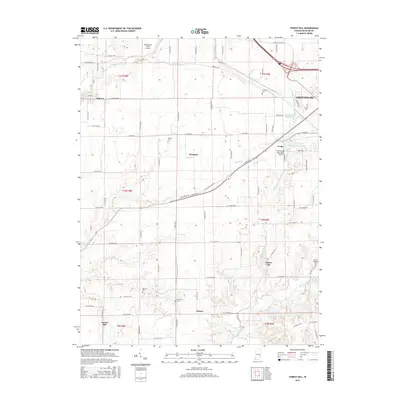
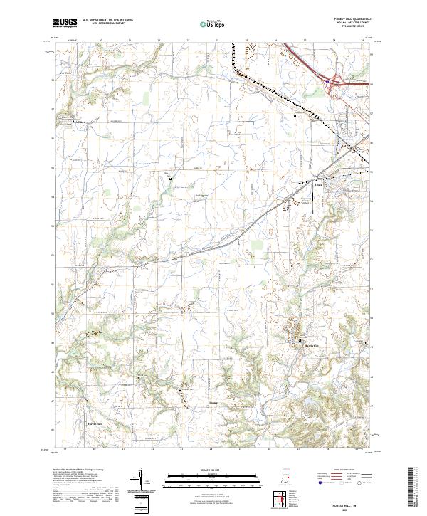 2022 Forest Hill2022 Print · USGSDecatur County at the start of the 2020s shows a landscape of enduring rural settlements and family burial grounds. Genealogists can trace lineage at Harris City Cem or Mount Pleasant Cem and locate homes near Ewington or Horace.
 - 2022 Map of Greensburg, 2022 Print
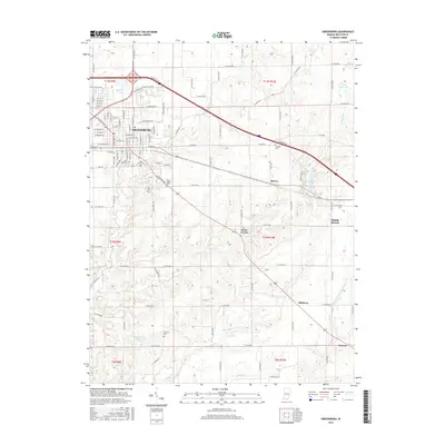
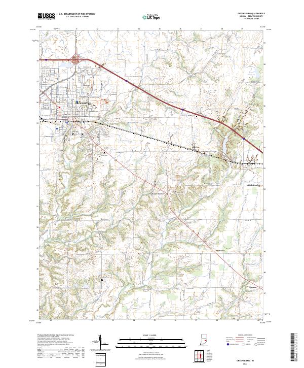 2022 Greensburg2022 Print · USGSGreensburg and its surrounding Decatur County townships are captured here in the early twenty-first century as the city expands into the traditional farm landscape. Genealogists can locate several local burial sites, from Saint Marys Cem to Antioch Cem, and trace the paths of Sand Cr and Cobbs Fork.
End of results
Showing maps 1-16 of 16
Top cities near Greensburg
- Osgood historical maps
- Westport historical maps
- St. Paul historical maps
- Saint Paul historical maps
- Richland historical maps
- Hartsville historical maps
See more
Frequently asked questions
- What are the different types of historical maps available for Greensburg?
- What is the oldest map of Greensburg?
- Where can I purchase historical maps of Greensburg for my home or office?
- Where can I download high-res historical maps of Greensburg?
- Are there historical topographic maps available for Greensburg?
- Is there historical aerial imagery available for Greensburg?
- Where are historical maps of Greensburg sourced from?