2020s Maps of DeKalb County, Indiana
Explore 12 historic maps of DeKalb County from the 2020s. These maps offer a rare glimpse into what life looked like during the 2020s — showing old roads, neighborhoods, homes, and landmarks that have changed or disappeared over time.
Whether you're researching your family's past, planning a metal detecting trip, or studying how DeKalb County's landscape evolved across the 2020s, these high-resolution maps are a powerful tool for exploring the history of this region.
- Focus on a specific era: All maps on this page are from the 2020s, giving you a focused view of this time period.
- See what’s changed: Compare century-old streets, trails, and buildings to today's modern landscape using overlays and satellite layers.
- Research with precision: Use these maps for genealogy, historical research, land use analysis, or educational projects.
- View, download, or print: Maps are fully viewable online in high resolution, and can be downloaded or printed for your own records.
Start exploring DeKalb County's history through authentic maps from the 2020s. This is your window into the past.
DeKalb County, IN maps
(12)- 2022 Map of Garrett, 2022 Print
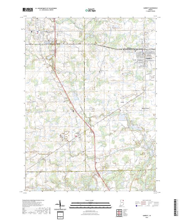 2022 Garrett2022 Print · USGSDeKalb and Noble counties come into focus in the early 2020s, showcasing a landscape defined by organized drainage and tight-knit crossroads. Researchers can trace family history at Calvary Cem, explore the residential layout of Altona, or locate the small settlement of Butler Center.
 - 2022 Map of Auburn, 2022 Print
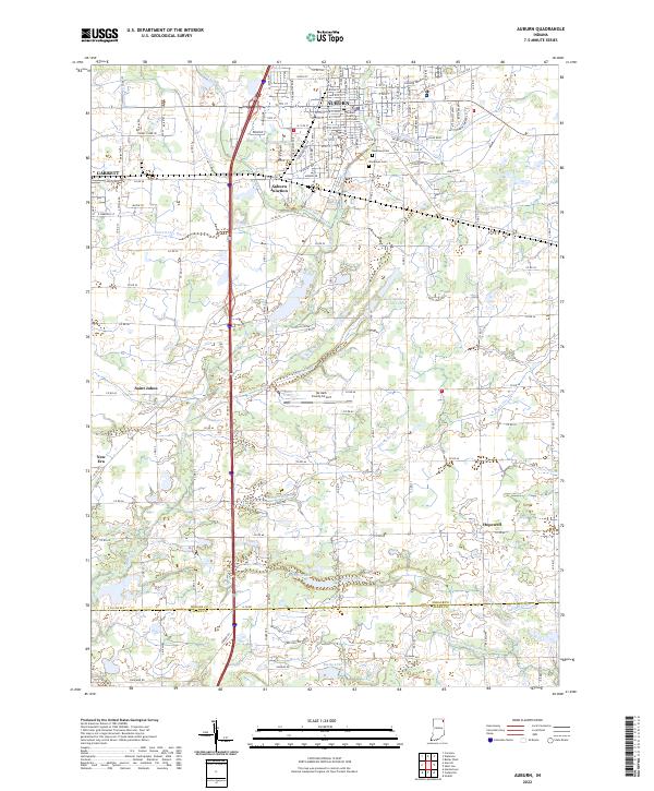 2022 Auburn2022 Print · USGSDeKalb County enters the 2020s as a hub of municipal growth and complex drainage systems. Researchers can trace the layout of Auburn and Garrett, alongside smaller locales like New Era and landmarks such as the DeKalb County Courthouse.
 - 2022 Map of Butler West, 2022 Print
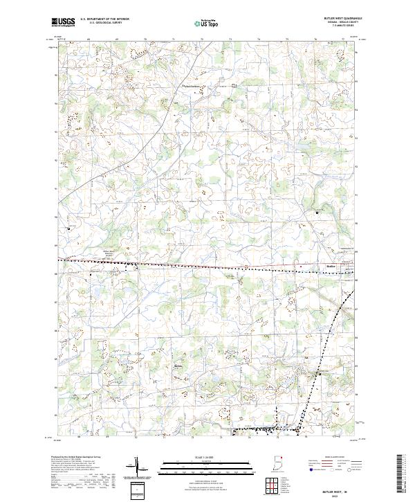 2022 Butler West2022 Print · USGSDeKalb County farmland in the early twenty-first century is defined by its complex network of drainage ditches and small rural corners. Genealogists and local historians can locate family burial sites at Lutz Cem and Rude Cem or trace the early settlement at Taylor Corner.
 - 2022 Map of Ashley, 2022 Print
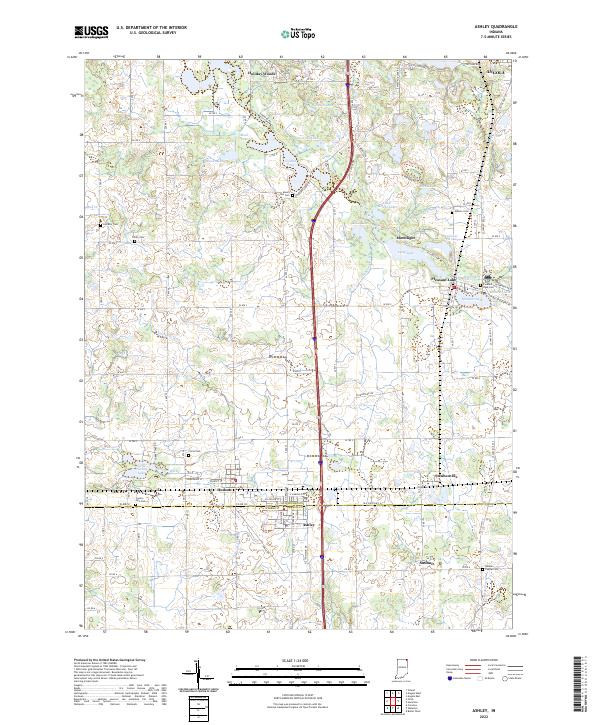 2022 Ashley2022 Print · USGSThe borderlands of Steuben and DeKalb counties are shown in detail as they appeared in the early 2020s. Researchers can trace family history through several rural burial sites like Mount Zion Cem and Hollister Cem, or explore lakeside settlements such as Pleasant Lake and Hudson.
 - 2022 Map of Corunna, 2022 Print
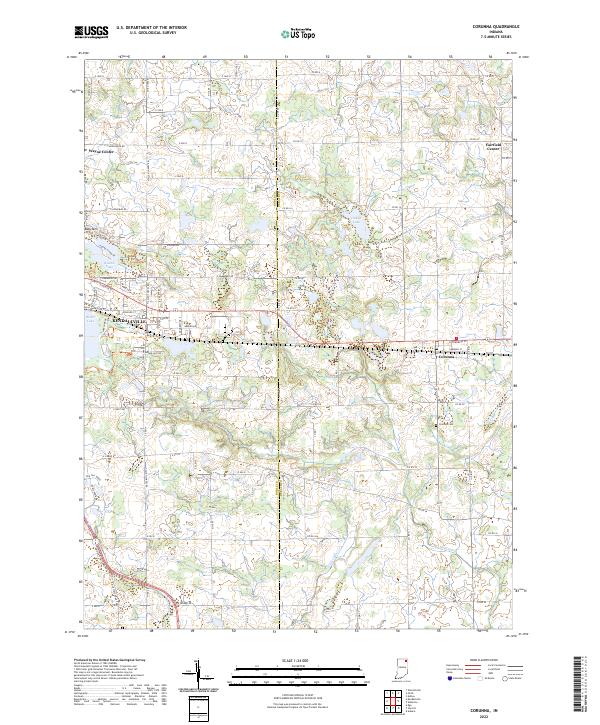 2022 Corunna2022 Print · USGSCorunna and Kendallville appear at the dawn of the 2020s in this detailed look at the Noble-DeKalb county line. Researchers can trace local lineage through the Corunna Cemetery and Fairfield Center Church, or locate the historic Wayne Center School.
 - 2022 Map of Saint Joe, 2022 Print
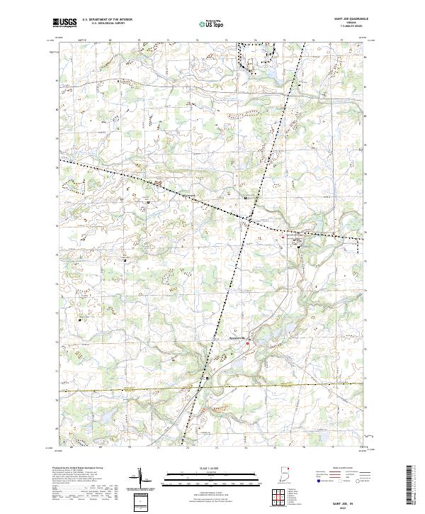 2022 Saint Joe2022 Print · USGSThe Saint Joseph River valley north of Fort Wayne is documented here in the early 2020s, showing a landscape of small river towns and family cemeteries. Genealogists can trace roots at White City Cem, Cosper Cem, or Kraft Cem while exploring the crossroads of Concord and Spencerville.
 - 2022 Map of Hamilton, 2022 Print
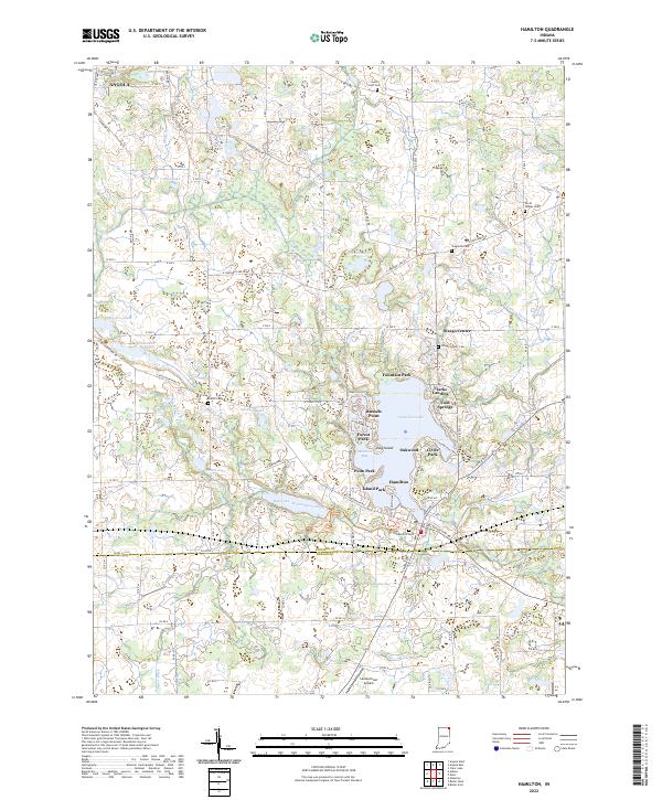 2022 Hamilton2022 Print · USGSThe lakeside communities of northeast Indiana are captured here in the early twenty-first century, centered on the expansive Hamilton Lake. Researchers can trace local genealogy through several rural burial grounds like Carter Cem and North Otsego Cem.
 - 2022 Map of Waterloo, 2022 Print
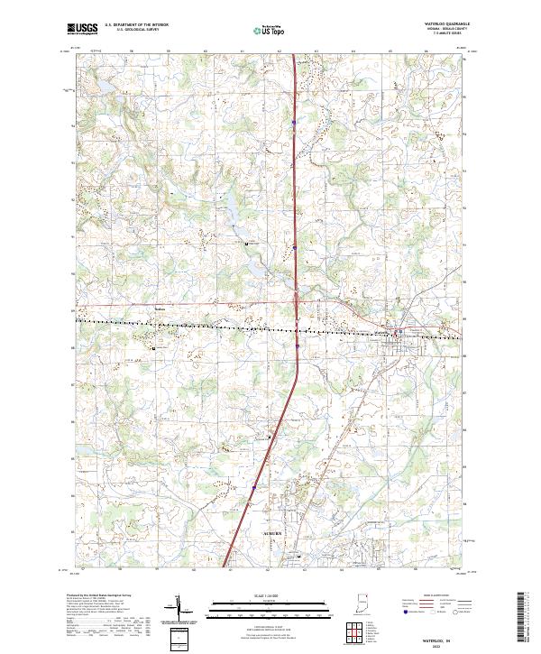 2022 Waterloo2022 Print · USGSDeKalb County enters the 2020s as a landscape of managed waterways and historic crossroads at Waterloo and Sedan. Genealogists and local historians can locate rural burial sites like Tamarack Cem and Cedar Lake Cem amidst a complex network of agricultural channels.
 - 2022 Map of Stroh, 2022 Print
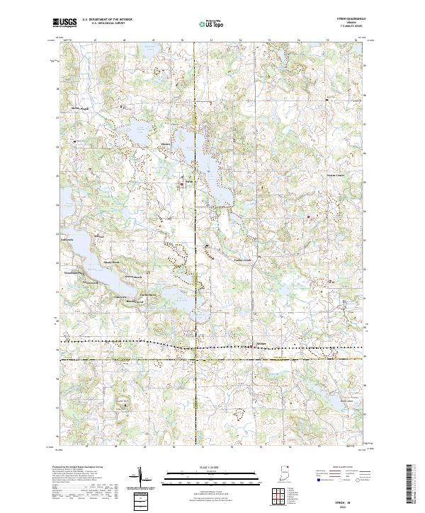 2022 Stroh2022 Print · USGSGlacial lakes and rural crossroads define this northern Indiana landscape at the borders of four counties. Genealogists and local historians can trace family roots at Bethel Cem or Wright Cem and explore lakefront developments like Gravel Beach and Shady Nook.
 - 2022 Map of Butler East, 2022 Print
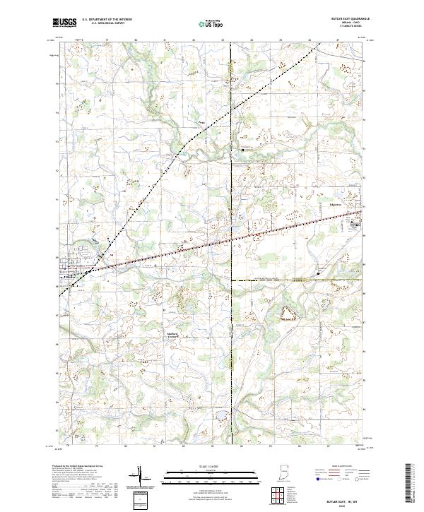 2022 Butler East2022 Print · USGSThe Indiana-Ohio borderlands come into focus in this contemporary survey of DeKalb and Williams Counties. Genealogists and local historians can trace the rural landscape between Edgerton and Butler, locating family sites near Saint Marys Cem and Ladd Lake.
 - 2023 Map of Hicksville, 2023 Print
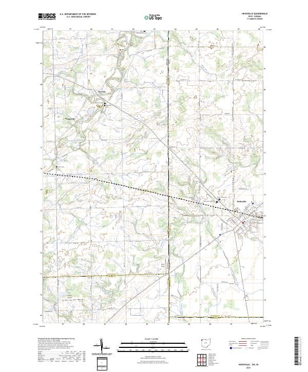 2023 Hicksville2023 Print · USGSThe Indiana-Ohio state line and the agricultural fields of Defiance County define this landscape in the 2020s. Researchers can locate several burial sites including Wartenbe Cemetery and Alton Cem, or trace the managed waters of the Saint Joseph River and Mill Creek.
 - 2023 Map of Edon, 2023 Print
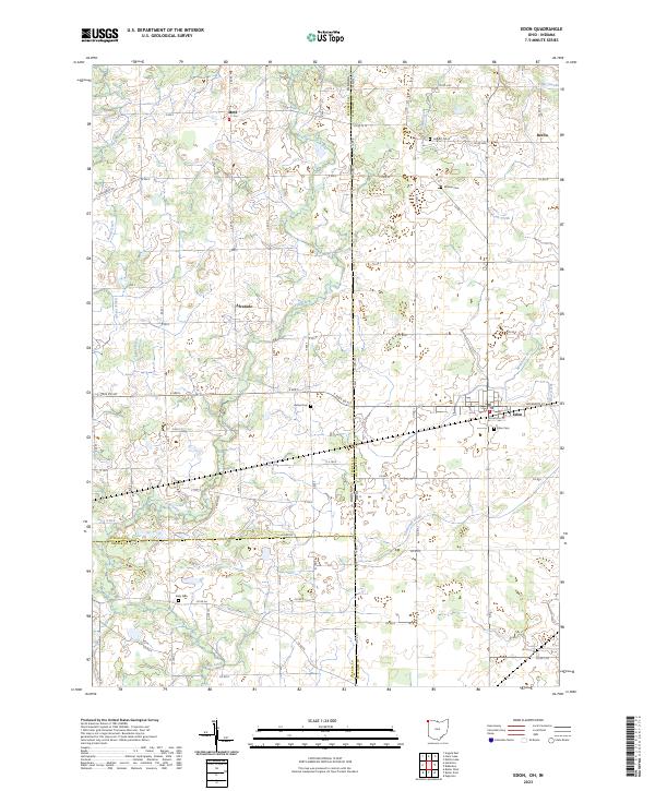 2023 Edon2023 Print · USGSThe crossroads of Indiana and Ohio are captured here in the early 2020s, showing a landscape defined by drainage and small-town roots. Researchers can trace family history through several rural burial grounds including Eddy Cem, Boisher Cem, and the village of Edon.
End of results
Showing maps 1-12 of 12
Top cities of DeKalb County
- Auburn historical maps
- Garrett historical maps
- Butler historical maps
- Waterloo historical maps
- Concord historical maps
- Ashley historical maps
See more
Frequently asked questions
- What are the different types of historical maps available for DeKalb County?
- What is the oldest map of DeKalb County?
- Where can I purchase historical maps of DeKalb County for my home or office?
- Where can I download high-res historical maps of DeKalb County?
- Are there historical topographic maps available for DeKalb County?
- Is there historical aerial imagery available for DeKalb County?
- Where are historical maps of DeKalb County sourced from?