Old Maps of DeKalb County, Indiana for Metal Detecting
Plan your next treasure hunt with 95 historic maps of DeKalb County. Find old homesites, ghost towns, trails, and gathering spots that may be lost to time — perfect for identifying promising metal detecting locations.
- Locate forgotten sites: Uncover places like long-lost settlements, abandoned rail lines, or gathering spots.
- Plan better hunts: Use map overlays combined with LiDAR or satellite views to narrow in on historically rich areas.
- Made for detectorists: Thousands of hobbyists use these maps to discover relics, coins, and hidden history.
Use these historic maps to boost your research and find new opportunities beneath the surface of DeKalb County.
DeKalb County, IN maps
(95)- 1914 Map of Bryan, 1942 Print
 1914 Bryan1942 Print · USGSNorthwest Ohio at the height of the steam era reveals a landscape of thriving rail towns and dense country school districts. Researchers can trace the original routes of the Wabash RR and Electric R R through Bryan and Hicksville, while locating vanished rural sites like Crazy School and Ziegler.
 - 1939 Map of Hamilton
 1939 Hamilton1939 Print · USGSSteuben and De Kalb counties are captured here in the late 1930s, documenting a landscape defined by glacial lakes and established farming townships. Researchers can trace rural life through the locations of Otsego Center Cem, South Scott Ch, and the shoreline developments of Hamilton Lake.
 - 1940 Map of Metz
 1940 Metz1940 Print · USGSThe Indiana-Ohio borderlands come into focus in the years before the war, showing a landscape of drainage ditches and family-named bridge crossings. Genealogists can trace rural life through landmarks like Metz Cem, Bethel Ch, and the small settlement of Alvarado.2 unique versions available
 - 1942 Map of Ashley
 1942 Ashley1942 Print · USGSNortheastern Indiana's lake country is captured in the early 1940s, showing the vital rail junction where the WABASH and Central York New lines intersect. Genealogists can trace family roots at Hollister Cem, St Johns Ch, and the settlements of Ashley and Steubenville.2 unique versions available
 - 1942 Map of Stroh
 1942 Stroh1942 Print · USGSNortheast Indiana’s lake country is captured here in the early 1940s, showing a landscape of small farming hamlets and lakeside landings. Researchers can trace family roots at Reed Cem or locate old community hubs like Salem Center and Helmer.2 unique versions available
 - 1943 Map of Bryan
 1943 Bryan1943 Print · USGSNorthwest Ohio during the mid-century is captured here as a landscape of grid-roads, small hamlets, and heavy rail traffic. Genealogists and local historians can trace family roots through numerous rural landmarks like Bethel Ch, Bratton Sch, and the hamlet of Farmer.
 - 1948 Map of Hamilton
 1948 Hamilton1948 Print · USGSNortheastern Indiana's glaciated landscape is revealed here in the late 1940s, centered on the growing community of Hamilton. Genealogists can trace early homesteads and landmarks like Otsego Center Cem, the Wabash rail line, and South Scott Ch.2 unique versions available
 - 1953 Map of Fort Wayne, 1963 Print
 1953 Fort Wayne1963 Print · USGSNortheast Indiana and its neighboring borderlands in Michigan and Ohio appear here during a peak era of rail and road expansion. Researchers can trace the massive rail networks of the Nickel Plate Road and Wabash or locate lakeside landmarks like Lake Wawasee and Clear Lake.4 unique versions available
 - 1955 Map of Corunna, 1957 Print
 1955 Corunna1957 Print · USGSDeKalb and Noble Counties are captured here in the mid-1950s, showing a landscape shaped by glacial lakes and the reach of the Pennsylvania railroad. Researchers can trace rural life through landmarks like Allen Chapel, the Township Sch, and the small settlement at Fairfield Center.
 - 1956 Map of Fort Wayne
 1956 Fort Wayne1956 Print · USGSThe tri-state borderlands of Indiana, Michigan, and Ohio are captured here in the mid-fifties, centered on the growing industrial hub of Fort Wayne. Researchers can trace the heavy rail lines of the New York Central and Pennsylvania alongside prominent water features like Lake Wawasee and the Maumee River.2 unique versions available
 - 1957 Map of Auburn, 1959 Print
 1957 Auburn1959 Print · USGSDeKalb County in the late fifties is a landscape defined by its vital rail junctions and organized farm townships. Genealogists can trace family names and sites across Auburn Junction, Roselawn Cem, and rural schoolhouses like Harrison Sch.
 - 1957 Map of Waterloo, 1959 Print
 1957 Waterloo1959 Print · USGSDeKalb County is captured here in the late fifties, showing a landscape defined by rail lines and rural community centers. Genealogists can locate family landmarks such as the De Kalb County Home, St Michaels Ch, and the Tamarack Cem.
 - 1957 Map of Garrett, 1959 Print
 1957 Garrett1959 Print · USGSDeKalb and Noble County landscapes converge here in the late fifties, showcasing a robust railroad economy centered on Garrett. Genealogists and local historians can trace rural family roots through landmarks like Bethlehem Ch, Fitch, and the Swan Cem.
 - 1958 Map of Hicksville, 1959 Print
 1958 Hicksville1959 Print · USGSThe Indiana-Ohio borderlands at the end of the 1950s showcase a landscape of river-bend settlements and cross-state rail traffic. Genealogists can trace family footprints at Wartenbe Cem and Evergreen Cem, or locate mid-century landmarks like the County Fairgrounds and Coburn Corners Ch.4 unique versions available
 - 1958 Map of Butler West, 1959 Print
 1958 Butler West1959 Print · USGSDeKalb County’s rural rail and road network is caught in detail during the late fifties, centered on the junction at Butler. Researchers can trace old family names and local landmarks like Norris Chapel, Franklin Center Sch, and several cemeteries including Ridge Cem.2 unique versions available
 - 1958 Map of Saint Joe, 1960 Print
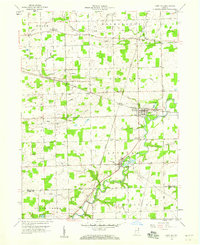 1958 Saint Joe1960 Print · USGSDeKalb County and northern Allen County are shown in the late fifties as the St. Joseph River valley maintained its rural character. Genealogists can locate family names at Cosper Cem and Watson Cem or trace the Baltimore and Ohio rail line through Saint Joe.3 unique versions available
 - 1958 Map of Butler East, 1960 Print
 1958 Butler East1960 Print · USGSDeKalb County and the Ohio borderlands are shown here in the late fifties, where the Principal Meridian separates two states. Researchers can locate community anchors like Stafford Center, Big Run Ch, and the old Jerusalem Sch.4 unique versions available
 - 1959 Map of Stroh, 1960 Print
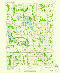 1959 Stroh1960 Print · USGSNortheast Indiana at the end of the fifties reveals a landscape defined by glacial waters where four counties meet. Genealogists and local historians can locate lakeside communities like Shady Nook and family-centered landmarks such as Weston Chapel Cem and Salem Center Sch.2 unique versions available
 - 1959 Map of Hamilton, 1961 Print
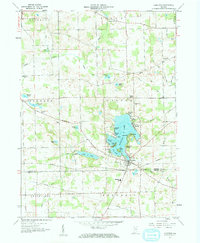 1959 Hamilton1961 Print · USGSNortheast Indiana’s lake country is captured here during the late fifties, showing a landscape defined by glacial waters and rural townships. Researchers can trace family history through sites like Teegardin Cem, South Scott Ch, and the many parks lining Hamilton Lake.2 unique versions available
 - 1959 Map of Ashley, 1961 Print
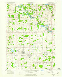 1959 Ashley1961 Print · USGSSteuben and DeKalb counties come together in this late 1950s survey of the lake-studded landscape around the town of Ashley. Genealogists and local historians can trace rural family landmarks like Matson Cem, Barker Ch, and the small settlement of Steubenville.3 unique versions available
 - 1961 Map of Edon, 1963 Print
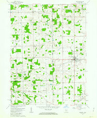 1961 Edon1963 Print · USGSIn the early 1960s, this tri-state border region centered on Edon highlights a landscape of river-fed farms and remote rural settlements. Researchers can locate historic landmarks like the Covered Bridge and family heritage sites such as Eddy Cem and Zion Ch.4 unique versions available
 - 1973 Map of Waterloo, 1974 Print
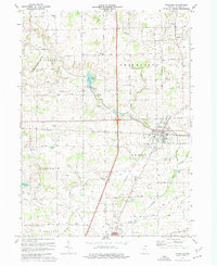 1973 Waterloo1974 Print · USGSDeKalb County in the early seventies shows a landscape of busy rail corridors and quiet rural crossroads. Genealogists can locate several family landmarks and community centers, including Sedan, Cedar Lake Church, and the Tamerack Cemetery.2 unique versions available
 - 1973 Map of Corunna, 1974 Print
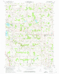 1973 Corunna1974 Print · USGSDeKalb and Noble Counties are shown in the early seventies as a series of well-defined rural townships and small rail-side settlements. Local historians can trace the foundations of the community through the Corunna Cemetery, Allen Chapel, and the Penn Central line.
 - 1973 Map of Garrett, 1974 Print
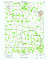 1973 Garrett1974 Print · USGSIn the early 1970s, the industrial rail center of Garrett and its neighboring agricultural townships were defined by the Penn Central line. Genealogists and local historians can trace family-named sites like Swan Cem and Embrey Cem, or locate landmarks such as Bethlehem Ch and the Old Railroad Grade near Altona.
 - 1973 Map of Auburn, 1975 Print
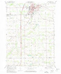 1973 Auburn1975 Print · USGSAuburn and the surrounding DeKalb County townships are captured here in the early seventies, showcasing a thriving hub of rail and agriculture. Genealogists and local historians can trace family locations near Harrison Sch, Roselawn Cem, or the rural crossroads of Saint Johns and New Era.2 unique versions available
Showing maps 1-25 of 95
Top cities of DeKalb County
- Auburn historical maps
- Garrett historical maps
- Butler historical maps
- Waterloo historical maps
- Concord historical maps
- Ashley historical maps
See more
Frequently asked questions
- What are the different types of historical maps available for DeKalb County?
- What is the oldest map of DeKalb County?
- Where can I purchase historical maps of DeKalb County for my home or office?
- Where can I download high-res historical maps of DeKalb County?
- Are there historical topographic maps available for DeKalb County?
- Is there historical aerial imagery available for DeKalb County?
- Where are historical maps of DeKalb County sourced from?