1900s (20th Century) Maps of Elkhart County, Indiana
Explore 37 historic maps of Elkhart County from the 1900s (20th Century). These maps offer a rare glimpse into what life looked like during the 1900s — showing old roads, neighborhoods, homes, and landmarks that have changed or disappeared over time.
Whether you're researching your family's past, planning a metal detecting trip, or studying how Elkhart County's landscape evolved across the 1900s, these high-resolution maps are a powerful tool for exploring the history of this region.
- Focus on a specific era: All maps on this page are from the 1900s, giving you a focused view of this time period.
- See what’s changed: Compare century-old streets, trails, and buildings to today's modern landscape using overlays and satellite layers.
- Research with precision: Use these maps for genealogy, historical research, land use analysis, or educational projects.
- View, download, or print: Maps are fully viewable online in high resolution, and can be downloaded or printed for your own records.
Start exploring Elkhart County's history through authentic maps from the 1900s. This is your window into the past.
Elkhart County, IN maps
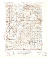
(37)- 1914 Map of Three Rivers, 1966 Print
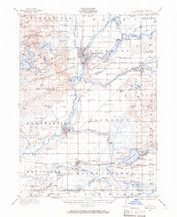 1914 Three Rivers1966 Print · USGSSt. Joseph County's river-driven economy is on full display in the early 1900s, centered on the busy rail junction at Three Rivers. Genealogists can locate dozens of country schools and churches, from Peck Academy to the remote Quail Trap School.
 - 1916 Map of Three Rivers
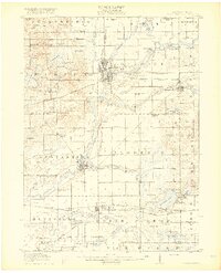 1916 Three Rivers1916 Print · USGSThe river-driven industry and rural school networks of St. Joseph County are in full view during the mid-nineteen-teens. Genealogists and historians can locate old homesteads near Johnnycake School, trace the Chicago Road, or find the early power structures at Sturgis Power Dam.3 unique versions available
 - 1943 Map of Three Rivers
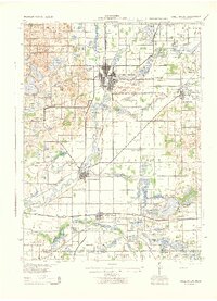 1943 Three Rivers1943 Print · USGSSt. Joseph County and the northern Indiana borderlands appear here in the 1940s at the height of the steam-rail era. Genealogists can trace dozens of rural school sites like Johnnycake Sch and family landmarks near White Pigeon, Constantine, and Klinger Lake.
 - 1945 Map of Cassopolis, 1967 Print
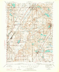 1945 Cassopolis1967 Print · USGSSouthwestern Michigan's rural landscape is captured here in the mid-1940s, showing a dense network of country schools and family-named cemeteries. Genealogists can trace property roots near Barron Lake Cem, Crystal Springs Campground, and numerous landmarks like Morris Chapel.3 unique versions available
 - 1947 Map of Cassopolis
 1947 Cassopolis1947 Print · USGSSouthwest Michigan's lake country is captured here just after the war, showing the busy rail-and-river hubs and rural townships. Researchers can locate dozens of neighborhood schoolhouses like Brooklyn Sch and country churches such as Smith Chapel.2 unique versions available
 - 1948 Map of Vandalia
 1948 Vandalia1948 Print · USGSCass County's lake-studded landscape is captured here in the mid-1940s, showing a vibrant network of rural schoolhouses and lakeside retreats. Genealogists and local historians can trace early school districts like Allegheny Sch, locate the Moon Cem, and see the rail economy of Vandalia along the Grand Trunk.5 unique versions available
 - 1949 Map of Vandalia
 1949 Vandalia1949 Print · USGSIn the late 1940s, this pocket of Cass County was a hub of rural life and summer lakeside recreation. Genealogists can locate family landmarks like the Shavehead Cem or Chain Lake Ch, and trace old rail stops along the Grand Trunk.2 unique versions available
 - 1951 Map of Milford
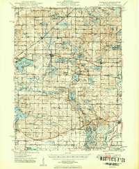
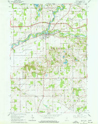
 1951 Milford1951 Print · USGSKosciusko and Elkhart counties are captured in the early fifties at a peak of rail activity and lakeside development. Genealogists and rail historians can trace the crossing of three major lines at Milford Junction or locate family sites like Pleasant View Cem Ch and Bethany Sch.2 unique versions available
 - 1951 Map of Wawasee
 1951 Wawasee1951 Print · USGSKosciusko and Noble counties are captured here in the early fifties, showing the vibrant lakeside communities and rural townships. Genealogists can trace family landmarks and early schools like Judy School, Weybright Cem, and the Zion Church near the town of Syracuse.2 unique versions available
 - 1953 Map of Fort Wayne, 1963 Print
 1953 Fort Wayne1963 Print · USGSNortheast Indiana and its neighboring borderlands in Michigan and Ohio appear here during a peak era of rail and road expansion. Researchers can trace the massive rail networks of the Nickel Plate Road and Wabash or locate lakeside landmarks like Lake Wawasee and Clear Lake.4 unique versions available
 - 1953 Map of Chicago, 1964 Print
 1953 Chicago1964 Print · USGSThe southern Lake Michigan shoreline was rapidly modernizing in the mid-fifties, balancing heavy industry with its famous academic centers. Researchers can trace the footprints of Notre Dame University or locate vanished sites like the Kingsbury Ordnance Plant and Meigs Field.5 unique versions available
 - 1956 Map of Fort Wayne
 1956 Fort Wayne1956 Print · USGSThe tri-state borderlands of Indiana, Michigan, and Ohio are captured here in the mid-fifties, centered on the growing industrial hub of Fort Wayne. Researchers can trace the heavy rail lines of the New York Central and Pennsylvania alongside prominent water features like Lake Wawasee and the Maumee River.2 unique versions available
 - 1957 Map of Chicago
 1957 Chicago1957 Print · USGSThe industrial heartland and southern Great Lakes shoreline are captured here during the peak of mid-century growth. Researchers can trace the massive Gary Steel Works, the grounds of the University of Notre Dame, and the early paths of the Tri-State Tollway.
 - 1958 Map of Nappanee West, 1960 Print
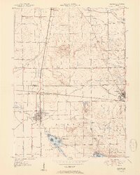
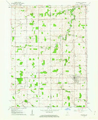
 1958 Nappanee West1960 Print · USGSNorthern Indiana farm country is captured here in the late fifties, showing the rural grid where Marshall and Elkhart counties meet. Genealogists can trace family footprints through Borkholder Sch, South Union Chapel, and Sarah Hershberger Road.3 unique versions available
 - 1958 Map of Osceola, 1960 Print
 1958 Osceola1960 Print · USGSOsceola and the St. Joseph River valley are shown here in the late fifties as the region balanced its agrarian roots with modern infrastructure. Researchers can trace the legacy of local families through Carlton Cem, Salem Ch, and the many schools like Frank Sch dotting the landscape.
 - 1958 Map of Nappanee East, 1960 Print
 1958 Nappanee East1960 Print · USGSNorthern Kosciusko County appears as a burgeoning agricultural and rail corridor in the late fifties. Genealogists can trace family landmarks like Wisler Ch, Providence Cem, and the small community of Gravelton along the railroad.2 unique versions available
 - 1959 Map of Millersburg, 1961 Print
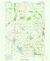
 1959 Millersburg1961 Print · USGSMillersburg and the surrounding Elkhart County townships are captured here in the late fifties, showing a landscape defined by small-town life and the New York Central railroad. Genealogists and local historians can locate many country churches and burial grounds, such as Clinton Brick Ch, Fair Haven Ch, and Miller Cem.4 unique versions available
 - 1959 Map of Goshen, 1961 Print
 1959 Goshen1961 Print · USGSGoshen and its surrounding townships are captured in the late fifties, showing a landscape shaped by the Elkhart River and major rail lines. Genealogists and local historians can locate early family burial sites like Studebaker Cem and trace the paths of the New York Central and Wabash Railroad through New Paris and Benton.4 unique versions available
 - 1960 Map of Foraker, 1961 Print
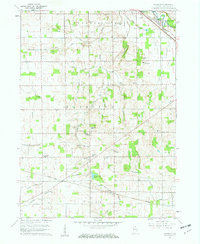 1960 Foraker1961 Print · USGSElkhart County farmland is depicted here in the early sixties, showing a landscape defined by organized drainage and rural community life. Researchers can locate numerous family-named landmarks and old country churches like Wisler Ch, Wenger Cem, and the settlement of Foraker.4 unique versions available
 - 1961 Map of Wakarusa, 1963 Print
 1961 Wakarusa1963 Print · USGSIn the early 1960s, the rural borderlands of Elkhart and St. Joseph counties remained a landscape of family-named drainage ditches and country congregations. Genealogists and local researchers can trace the vicinity of Wakarusa to find Holdeman Ch, Resthaven Cem, and Township High Sch.3 unique versions available
 - 1961 Map of Lake Wawasee, 1963 Print
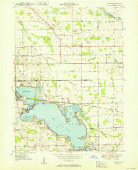
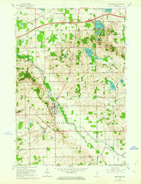
 1961 Lake Wawasee1963 Print · USGSKosciusko County lakelife in the early sixties centers on Lake Wawasee and its surrounding communities. Researchers can trace family history through sites like Hire Cemetery, Juday School, and the lakeside settlements of Vawter Park and Pickwick Park.3 unique versions available
 - 1961 Map of Bristol, 1963 Print
 1961 Bristol1963 Print · USGSNear the Michigan border in the early sixties, the St. Joseph River valley shows a landscape of historic grist mills and emerging interstates. Genealogists can trace family names at Bonneyville Mills, Cathcart Cem, and the Township High Sch.4 unique versions available
 - 1961 Map of Middlebury, 1964 Print
 1961 Middlebury1964 Print · USGSIn the early sixties, the Elkhart and LaGrange county borderlands were transitioning as a new interstate toll road met established rail lines. Genealogists can trace rural family roots at Grace Lawn Cemetery, Bontrager Cemetery, and the Stone Lake Community Church.3 unique versions available
 - 1961 Map of Elkhart, 1964 Print
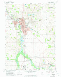
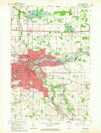 1961 Elkhart1964 Print · USGSElkhart emerges at the meeting of the forks during the early sixties, showing a dense network of rail, river, and road infrastructure. Genealogists can locate family names at Rice Cem and Rowe Cem or trace the early development of Garden Village and Dunlap.5 unique versions available
 - 1962 Map of Milford, 1963 Print
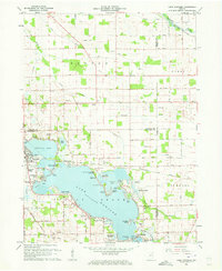
 1962 Milford1963 Print · USGSNorthern Indiana's rail and river networks are in full view during the early sixties, centered on the crossing of major lines. Genealogists and local historians can trace the locations of Milford Cem, Bethany Sch, and family sites near Wabee Lake.3 unique versions available
Showing maps 1-25 of 37
Top cities of Elkhart County
- Elkhart historical maps
- Goshen historical maps
- Nappanee historical maps
- Locke historical maps
- Middlebury historical maps
- Benton historical maps
See more
Frequently asked questions
- What are the different types of historical maps available for Elkhart County?
- What is the oldest map of Elkhart County?
- Where can I purchase historical maps of Elkhart County for my home or office?
- Where can I download high-res historical maps of Elkhart County?
- Are there historical topographic maps available for Elkhart County?
- Is there historical aerial imagery available for Elkhart County?
- Where are historical maps of Elkhart County sourced from?