Old Maps of Galena, Indiana
Explore 13 old maps of Galena, spanning from 1939 to today. These high-resolution historic maps reveal how streets, neighborhoods, landmarks, and natural features evolved over time — perfect for genealogy, metal detecting, research, and local history exploration.
What you can do with these maps:
- See how Galena changed over time: Compare historical maps to modern-day views to trace roads, homesites, rail lines & more.
- View detailed metadata: Each map includes creators, publishers, year, scale, and archive source.
- Overlay maps with satellite & LiDAR: Visualize the past alongside modern tools to explore terrain & human change.
- Trusted historical sources: Maps sourced from the USGS, Library of Congress, and other archives.
- Access maps your way: View online, download high-res files, or order prints for personal or research use.
Start exploring old maps of Galena to uncover forgotten places, hidden landmarks, and the deep history beneath your feet.
Galena, IN maps
(13)- 1939 Map of Georgetown
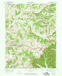
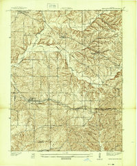 1939 Georgetown1939 Print · USGSSouthern Indiana's Floyd County highlands are captured here in the late 1930s, showing the early road and rail networks before modern expansion. Genealogists and local historians can trace family roots through Swartz Cem, Salem Ch, and the landmark Mt St Francis Seminary.
 - 1947 Map of Georgetown
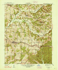 1947 Georgetown1947 Print · USGSFloyd County just after the war was a landscape of ridge-top farms and rail-connected hamlets like Georgetown and Edwardsville. Researchers can trace old family burial grounds at Buttontown Cem or locate rural landmarks like the Mt St Francis Seminary.2 unique versions available
 - 1949 Map of Georgetown, 1965 Print
 1949 Georgetown1965 Print · USGSFloyd County's ridge-and-valley landscape is captured here in the years following the war, showing a network of rural townships and rail-side villages. Researchers can locate family landmarks like Greenlawn Cem, Salem Ch, and the Southern railroad line through Georgetown.
 - 1952 Map of Georgetown
 1952 Georgetown1952 Print · USGSGeorgetown and Floyd County are captured here in the early fifties, showing a landscape of deep hollows and high ridges. Researchers can trace the SOUTHERN rail line through the TUNNEL or locate family burial sites like Wolf Cem and Buttontown Cem.
 - 1956 Map of Louisville, 1971 Print
 1956 Louisville1971 Print · USGSThe Ohio River valley and the Kentucky Bluegrass are captured here during a period of rapid mid-century growth and industrial activity. Genealogists and historians can trace rail-centered towns and military land use at Fort Knox and the Jefferson Proving Ground.2 unique versions available
 - 1964 Map of Louisville
 1964 Louisville1964 Print · USGSThe Ohio River valley and Kentucky Bluegrass are captured in the mid-1960s, showing a region balanced between industrial growth and its agrarian roots. Genealogists and historians can trace the development of county seats like Shelbyville and Paris, or locate established institutions such as Georgetown College and Bernheim Forest.
 - 1966 Map of Georgetown, 1969 Print
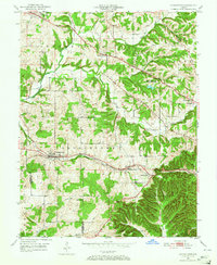
 1966 Georgetown1969 Print · USGSGeorgetown and Floyd County are captured here in the mid-sixties, showing a landscape of high ridges and narrow creek valleys. Researchers can trace historic family burial sites like Buttontown Cem, locate the Galena Sch, or follow the path of the Old Indian Road.4 unique versions available
 - 1986 Map of Louisville
 1986 Louisville1986 Print · USGSMid-1980s Louisville and southern Indiana are shown here during a decade of significant suburban growth and infrastructure development. Researchers can trace the layout of Cave Hill Cemetery, the expansion of Standiford Field, and industrial sites like the Indiana Army Ammunition Plant.2 unique versions available
 - 2010 Map of Georgetown, 2010 Print
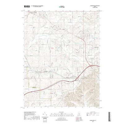
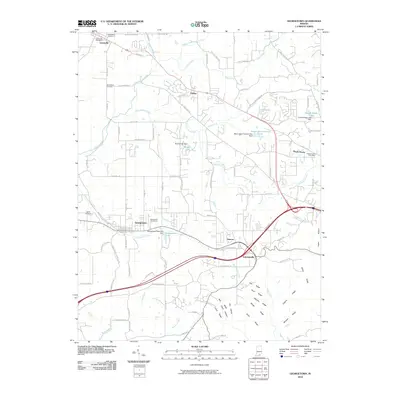 2010 Georgetown2010 Print · USGSCovers Galena, including Georgetown, Greenville, and other nearby areas
 - 2013 Map of Georgetown, 2013 Print
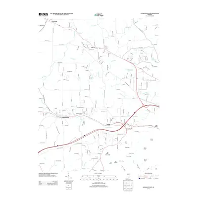 2013 Georgetown2013 Print · USGSCovers Galena, including Georgetown, Greenville, and other nearby areas
 - 2016 Map of Georgetown, 2016 Print
 2016 Georgetown2016 Print · USGSCovers Galena, including Georgetown, Greenville, and other nearby areas
 - 2019 Map of Georgetown, 2019 Print
 2019 Georgetown2019 Print · USGSCovers Galena, including Georgetown, Greenville, and other nearby areas
 - 2022 Map of Georgetown, 2022 Print
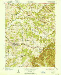
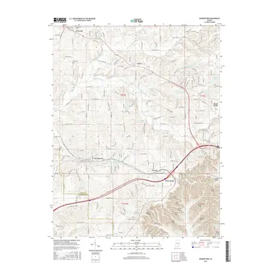
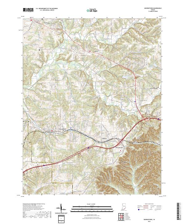 2022 Georgetown2022 Print · USGSFloyd County, Indiana, is captured here in the early 2020s, showcasing the intricate ridge-and-valley terrain west of New Albany. Genealogists can locate family landmarks like Green Lawn Cem and trace the winding paths of Middle Fork Indian Cr through Galena.
End of results
Showing maps 1-13 of 13
Top cities near Galena
- Louisville historical maps
- Jeffersonville historical maps
- New Albany historical maps
- Clarksville historical maps
- Shively historical maps
- Charlestown historical maps
See more
Frequently asked questions
- What are the different types of historical maps available for Galena?
- What is the oldest map of Galena?
- Where can I purchase historical maps of Galena for my home or office?
- Where can I download high-res historical maps of Galena?
- Are there historical topographic maps available for Galena?
- Is there historical aerial imagery available for Galena?
- Where are historical maps of Galena sourced from?