Old Maps of Floyd County, Indiana
Explore 85 old maps of Floyd County, spanning from 1909 to today. These high-resolution historic maps reveal how streets, neighborhoods, landmarks, and natural features evolved over time — perfect for genealogy, metal detecting, research, and local history exploration.
What you can do with these maps:
- See how Floyd County changed over time: Compare historical maps to modern-day views to trace roads, homesites, rail lines & more.
- View detailed metadata: Each map includes creators, publishers, year, scale, and archive source.
- Overlay maps with satellite & LiDAR: Visualize the past alongside modern tools to explore terrain & human change.
- Trusted historical sources: Maps sourced from the USGS, Library of Congress, and other archives.
- Access maps your way: View online, download high-res files, or order prints for personal or research use.
Start exploring old maps of Floyd County to uncover forgotten places, hidden landmarks, and the deep history beneath your feet.
Floyd County, IN maps
(85)- 1909 Map of Kosmosdale
 1909 Kosmosdale1909 Print · USGSSouthwest of Louisville at the turn of the century, the river valley meets the steep slopes of Muldraughs Hill. Researchers can trace early rural life through several family-named schoolhouses and small settlements like Kosmosdale, Valley Sta, and the County Infirmary.
 - 1912 Map of Kosmosdale
 1912 Kosmosdale1912 Print · USGSThe Ohio River valley and the Kentucky Knobs come alive in this pre-war survey, showing the expansion of southern Louisville and the rural hills of Jefferson and Bullitt counties. Researchers can locate vanished landmarks like Locust Point P.O. and the County Infirmary, or trace the old riverboat stops at Stewarts Landing.4 unique versions available
 - 1938 Map of Speed
 1938 Speed1938 Print · USGSSouthern Indiana was a busy junction of steam and electric rail at the close of the 1930s. Researchers can trace the dual paths of the Pennsylvania Railroad and Indiana Railroad (Electric) through Sellersburg, Speed, and Memphis.
 - 1939 Map of New Albany
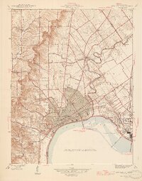
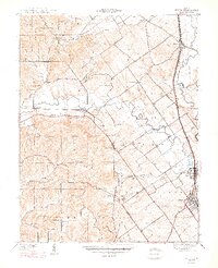
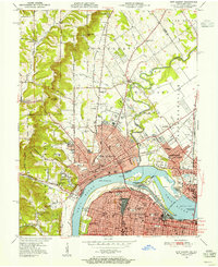
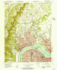
 1939 New Albany1939 Print · USGSThe industrial riverfront of southern Indiana comes alive in this pre-war survey of the Ohio River bend. Genealogists and historians can trace the early footprints of New Albany and Clarksville, locating the County Infirmary, St Marys Cem, and the massive Jeffersonville Military Reservation.
 - 1939 Map of Georgetown
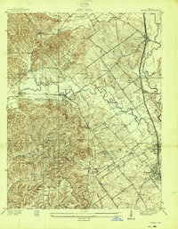
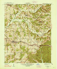
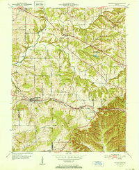
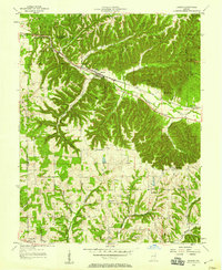
 1939 Georgetown1939 Print · USGSSouthern Indiana's Floyd County highlands are captured here in the late 1930s, showing the early road and rail networks before modern expansion. Genealogists and local historians can trace family roots through Swartz Cem, Salem Ch, and the landmark Mt St Francis Seminary.
 - 1941 Map of Borden
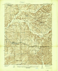
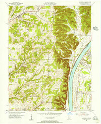
 1941 Borden1941 Print · USGSIn the hills of Clark and Floyd counties just before the war, small crossroads like Navilleton and Starlight were the heart of rural life. Genealogists can trace early homesteads through family landmarks like Fisher Cem and Goss Sch near the Muddy Fork railroad line.
 - 1946 Map of New Albany
 1946 New Albany1946 Print · USGSThe Indiana shoreline of the Ohio River bustles with mid-century activity as railroads and bridges connect New Albany to the south. Researchers can trace historic local sites like Blackiston Mill, the County Infirmary, and Graceland Cem near the Falls of the Ohio.2 unique versions available
 - 1947 Map of Speed
 1947 Speed1947 Print · USGSClark County's southern corridor comes alive in the late 1930s and 40s, featuring a dense network of interurban and steam railroads. Trace family roots through rural landmarks like College Hill Sch, Ebenezer Ch, and Smith Cem near the rail-side town of Speed.2 unique versions available
 - 1947 Map of Georgetown
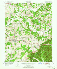
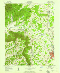
 1947 Georgetown1947 Print · USGSFloyd County just after the war was a landscape of ridge-top farms and rail-connected hamlets like Georgetown and Edwardsville. Researchers can trace old family burial grounds at Buttontown Cem or locate rural landmarks like the Mt St Francis Seminary.2 unique versions available
 - 1949 Map of Georgetown, 1965 Print
 1949 Georgetown1965 Print · USGSFloyd County's ridge-and-valley landscape is captured here in the years following the war, showing a network of rural townships and rail-side villages. Researchers can locate family landmarks like Greenlawn Cem, Salem Ch, and the Southern railroad line through Georgetown.
 - 1950 Map of Palmyra
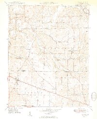 1950 Palmyra1950 Print · USGSMid-century Harrison and Washington counties are documented here at a time when small rural settlements like Martinsburg and Palmyra anchored the local landscape. Genealogists can trace family footprints through sites like Snyders Chapel, Miller Cem, and the Morgan Township Sch.2 unique versions available
 - 1950 Map of New Albany, 1955 Print
 1950 New Albany1955 Print · USGSThe riverfront communities of Indiana and Kentucky meet at the Ohio River during a mid-century period of heavy industry and rail expansion. Genealogists and local historians can locate early burial grounds like Portland Cem, institutional landmarks such as the County Infirmary, and long-standing schools including McCulloch Sch.
 - 1950 Map of Kosmosdale, 1959 Print
 1950 Kosmosdale1959 Print · USGSGreater Louisville and the Ohio River valley are captured here at mid-century, showing the city's industrial south side meeting rural river towns. Genealogists and historians can trace family locations through Lanesville Cem, the Waverly Hills Sanatorium, and Churchill Downs.
 - 1951 Map of New Albany
 1951 New Albany1951 Print · USGSThe Ohio River waterfront at mid-century shows the industrial heart of New Albany and Louisville linked by massive river and rail works. Genealogists can trace family roots through neighborhood landmarks like Blackiston Mill, Portland Cem, and the Silvercrest State Hospital.2 unique versions available
 - 1951 Map of Lanesville
 1951 Lanesville1951 Print · USGSHarrison County and the Ohio River valley appear here in the early fifties, showing a rural landscape of ridge-top farms and river landings. Genealogists can trace family names through sites like Shoemaker Cem, Lottick Corner, and Seven Springs Sch.2 unique versions available
 - 1952 Map of Georgetown
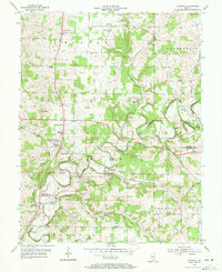
 1952 Georgetown1952 Print · USGSGeorgetown and Floyd County are captured here in the early fifties, showing a landscape of deep hollows and high ridges. Researchers can trace the SOUTHERN rail line through the TUNNEL or locate family burial sites like Wolf Cem and Buttontown Cem.
 - 1954 Map of Crandall, 1955 Print
 1954 Crandall1955 Print · USGSHarrison County settlement patterns and rural life are documented here in the mid-fifties as the Southern railroad serviced small towns. Researchers can locate family roots at Old German Ch, trace the post office at Corydon Junction, or explore the crossroads at Byrneville.4 unique versions available
 - 1955 Map of New Albany, 1956 Print
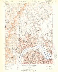
 1955 New Albany1956 Print · USGSThe Ohio River separates the growing industrial hubs of New Albany and Louisville in the mid-fifties. Researchers can trace the extensive rail networks and local institutions of the day, from the Falls of the Ohio to the Silvercrest State Hospital.
 - 1955 Map of Lanesville, 1956 Print
 1955 Lanesville1956 Print · USGSHarrison County's river bluffs and rural townships are captured here in the mid-fifties, showing the rugged Indiana shoreline across from Kentucky. Researchers can trace ancestral sites at Lottick Corner, Hopewell Cem, and the old Locust Point PO.
 - 1955 Map of Louisville West, 1957 Print
 1955 Louisville West1957 Print · USGSLouisville and its southwestern suburbs are captured here during a decade of significant growth and post-war industrial activity. Researchers can trace historic landmarks like Churchill Downs, the Waverly Hills Sanatorium, and neighborhood schools like Virginia Ave Sch.
 - 1956 Map of Vincennes, 1967 Print
 1956 Vincennes1967 Print · USGSSouthern Indiana and the Illinois borderlands are captured here in the mid-fifties, showing the region's dense network of river towns and rail lines. Researchers can trace historic river crossings along the Wabash River or locate landmarks like Wyandotte Cave and Lincoln State Park.4 unique versions available
 - 1956 Map of Louisville, 1971 Print
 1956 Louisville1971 Print · USGSThe Ohio River valley and the Kentucky Bluegrass are captured here during a period of rapid mid-century growth and industrial activity. Genealogists and historians can trace rail-centered towns and military land use at Fort Knox and the Jefferson Proving Ground.2 unique versions available
 - 1957 Map of Vincennes
 1957 Vincennes1957 Print · USGSSouthwest Indiana and the Illinois borderlands come alive in the late 1950s, a period of heavy rail traffic and expanding state forests. Genealogists and historians can trace the riverfronts and rail lines of Vincennes, New Harmony, and the vast Crane Naval Ammunition Depot.
 - 1957 Map of Borden, 1958 Print
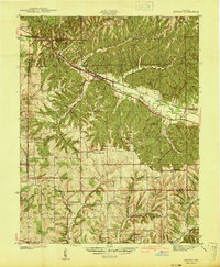
 1957 Borden1958 Print · USGSSouthern Indiana in the late fifties shows a landscape of deep hollows and high ridges centered on the MONON rail line. Genealogists can trace rural family roots through landmarks like St Johns Sch, Bear Hill Ch, and the settlement of Starlight.
 - 1957 Map of Speed, 1958 Print
 1957 Speed1958 Print · USGSMid-century Clark County comes into focus here as the industrial and rail corridors of Sellersburg and Memphis meet the wooded ridges of the Knobs. Genealogists and historians can trace local landmarks like Atkins Chapel, Hickory Grove Cem, and the old Monon rail line.
Showing maps 1-25 of 85
Top cities of Floyd County
Frequently asked questions
- What are the different types of historical maps available for Floyd County?
- What is the oldest map of Floyd County?
- Where can I purchase historical maps of Floyd County for my home or office?
- Where can I download high-res historical maps of Floyd County?
- Are there historical topographic maps available for Floyd County?
- Is there historical aerial imagery available for Floyd County?
- Where are historical maps of Floyd County sourced from?