1940s Maps of Floyd County, Indiana
Explore 5 historic maps of Floyd County from the 1940s. These maps offer a rare glimpse into what life looked like during the 1940s — showing old roads, neighborhoods, homes, and landmarks that have changed or disappeared over time.
Whether you're researching your family's past, planning a metal detecting trip, or studying how Floyd County's landscape evolved across the 1940s, these high-resolution maps are a powerful tool for exploring the history of this region.
- Focus on a specific era: All maps on this page are from the 1940s, giving you a focused view of this time period.
- See what’s changed: Compare century-old streets, trails, and buildings to today's modern landscape using overlays and satellite layers.
- Research with precision: Use these maps for genealogy, historical research, land use analysis, or educational projects.
- View, download, or print: Maps are fully viewable online in high resolution, and can be downloaded or printed for your own records.
Start exploring Floyd County's history through authentic maps from the 1940s. This is your window into the past.
Floyd County, IN maps
(5)- 1941 Map of Borden
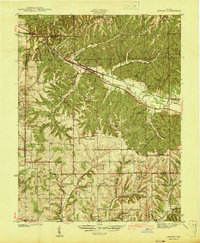 1941 Borden1941 Print · USGSIn the hills of Clark and Floyd counties just before the war, small crossroads like Navilleton and Starlight were the heart of rural life. Genealogists can trace early homesteads through family landmarks like Fisher Cem and Goss Sch near the Muddy Fork railroad line.
 - 1946 Map of New Albany
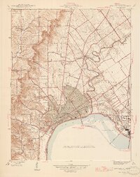 1946 New Albany1946 Print · USGSThe Indiana shoreline of the Ohio River bustles with mid-century activity as railroads and bridges connect New Albany to the south. Researchers can trace historic local sites like Blackiston Mill, the County Infirmary, and Graceland Cem near the Falls of the Ohio.2 unique versions available
 - 1947 Map of Speed
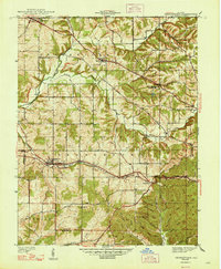
 1947 Speed1947 Print · USGSClark County's southern corridor comes alive in the late 1930s and 40s, featuring a dense network of interurban and steam railroads. Trace family roots through rural landmarks like College Hill Sch, Ebenezer Ch, and Smith Cem near the rail-side town of Speed.2 unique versions available
 - 1947 Map of Georgetown
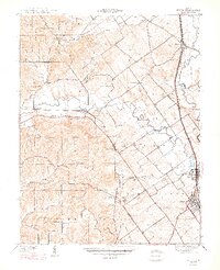
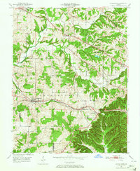
 1947 Georgetown1947 Print · USGSFloyd County just after the war was a landscape of ridge-top farms and rail-connected hamlets like Georgetown and Edwardsville. Researchers can trace old family burial grounds at Buttontown Cem or locate rural landmarks like the Mt St Francis Seminary.2 unique versions available
 - 1949 Map of Georgetown, 1965 Print
 1949 Georgetown1965 Print · USGSFloyd County's ridge-and-valley landscape is captured here in the years following the war, showing a network of rural townships and rail-side villages. Researchers can locate family landmarks like Greenlawn Cem, Salem Ch, and the Southern railroad line through Georgetown.
End of results
Showing maps 1-5 of 5
Top cities of Floyd County
Frequently asked questions
- What are the different types of historical maps available for Floyd County?
- What is the oldest map of Floyd County?
- Where can I purchase historical maps of Floyd County for my home or office?
- Where can I download high-res historical maps of Floyd County?
- Are there historical topographic maps available for Floyd County?
- Is there historical aerial imagery available for Floyd County?
- Where are historical maps of Floyd County sourced from?