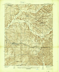
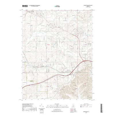
1939 Map of Georgetown
USGS Topo · Published 1939About this map
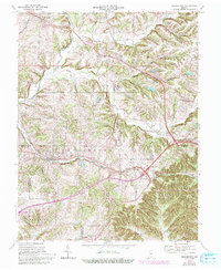
The hills and valleys of western Floyd County are documented here as they appeared just before World War II, showing a landscape defined by small ridgetop settlements and deep creek drainages. The Southern railway line serves as a central east-west corridor, passing through Georgetown and Duncan, while the Old Vincennes Road and State Highway No 150 trace the higher ground between Greenville and Galena. For genealogists, this 1930s survey is particularly rich in landmark data, pinpointing several local burial grounds including Greenlawn Cem, Buttontown Cem, and Swartz Cem. Religious and educational life is anchored by institutions like the Mt St Francis Seminary and smaller country houses of worship such as Fairview Ch and Salem Ch. The complex terrain of Ulmer Ridge and the winding course of Big Indian Creek illustrate why historical transit followed specific ridge-bound paths in this part of southern Indiana.
Find a feature on this map
33 named features on this map. Tap any name to fly to it.
Don’t see what you’re looking for? This feature index may not catch every label — zoom into the map to look around manually.
Map Details
Editions of this 1939 Georgetown Map
This is the sole edition of this map. No revisions or reprints were ever made.
Historical Maps of Georgetown Through Time
10 maps found
1939 Georgetown
Floyd County, IN
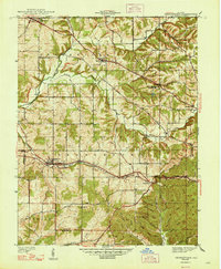
1947 Georgetown
Floyd County, IN
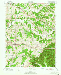
1949 Georgetown
Floyd County, IN
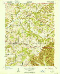
1952 Georgetown
Floyd County, IN
1966 Georgetown
Floyd County, IN
2010 Georgetown
Floyd County, IN
2013 Georgetown
Floyd County, IN
2016 Georgetown
Floyd County, IN
2019 Georgetown
Floyd County, IN
2022 Georgetown
Floyd County, IN