Old Maps of Attica, Indiana
Explore 17 old maps of Attica, spanning from 1953 to today. These high-resolution historic maps reveal how streets, neighborhoods, landmarks, and natural features evolved over time — perfect for genealogy, metal detecting, research, and local history exploration.
What you can do with these maps:
- See how Attica changed over time: Compare historical maps to modern-day views to trace roads, homesites, rail lines & more.
- View detailed metadata: Each map includes creators, publishers, year, scale, and archive source.
- Overlay maps with satellite & LiDAR: Visualize the past alongside modern tools to explore terrain & human change.
- Trusted historical sources: Maps sourced from the USGS, Library of Congress, and other archives.
- Access maps your way: View online, download high-res files, or order prints for personal or research use.
Start exploring old maps of Attica to uncover forgotten places, hidden landmarks, and the deep history beneath your feet.
Attica, IN maps
(17)- 1953 Map of Danville, 1965 Print
 1953 Danville1965 Print · USGSIndiana and Illinois crossroads come to life in this mid-century survey as the interstate era begins to reshape the river-and-rail landscape. Genealogists and collectors can trace the historic paths of the Nickel Plate railroad or locate smaller communities like Veedersburg, Goodland, and Bismarck.3 unique versions available
 - 1955 Map of Danville
 1955 Danville1955 Print · USGSThe Indiana-Illinois borderlands during the mid-fifties reveal a landscape of thriving rail hubs and university towns. Researchers can trace the legacy of Purdue University, the Tippecanoe Battlefield, and the path of the Pennsylvania RR.
 - 1956 Map of Danville
 1956 Danville1956 Print · USGSMid-century Indiana and Illinois are captured here as the river-and-rail economy evolved into the modern highway era. Researchers can trace ancestral roots and old transport lines through Logansport, Battle Ground, and the dams at Lake Shafer.
 - 1962 Map of Williamsport, 1964 Print
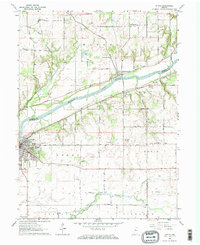
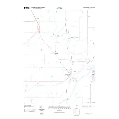
 1962 Williamsport1964 Print · USGSWilliamsport and Attica anchor the Wabash River crossing in the early sixties, a time when mineral spring resorts and river industry shaped the county line. Researchers can trace family sites at McCabe Cem, visit the old Falls Sch, or locate the Mudlavia Springs grounds.3 unique versions available
 - 1962 Map of Attica, 1964 Print
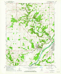
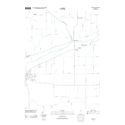
 1962 Attica1964 Print · USGSThe banks of the Wabash River dominate this early 1960s Indiana landscape at the border of Fountain and Warren counties. Local historians can trace established homesteads near Attica, the rural crossroads of Banning Corner, and scattered landmarks like Bethel Ch and Riley Airfield.2 unique versions available
 - 1984 Map of Danville, 1985 Print
 1984 Danville1985 Print · USGSEastern Illinois and western Indiana meet here in the mid-1980s, centered on the river forks and rail lines surrounding the industrial hub of Danville. Researchers can trace old transport routes and rural landmarks like Rossville Junction, Hope Ch, and the Univ of Ill Radio Telescope.
 - 1987 Map of Danville, 1994 Print
 1987 Danville1994 Print · USGSThe Illinois-Indiana borderlands thrived in the 1980s as a crossroads of rail commerce and river-fed agriculture. Genealogists and historians can trace the foundations of Danville and Covington while locating landmarks like Spring Hill Cemetery or the Vermilion County Courthouse.
 - 2010 Map of Williamsport, 2010 Print
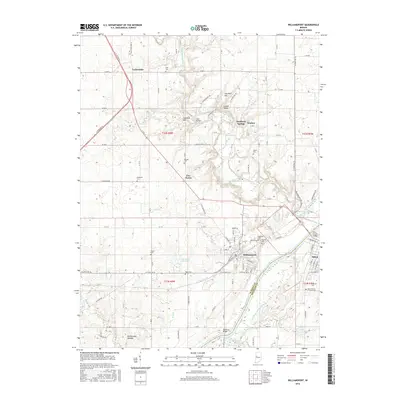
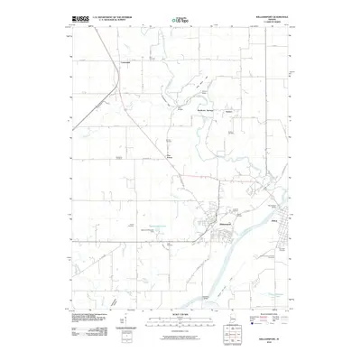 2010 Williamsport2010 Print · USGSCovers Attica, including Williamsport, Carbondale, and other nearby areas
 - 2010 Map of Attica, 2010 Print
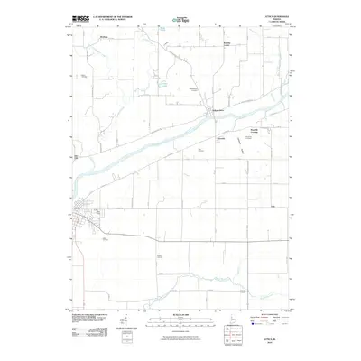 2010 Attica2010 Print · USGSCovers Attica, including Maysville Crossing, Independence, and other nearby areas
 - 2013 Map of Attica, 2013 Print
 2013 Attica2013 Print · USGSCovers Attica, including Maysville Crossing, Independence, and other nearby areas
 - 2013 Map of Williamsport, 2013 Print
 2013 Williamsport2013 Print · USGSCovers Attica, including Williamsport, Carbondale, and other nearby areas
 - 2016 Map of Williamsport, 2016 Print
 2016 Williamsport2016 Print · USGSCovers Attica, including Williamsport, Carbondale, and other nearby areas
 - 2016 Map of Attica, 2016 Print
 2016 Attica2016 Print · USGSCovers Attica, including Maysville Crossing, Independence, and other nearby areas
 - 2019 Map of Williamsport, 2019 Print
 2019 Williamsport2019 Print · USGSCovers Attica, including Williamsport, Carbondale, and other nearby areas
 - 2019 Map of Attica, 2019 Print
 2019 Attica2019 Print · USGSCovers Attica, including Maysville Crossing, Independence, and other nearby areas
 - 2022 Map of Attica, 2022 Print
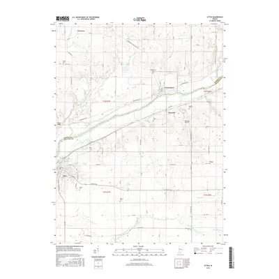
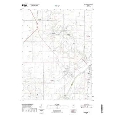
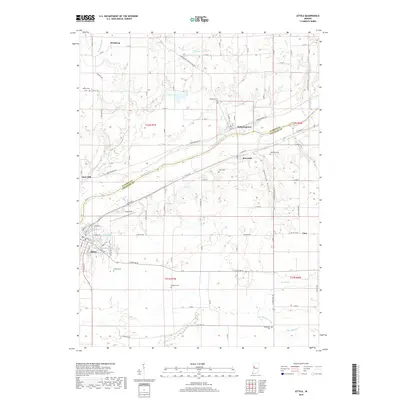
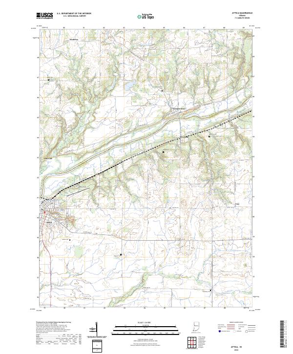 2022 Attica2022 Print · USGSThe Wabash River corridor comes alive in this survey of the Indiana heartland during the early 2020s. Researchers can trace local heritage through numerous burial sites like Bethel Cem and Maysville Cem or explore the riverfront layouts of Attica and Independence.
 - 2022 Map of Williamsport, 2022 Print
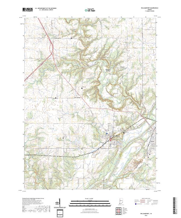 2022 Williamsport2022 Print · USGSWilliamsport and Attica are shown here along the Wabash River during the early 2020s. Genealogists can locate several family burial grounds like McCabe Cem and Owens Cem, while historians can trace the old Wabash and Erie Canal corridor.
End of results
Showing maps 1-17 of 17
Top cities near Attica
- Covington historical maps
- Veedersburg historical maps
- Williamsport historical maps
- Otterbein historical maps
- Waynetown historical maps
- Boswell historical maps
See more
Frequently asked questions
- What are the different types of historical maps available for Attica?
- What is the oldest map of Attica?
- Where can I purchase historical maps of Attica for my home or office?
- Where can I download high-res historical maps of Attica?
- Are there historical topographic maps available for Attica?
- Is there historical aerial imagery available for Attica?
- Where are historical maps of Attica sourced from?