2020s Maps of Fulton County, Indiana
Explore 14 historic maps of Fulton County from the 2020s. These maps offer a rare glimpse into what life looked like during the 2020s — showing old roads, neighborhoods, homes, and landmarks that have changed or disappeared over time.
Whether you're researching your family's past, planning a metal detecting trip, or studying how Fulton County's landscape evolved across the 2020s, these high-resolution maps are a powerful tool for exploring the history of this region.
- Focus on a specific era: All maps on this page are from the 2020s, giving you a focused view of this time period.
- See what’s changed: Compare century-old streets, trails, and buildings to today's modern landscape using overlays and satellite layers.
- Research with precision: Use these maps for genealogy, historical research, land use analysis, or educational projects.
- View, download, or print: Maps are fully viewable online in high resolution, and can be downloaded or printed for your own records.
Start exploring Fulton County's history through authentic maps from the 2020s. This is your window into the past.
Fulton County, IN maps
(14)- 2022 Map of Rochester, 2022 Print
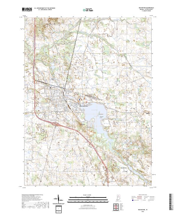 2022 Rochester2022 Print · USGSRochester and the surrounding Fulton County countryside are shown here in the 2020s, centered on the expansive Lake Manitou. Researchers can trace local heritage through the Fulton County Courthouse, the Nickle Plate Rail-Trl, and several cemeteries like Sand Hill Cem.
 - 2022 Map of Mentone, 2022 Print
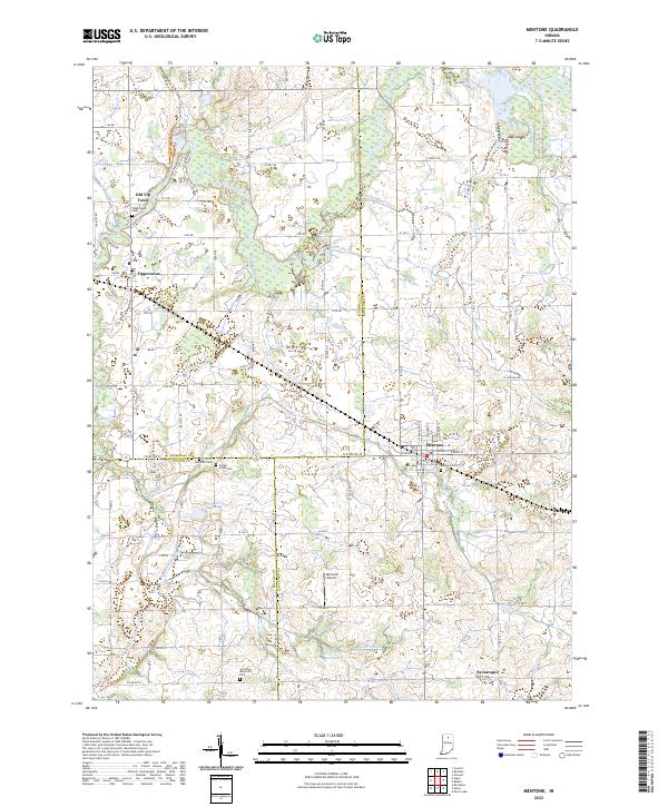 2022 Mentone2022 Print · USGSNorthern Indiana farm country and the three-county junction come alive in this recent survey. Researchers can trace family history at Mentone Cem, follow the Tippecanoe River, or explore small hubs like Old Tip Town and Sevastopol.
 - 2022 Map of Pershing, 2022 Print
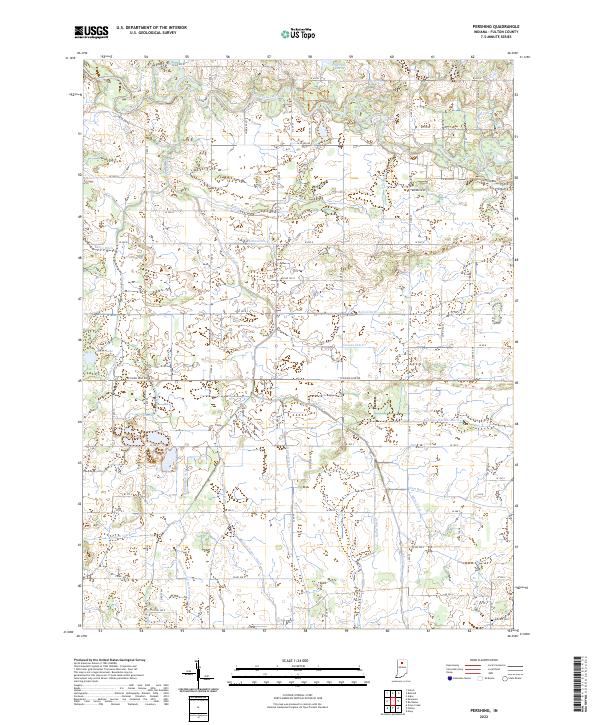 2022 Pershing2022 Print · USGSFulton County agricultural lands are defined by the winding Tippecanoe River and a complex system of local drainage canals. Genealogists and researchers can trace family-named landmarks like Antioch Cem and the Kersey Finney Ditch.
 - 2022 Map of Silver Lake, 2022 Print
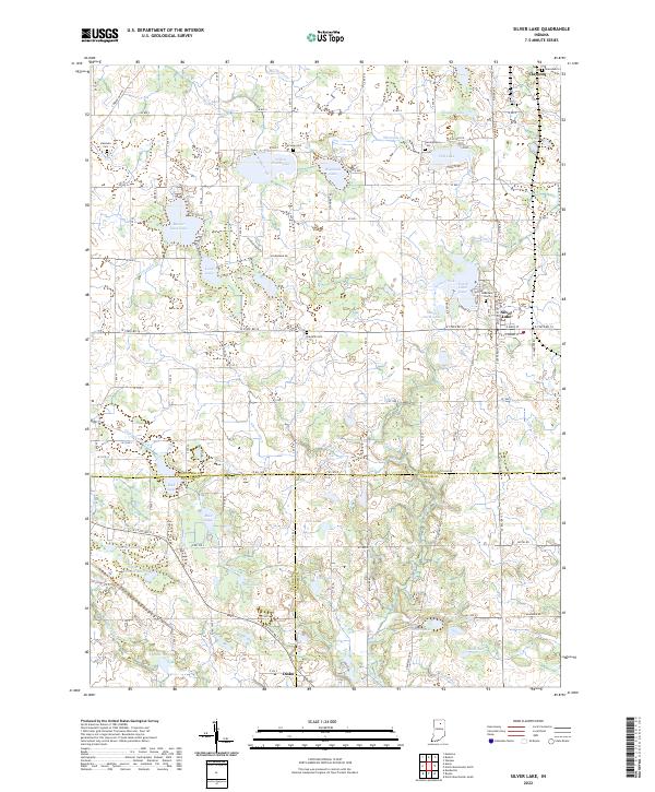 2022 Silver Lake2022 Print · USGSSilver Lake and Claypool anchor this detailed survey of the lake-dotted borderlands between Kosciusko, Fulton, and Wabash counties. Researchers can locate family burial sites at Lakeview Cem and Hamman Cem or trace the drainage of Beaver Dam Lake and Yellow Creek Lake.
 - 2022 Map of Rutland, 2022 Print
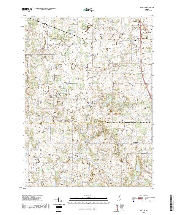 2022 Rutland2022 Print · USGSMarshall and Fulton County farmsteads and wetlands are documented here in the early 2020s. Genealogists and local historians can trace the drainage of this landscape through Eddy Cr Ditch and locate local landmarks like DDT Field and Richland Center.
 - 2022 Map of Argos, 2022 Print
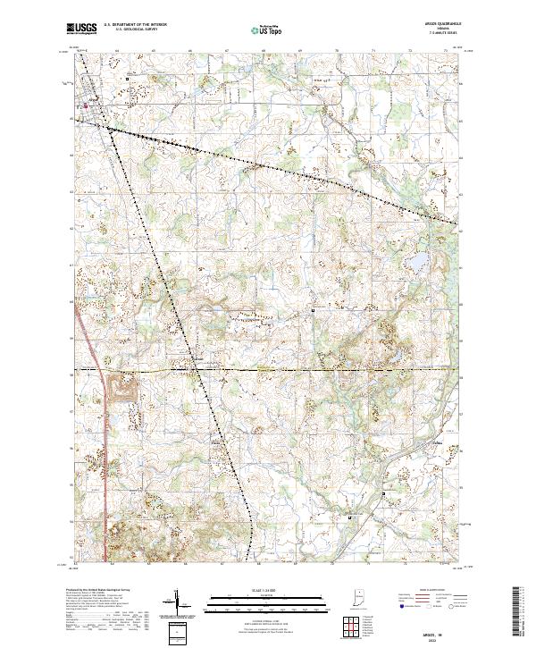 2022 Argos2022 Print · USGSSettled on the border of Marshall and Fulton counties, this contemporary landscape shows a deep history of drainage and agricultural development. Genealogists can locate family burial sites at Maple Grove Cem and Hamlett Cem, or trace the rural crossroads of Walnut and Tiosa.
 - 2022 Map of Roann, 2022 Print
 2022 Roann2022 Print · USGSWabash and Miami counties are captured in this modern survey of the Eel River valley. Researchers can trace genealogical roots through numerous burial sites like the Independent Order of Odd Fellows Cem, Stockdale, and Pettysville.
 - 2022 Map of Grass Creek, 2022 Print
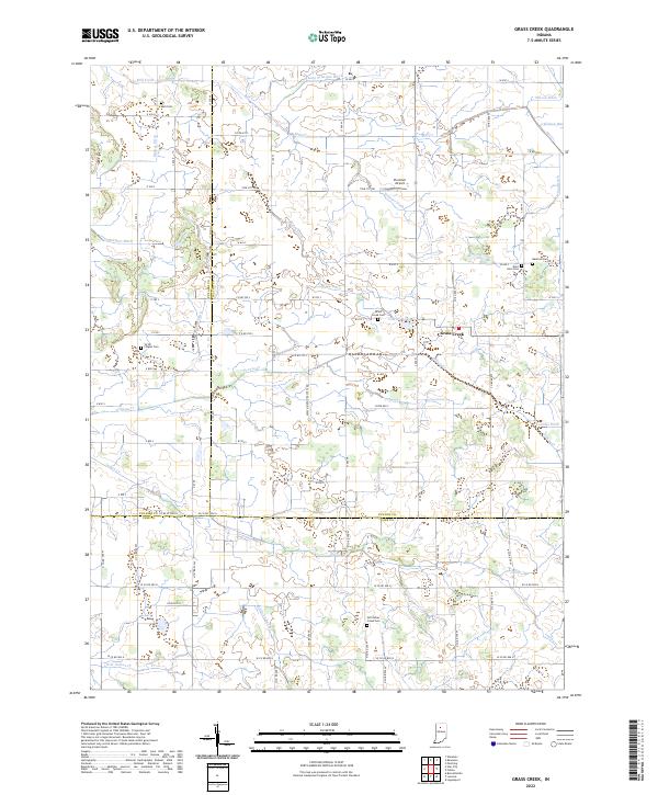 2022 Grass Creek2022 Print · USGSThe tri-county borderlands of Fulton, Pulaski, and Cass counties are documented here in the early twenty-first century. Genealogists and local historians can locate several family and community burial sites like Victor Chapel Cemetery and Bauman Cemetery.
 - 2022 Map of Macy, 2022 Print
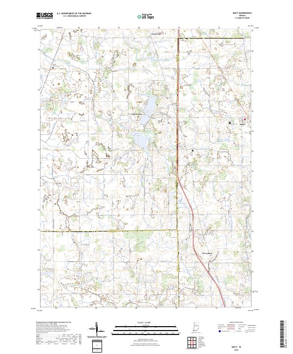 2022 Macy2022 Print · USGSThe borderlands of Fulton, Miami, and Cass counties are documented here in the early 2020s, showing the enduring rural character of North-Central Indiana. Researchers can trace local heritage through sites like Plainview Cem, the lakeside community of Nyona Lake, and the historic Nickle Plate Rail Trl.
 - 2022 Map of Fulton, 2022 Print
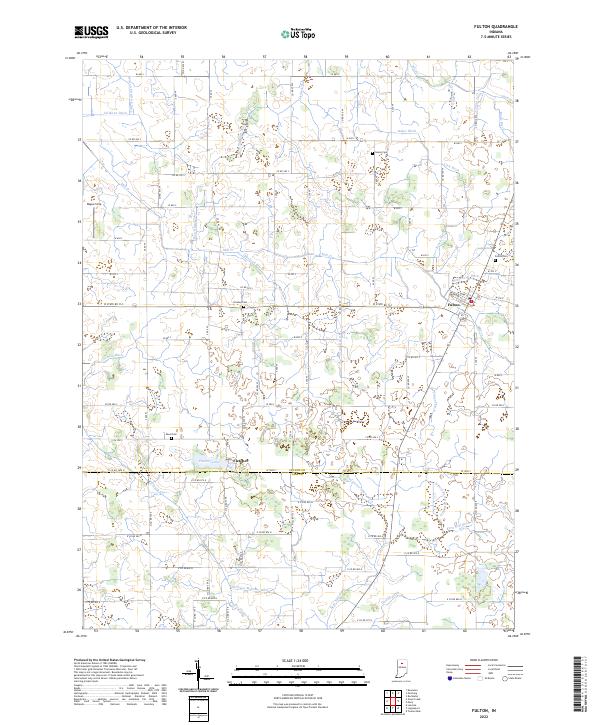 2022 Fulton2022 Print · USGSFulton and the surrounding farmsteads of north-central Indiana are shown here in their modern agricultural context. Genealogists and local historians can locate family-named landmarks and resting places including Fulton Cem, Reed Cem, and the waters of Fletcher Lake.
 - 2022 Map of Deedsville, 2022 Print
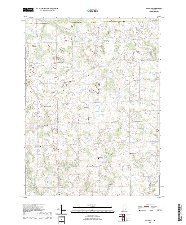 2022 Deedsville2022 Print · USGSMiami and Fulton counties in the modern day still reflect a legacy of rural township life and water engineering. Genealogists can locate several family and fraternal burial sites including Yike Cem, Musselman Cem, and the Mount Zion Cem.
 - 2022 Map of Culver, 2022 Print
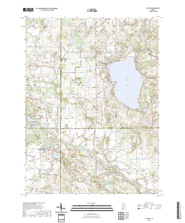 2022 Culver2022 Print · USGSThe northern Indiana lake country is captured here in the early twenty-first century, centered on the shores of the deep Lake Maxinkuckee. Researchers can locate family sites across several county lines, from the town of Culver to rural landmarks like Zion Cem and the banks of the Tippecanoe River.
 - 2022 Map of Akron, 2022 Print
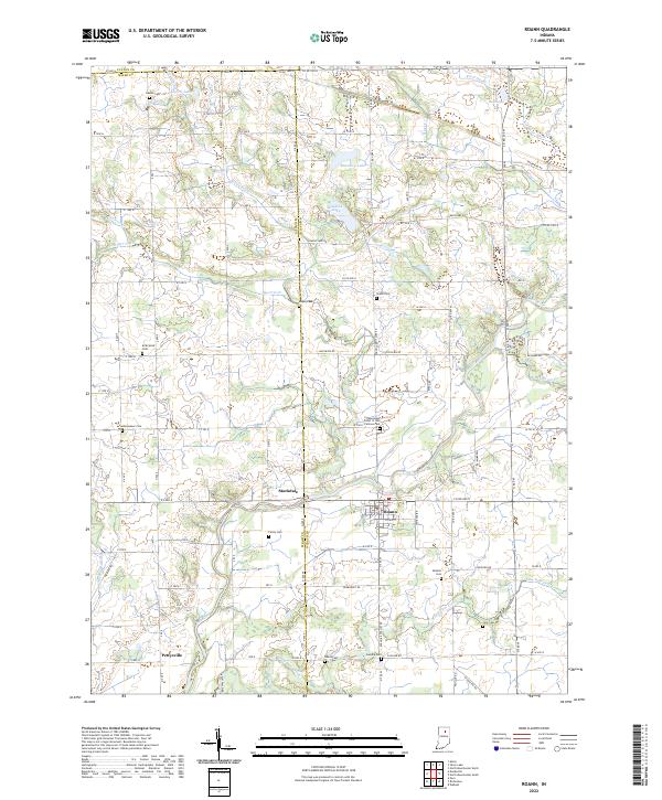
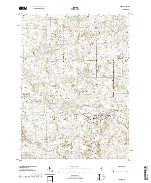 2022 Akron2022 Print · USGSFulton and Kosciusko Counties are captured in this modern survey, showing a landscape of productive farmland and vital glacial lakes. Genealogists can locate family sites near Akron, the Hoovers Cem, and the quiet crossroads of Athens.
 - 2022 Map of Kewanna, 2022 Print
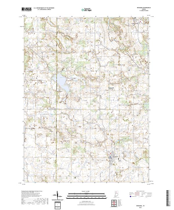 2022 Kewanna2022 Print · USGSThe western edge of Fulton County is captured here in the early 2020s, showing a landscape of managed waterways and small rural hubs. Researchers can trace family history at the Kewanna Citizens IOOF Cem or explore the shoreline developments around Lake Bruce and Leiters Ford.
End of results
Showing maps 1-14 of 14
Top cities of Fulton County
Frequently asked questions
- What are the different types of historical maps available for Fulton County?
- What is the oldest map of Fulton County?
- Where can I purchase historical maps of Fulton County for my home or office?
- Where can I download high-res historical maps of Fulton County?
- Are there historical topographic maps available for Fulton County?
- Is there historical aerial imagery available for Fulton County?
- Where are historical maps of Fulton County sourced from?