1960s Maps of Fulton County, Indiana
Explore 13 historic maps of Fulton County from the 1960s. These maps offer a rare glimpse into what life looked like during the 1960s — showing old roads, neighborhoods, homes, and landmarks that have changed or disappeared over time.
Whether you're researching your family's past, planning a metal detecting trip, or studying how Fulton County's landscape evolved across the 1960s, these high-resolution maps are a powerful tool for exploring the history of this region.
- Focus on a specific era: All maps on this page are from the 1960s, giving you a focused view of this time period.
- See what’s changed: Compare century-old streets, trails, and buildings to today's modern landscape using overlays and satellite layers.
- Research with precision: Use these maps for genealogy, historical research, land use analysis, or educational projects.
- View, download, or print: Maps are fully viewable online in high resolution, and can be downloaded or printed for your own records.
Start exploring Fulton County's history through authentic maps from the 1960s. This is your window into the past.
Fulton County, IN maps
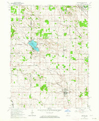
(13)- 1960 Map of Fulton, 1963 Print
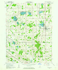
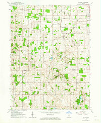
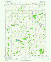 1960 Fulton1963 Print · USGSFulton County agricultural life is centered on the town of Fulton during the mid-twentieth century. Genealogists and historians can trace an extensive network of family-named drainage projects like the Sylvester Maroney Ditch and local landmarks like Olive Branch Ch.2 unique versions available
 - 1960 Map of Macy, 1963 Print
 1960 Macy1963 Print · USGSMiami and Fulton counties are captured here in the early 1960s, a period when the rural landscape was defined by its railroad crossings and small townships. Researchers can trace the junction of two major lines at Macy or locate ancestral sites like Mud Lake Chapel and Plainview Cemetery.3 unique versions available
 - 1960 Map of Deedsville, 1963 Print
 1960 Deedsville1963 Print · USGSMiami County, Indiana, is captured at the dawn of the 1960s, showing a rural landscape defined by the Old Indian Treaty Boundary and the Chicago and St Louis RR. Genealogists and local historians can trace the foundations of Deedsville and find scattered landmarks like Ebenezer Ch and Yike Cem.2 unique versions available
 - 1960 Map of Grass Creek, 1964 Print
 1960 Grass Creek1964 Print · USGSIndiana farm country in the early sixties is defined here by the iron rails of the Pennsylvania and a complex web of drainage ditches. Genealogists can locate family-named sites like Bowman Cem, O'Brien Lake, and the rural West Union Ch.3 unique versions available
 - 1961 Map of Silver Lake, 1963 Print
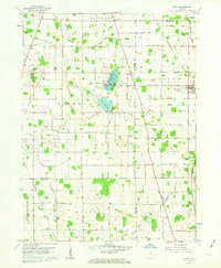
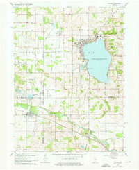
 1961 Silver Lake1963 Print · USGSThe lake country of Kosciusko County comes into focus in the early sixties, showing the intersection of rural agriculture and rail-side industry. Genealogists can trace family roots through sites like Graceland Cem, Silver Creek Ch, and the small settlement of Disko.2 unique versions available
 - 1961 Map of Roann, 1963 Print
 1961 Roann1963 Print · USGSIndiana's Eel River valley comes alive in this early 1960s survey of Wabash and Miami counties. Genealogists and local historians can trace family ties at the Abshire Cem, locate the historic Covered Bridge at Roann, or explore the rail corridors of the Erie-Lackawanna.3 unique versions available
 - 1962 Map of Pershing, 1964 Print
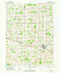
 1962 Pershing1964 Print · USGSFulton County agriculture and rail lines are captured here in the early sixties, showing a landscape defined by the Tippecanoe River and a complex drainage system. Genealogists can locate family landmarks like South Germany Cem, Burton Ch, and the small settlement of Pershing.
 - 1962 Map of Akron, 1964 Print
 1962 Akron1964 Print · USGSAkron and the Fulton-Kosciusko county line are shown here in the early sixties, a period when rail service still anchored these agricultural townships. Researchers can locate family landmarks such as Bethlehem Ch, Mt Hope Athens Cem, and the small settlement of Athens.3 unique versions available
 - 1962 Map of Kewanna, 1964 Print
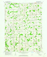
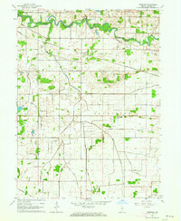
 1962 Kewanna1964 Print · USGSFulton County and its agricultural landscape are shown here in the early sixties, centered on the crossroads of Kewanna. Local historians can trace the Indian Treaty Boundary and locate family burial grounds like Shaffer Cem and Moon Cem.2 unique versions available
 - 1962 Map of Argos, 1964 Print
 1962 Argos1964 Print · USGSNorthern Indiana's rural landscape is captured here in the early sixties, showing the transition between the agricultural plains and the winding Tippecanoe River. Genealogists can trace local roots through landmarks like the Walnut Ch, McGrew Cem, and the historic Old Indian Treaty Boundary.3 unique versions available
 - 1962 Map of Rochester, 1964 Print
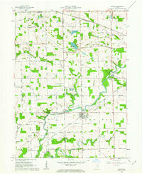
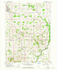
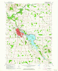 1962 Rochester1964 Print · USGSRochester and the surrounding Fulton County countryside are captured here in the early sixties as a bustling rail and water hub. Researchers can trace family history through sites like Sand Hill Cem, Riddle Sch, and the Mt Zion Millpond.2 unique versions available
 - 1962 Map of Culver, 1964 Print
 1962 Culver1964 Print · USGSThe Lake Maxinkuckee region in the early sixties is dominated by the prestigious Culver Military Academy and the busy riverfront village of Monterey. Researchers can trace the Old Indian Treaty Boundary and locate family names at North Union Cem and Masonic Cem.3 unique versions available
 - 1962 Map of Rutland, 1964 Print
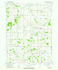
 1962 Rutland1964 Print · USGSMarshall and Fulton County farmlands are captured here in the early sixties, split by the historic Old Indian Treaty Bdy. Genealogists can locate family-named landmarks and rural hubs like Poplar Grove Ch, Richland Center, and Rutland.2 unique versions available
End of results
Showing maps 1-13 of 13
Top cities of Fulton County
Frequently asked questions
- What are the different types of historical maps available for Fulton County?
- What is the oldest map of Fulton County?
- Where can I purchase historical maps of Fulton County for my home or office?
- Where can I download high-res historical maps of Fulton County?
- Are there historical topographic maps available for Fulton County?
- Is there historical aerial imagery available for Fulton County?
- Where are historical maps of Fulton County sourced from?