
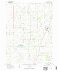
1960 Map of Fulton
USGS Topo · Published 1963About this map
The town of Fulton serves as a hub for this rural Indiana landscape, which is marked by a complex network of agricultural drainage ditches that reveal the intensive efforts to reclaim the wetlands of Liberty and Wayne Townships. The Erie Railroad cuts diagonally through the northeast, passing through Fulton where several family and community landmarks are gathered, including Fulton Cem. Further west and south, smaller settlements like Marshtown and Fletcher appear alongside distinctive water bodies such as Fletcher Lake. The map is particularly rich in family-named infrastructure, with dozens of identified ditches like the Callahan Ditch and Sylvester Maroney Ditch illustrating the localized management of the watershed. Rural life is further anchored by neighborhood institutions such as Olive Branch Ch and several small burial grounds like Smalley Cem and Reed Cem.
Find a feature on this map
43 named features on this map. Tap any name to fly to it.
Don’t see what you’re looking for? This feature index may not catch every label — zoom into the map to look around manually.
Map Details
Editions of this 1960 Fulton Map
2 editions found
Other maps of this area

1951 · Twelve Mile
USGS Topo · 1:24,000

1953 · Chicago
USGS Topo · 1:250,000

1953 · Danville
USGS Topo · 1:250,000

1955 · Danville
USGS Topo · 1:250,000

1955 · Logansport
USGS Topo · 1:24,000

1956 · Danville
USGS Topo · 1:250,000

1957 · Chicago
USGS Topo · 1:250,000

1960 · Lucerne
USGS Topo · 1:24,000

1960 · Macy
USGS Topo · 1:24,000

1960 · Grass Creek
USGS Topo · 1:24,000