
1960 Map of Grass Creek
USGS Topo · Published 1964About this map
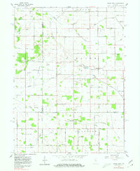
Grass Creek serves as a central hub in this Indiana landscape, where the Pennsylvania railroad line cuts a straight path through the agricultural terrain of Wayne and Harrison townships. The map reveals an intricate network of drainage systems essential to the region's farming, including the Gillespie Ditch and Weasner Ditch. This 1960 field check captures the area at a time when local history was preserved in numerous small burial grounds and rural congregations, such as the West Union Ch and Victor Chapel Cem. The intersection of the Principal Meridian and the Cass and Fulton county lines provides a rigid geometric framework to the natural wanderings of Indian Creek and Mill Creek. This survey offers genealogists a detailed look at family-named landmarks like O'Brien Lake and St Anns Cem.
Find a feature on this map
44 named features on this map. Tap any name to fly to it.
Don’t see what you’re looking for? This feature index may not catch every label — zoom into the map to look around manually.
Map Details
Editions of this 1960 Grass Creek Map
3 editions found

Other maps of this area

1953 · Chicago
USGS Topo · 1:250,000

1953 · Danville
USGS Topo · 1:250,000

1955 · Danville
USGS Topo · 1:250,000

1955 · Logansport
USGS Topo · 1:24,000

1956 · Danville
USGS Topo · 1:250,000

1957 · Chicago
USGS Topo · 1:250,000

1960 · Lucerne
USGS Topo · 1:24,000

1960 · Fulton
USGS Topo · 1:24,000

1962 · Pershing
USGS Topo · 1:24,000

1962 · Winamac
USGS Topo · 1:24,000