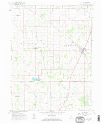
1960 Map of Fulton
USGS Topo · Published 1963About this map
Fulton and the nearby settlement of Marshtown anchor this 1960 landscape along the border of Fulton and Cass Counties. The area is defined by an intricate network of drainage systems designed to manage the flat Indiana terrain, including the Wilson Friedrick Ditch, Grube Ditch, and Ulch Ditch. These man-made channels intersect with natural waterways like Mill Creek and Grassy Creek, illustrating the extensive mid-century efforts to reclaim and maintain agricultural land.
Find a feature on this map
48 named features on this map. Tap any name to fly to it.
Don’t see what you’re looking for? This feature index may not catch every label — zoom into the map to look around manually.
Map Details
Editions of this 1960 Fulton Map
2 editions found
Other maps of this area

1951 · Twelve Mile
USGS Topo · 1:24,000

1953 · Chicago
USGS Topo · 1:250,000

1953 · Danville
USGS Topo · 1:250,000

1955 · Danville
USGS Topo · 1:250,000

1955 · Logansport
USGS Topo · 1:24,000

1956 · Danville
USGS Topo · 1:250,000

1957 · Chicago
USGS Topo · 1:250,000

1960 · Lucerne
USGS Topo · 1:24,000

1960 · Fulton
USGS Topo · 1:24,000

1960 · Macy
USGS Topo · 1:24,000