
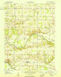
1951 Map of Twelve Mile
USGS Topo · Published 1951About this map
The Wabash River and Eel River define the southern and central reaches of this north-central Indiana landscape, where early 1950s infrastructure reveals a region built on river-and-rail commerce. The village of Twelve Mile serves as a northern anchor, while the communities of Hoover and New Waverly are positioned along the major rail lines that crisscross the terrain. This survey provides a distinct look at the transit network of the era, featuring the Chesapeake and Ohio, Pennsylvania, and Wabash railroads as they navigate the glacial drainage basins.
Find a feature on this map
35 named features on this map. Tap any name to fly to it.
Don’t see what you’re looking for? This feature index may not catch every label — zoom into the map to look around manually.
Map Details
Editions of this 1951 Twelve Mile Map
2 editions found
Other maps of this area

1951 · Peru
USGS Topo · 1:24,000

1951 · Onward
USGS Topo · 1:24,000

1951 · Bunker Hill
USGS Topo · 1:24,000

1953 · Danville
USGS Topo · 1:250,000

1955 · Danville
USGS Topo · 1:250,000

1955 · Logansport
USGS Topo · 1:24,000

1955 · Anoka
USGS Topo · 1:24,000

1956 · Danville
USGS Topo · 1:250,000
1960 · Peru
USGS Topo · 1:24,000

1960 · Fulton
USGS Topo · 1:24,000