
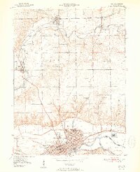
1951 Map of Peru
USGS Topo · Published 1951About this map
The Peru rail hub and industrial center anchor this mid-century survey of Miami County, where three major railroads—the Pennsylvania, Chesapeake and Ohio, and New York Chicago and St Louis—converge near the Wabash River. The landscape reflects a dense network of early Hoosier infrastructure, featuring the historic Slocum Trail and the distinctively named Circus City area. Local life is documented through scattered rural landmarks like Victory School, Richland Sch, and the Mississinewa Country Club.
Find a feature on this map
37 named features on this map. Tap any name to fly to it.
Don’t see what you’re looking for? This feature index may not catch every label — zoom into the map to look around manually.
Map Details
Editions of this 1951 Peru Map
2 editions found
Other maps of this area

1951 · Onward
USGS Topo · 1:24,000

1951 · Twelve Mile
USGS Topo · 1:24,000

1951 · Bunker Hill
USGS Topo · 1:24,000

1951 · Richvalley
USGS Topo · 1:24,000

1953 · Peoria
USGS Topo · 1:24,000

1953 · Danville
USGS Topo · 1:250,000

1953 · Muncie
USGS Topo · 1:250,000

1955 · Danville
USGS Topo · 1:250,000

1956 · Muncie
USGS Topo · 1:250,000

1956 · Danville
USGS Topo · 1:250,000