
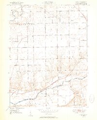
1951 Map of Richvalley
USGS Topo · Published 1951About this map
The Wabash River and Eel River carve through this North Central Indiana landscape, framing a rural territory where the Wabash railroad corridor defines the local economy and movement. Centered on the community of Richvalley, the map documents a post-war agricultural region transitioning into the 1950s, with small settlements like Erie, Gilbert, and Asher serving as local focal points. This survey is particularly valuable for genealogical research, as it identifies several family and community burial grounds, including the Francis Godfroy Cem, Huff Cem, and Wallace Cem. The presence of Center Chapel and various Oil extraction points suggests a community built on a foundation of both faith and resource extraction. The terrain is further detailed by numerous smaller waterways like Bachelor Creek and Kentner Creek, which dictated the early farm boundaries and road placements still visible in the mid-century grid.
Find a feature on this map
24 named features on this map. Tap any name to fly to it.
Don’t see what you’re looking for? This feature index may not catch every label — zoom into the map to look around manually.
Map Details
Editions of this 1951 Richvalley Map
2 editions found
Other maps of this area

1951 · Peru
USGS Topo · 1:24,000

1951 · Bunker Hill
USGS Topo · 1:24,000

1952 · Wabash
USGS Topo · 1:24,000

1953 · Somerset
USGS Topo · 1:24,000

1953 · Peoria
USGS Topo · 1:24,000

1953 · Danville
USGS Topo · 1:250,000

1953 · Muncie
USGS Topo · 1:250,000

1955 · Danville
USGS Topo · 1:250,000

1956 · Muncie
USGS Topo · 1:250,000

1956 · Danville
USGS Topo · 1:250,000