Old Maps of Fort Branch, Indiana
Explore 22 old maps of Fort Branch, spanning from 1901 to today. These high-resolution historic maps reveal how streets, neighborhoods, landmarks, and natural features evolved over time — perfect for genealogy, metal detecting, research, and local history exploration.
What you can do with these maps:
- See how Fort Branch changed over time: Compare historical maps to modern-day views to trace roads, homesites, rail lines & more.
- View detailed metadata: Each map includes creators, publishers, year, scale, and archive source.
- Overlay maps with satellite & LiDAR: Visualize the past alongside modern tools to explore terrain & human change.
- Trusted historical sources: Maps sourced from the USGS, Library of Congress, and other archives.
- Access maps your way: View online, download high-res files, or order prints for personal or research use.
Start exploring old maps of Fort Branch to uncover forgotten places, hidden landmarks, and the deep history beneath your feet.
Fort Branch, IN maps
(22)- 1901 Map of Princeton, 1954 Print
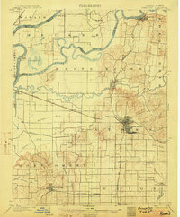
 1901 Princeton1954 Print · USGSGIBSON COUNTY at the turn of the century shows a landscape transitioning from river-and-canal transit to a bustling railroad hub. Trace early settlements and infrastructure like the Mt Carmel Ferry, the Wabash and Erie Canal (Abandoned), and the historic community of Lyles.
 - 1901 Map of Haubstadt, 1955 Print
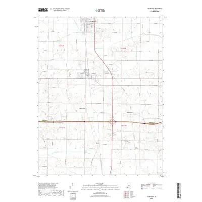
 1901 Haubstadt1955 Print · USGSSouthwestern Indiana thrived as a rail-centric farming region at the turn of the century. Genealogists and historians can trace old property lines and rural crossroads like Parker's Settlement, St. Wendells, and the thriving rail hub at Haubstadt.
 - 1903 Map of Haubstadt
 1903 Haubstadt1903 Print · USGSSouthern Indiana at the start of the century shows a landscape of busy rail junctions and tight-knit crossroads. Genealogists can trace family footprints across Parker's Settlement, St. Wendells, and McCutchanville as they appeared before modern road expansion.2 unique versions available
 - 1903 Map of Princeton
 1903 Princeton1903 Print · USGSIndiana's southwestern river country is shown at the height of its railroad era, centered on the junction at Princeton. Genealogists and historians can trace old property lines near the County Farm or locate vanished sites along the Wabash and Erie Canal and the settlement of Lyles.6 unique versions available
 - 1903 Map of Patoka
 1903 Patoka1903 Print · USGSThe lower Wabash Valley at the start of the twentieth century was a vital crossroads of river trade and rail expansion. Genealogists can trace family roots through settlements like New Harmony and Parker's Settlement or locate the County Farm and Grand Rapids.2 unique versions available
 - 1956 Map of Vincennes, 1967 Print
 1956 Vincennes1967 Print · USGSSouthern Indiana and the Illinois borderlands are captured here in the mid-fifties, showing the region's dense network of river towns and rail lines. Researchers can trace historic river crossings along the Wabash River or locate landmarks like Wyandotte Cave and Lincoln State Park.4 unique versions available
 - 1957 Map of Vincennes
 1957 Vincennes1957 Print · USGSSouthwest Indiana and the Illinois borderlands come alive in the late 1950s, a period of heavy rail traffic and expanding state forests. Genealogists and historians can trace the riverfronts and rail lines of Vincennes, New Harmony, and the vast Crane Naval Ammunition Depot.
 - 1958 Map of Vincennes
 1958 Vincennes1958 Print · USGSSouthern Indiana and the Illinois borderlands are captured during a mid-century period of heavy rail traffic and military activity. Researchers can trace the sprawling bounds of the Crane Naval Ammunition Depot or locate historic settlements like New Harmony and French Lick.2 unique versions available
 - 1959 Map of Princeton, 1961 Print
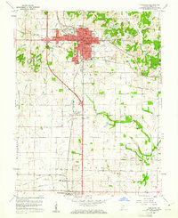 1959 Princeton1961 Print · USGSGibson County at the end of the fifties reveals a landscape shaped by rail lines and growing residential hubs like Baldwin Heights. Local researchers can trace family landmarks and vanished sites from the Oil Refinery and Drive-in Theater to old burial grounds like Walnut Hill Cem.4 unique versions available
 - 1959 Map of Princeton, 1964 Print
 1959 Princeton1964 Print · USGSIndiana's river-rich southwestern corner comes alive in the late fifties as a network of levees and railroads defines the landscape. Genealogists and historians can trace family roots through Lyles Sch, Decker Chapel, and the riverside settlements of Hazleton and Patoka.2 unique versions available
 - 1961 Map of Haubstadt, 1963 Print
 1961 Haubstadt1963 Print · USGSSouthern Indiana at the start of the 1960s was a landscape defined by small-town rail commerce and emerging oil production. Researchers can trace family roots through numerous churches like St Stephen Ch and local landmarks such as Fort Branch or the Coal Mine.3 unique versions available
 - 1986 Map of Princeton
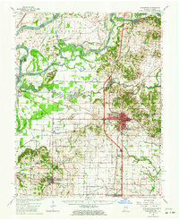
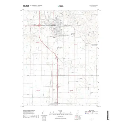
 1986 Princeton1986 Print · USGSSouthwestern Indiana is defined by the confluence of the Wabash and White Rivers during the mid-eighties, a period of established rail lines and expanding interstates. Genealogists and historians can trace property locations across numerous townships or locate family sites in Mount Carmel, Poseyville, and Boonville.2 unique versions available
 - 2010 Map of Princeton, 2010 Print
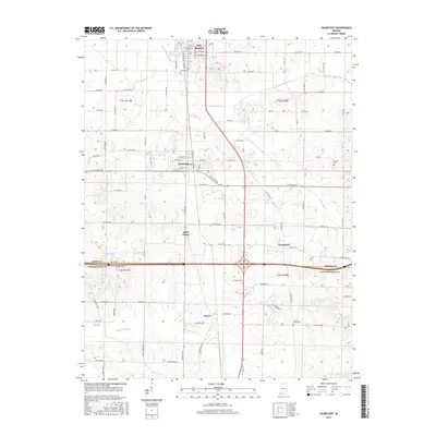
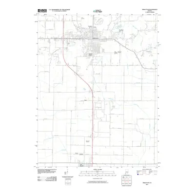 2010 Princeton2010 Print · USGSCovers Fort Branch, including Princeton, King, and other nearby areas
 - 2010 Map of Haubstadt, 2010 Print
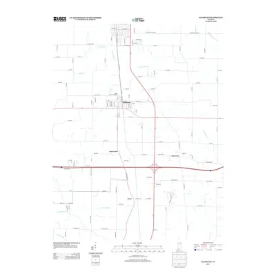
 2010 Haubstadt2010 Print · USGSCovers Fort Branch, including Haubstadt, Stacer, and other nearby areas
 - 2013 Map of Haubstadt, 2013 Print
 2013 Haubstadt2013 Print · USGSCovers Fort Branch, including Haubstadt, Stacer, and other nearby areas
 - 2013 Map of Princeton, 2013 Print
 2013 Princeton2013 Print · USGSCovers Fort Branch, including Princeton, King, and other nearby areas
 - 2016 Map of Haubstadt, 2016 Print
 2016 Haubstadt2016 Print · USGSCovers Fort Branch, including Haubstadt, Stacer, and other nearby areas
 - 2016 Map of Princeton, 2016 Print
 2016 Princeton2016 Print · USGSCovers Fort Branch, including Princeton, King, and other nearby areas
 - 2019 Map of Princeton, 2019 Print
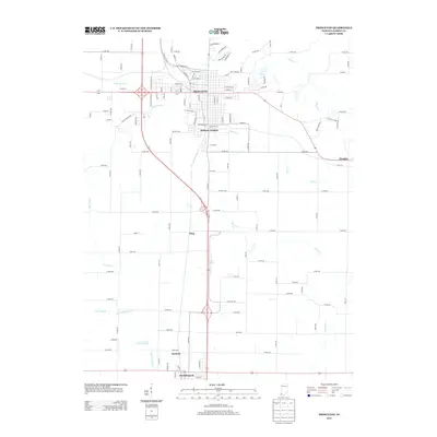
 2019 Princeton2019 Print · USGSCovers Fort Branch, including Princeton, King, and other nearby areas
 - 2019 Map of Haubstadt, 2019 Print
 2019 Haubstadt2019 Print · USGSCovers Fort Branch, including Haubstadt, Stacer, and other nearby areas
 - 2022 Map of Princeton, 2022 Print
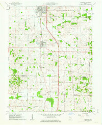
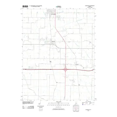
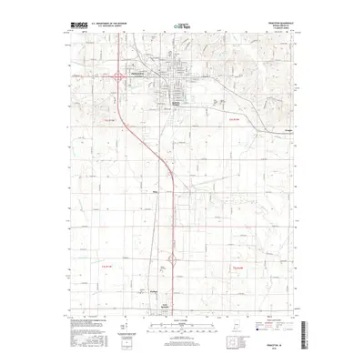
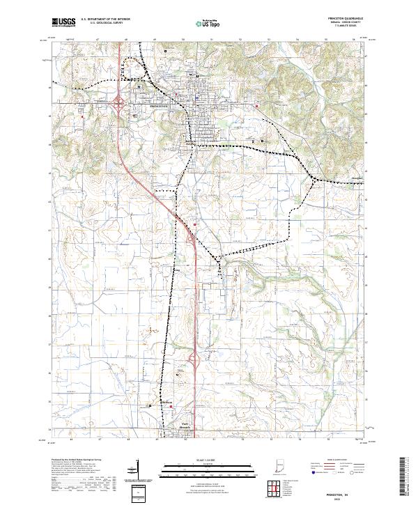 2022 Princeton2022 Print · USGSGibson County at the start of the 2020s shows a landscape of established towns and rural farmsteads tied together by historic drainages. Genealogists can locate family sites at Walnut Hill Cem or Odd Fellows Cem and trace the civic center around the Gibson County Courthouse.
 - 2022 Map of Haubstadt, 2022 Print
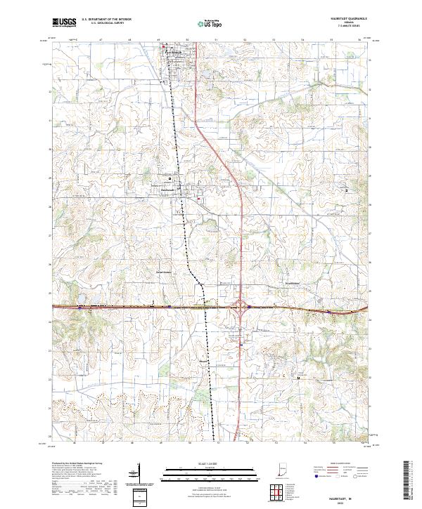 2022 Haubstadt2022 Print · USGSGibson and Vanderburgh counties are shown in this modern survey of southwestern Indiana's farming heartland. Genealogists can locate legacy sites like Saints Peter and Paul Cem and Trinity Parish Cem near the historic CSX rail line.
End of results
Showing maps 1-22 of 22
Top cities near Fort Branch
- Evansville historical maps
- Princeton historical maps
- Mount Carmel historical maps
- Johnson historical maps
- Chandler historical maps
- Oakland City historical maps
See more
Frequently asked questions
- What are the different types of historical maps available for Fort Branch?
- What is the oldest map of Fort Branch?
- Where can I purchase historical maps of Fort Branch for my home or office?
- Where can I download high-res historical maps of Fort Branch?
- Are there historical topographic maps available for Fort Branch?
- Is there historical aerial imagery available for Fort Branch?
- Where are historical maps of Fort Branch sourced from?