1960s Maps of Gas City, Indiana
Explore 4 historic maps of Gas City from the 1960s. These maps offer a rare glimpse into what life looked like during the 1960s — showing old roads, neighborhoods, homes, and landmarks that have changed or disappeared over time.
Whether you're researching your family's past, planning a metal detecting trip, or studying how Gas City's landscape evolved across the 1960s, these high-resolution maps are a powerful tool for exploring the history of this region.
- Focus on a specific era: All maps on this page are from the 1960s, giving you a focused view of this time period.
- See what’s changed: Compare century-old streets, trails, and buildings to today's modern landscape using overlays and satellite layers.
- Research with precision: Use these maps for genealogy, historical research, land use analysis, or educational projects.
- View, download, or print: Maps are fully viewable online in high resolution, and can be downloaded or printed for your own records.
Start exploring Gas City's history through authentic maps from the 1960s. This is your window into the past.
Gas City, IN maps
(4)- 1960 Map of Fairmount, 1961 Print
 1960 Fairmount1961 Print · USGSFairmount and Jonesboro stand at the center of this 1960s Grant County landscape, split by two major railroads and an old treaty line. Genealogists can locate family sites near Hill Chapel, Little Ridge Cem, and the small community of Weaver.3 unique versions available
 - 1960 Map of Gas City, 1961 Print
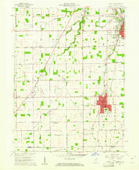
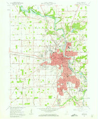
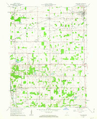
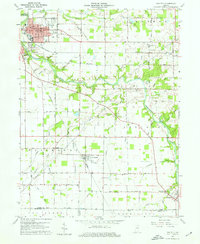 1960 Gas City1961 Print · USGSGrant County is shown during a period of steady growth and industrial rail activity in the early sixties. Genealogists and historians can locate family plots at Riverside Cem or trace the early paths of the PENNSYLVANIA and CHESAPEAKE AND OHIO railroads.4 unique versions available
 - 1961 Map of Marion, 1963 Print
 1961 Marion1963 Print · USGSMarion emerges as a thriving mid-century industrial center at the intersection of the Mississinewa River and multiple rail lines in the early sixties. Genealogists and historians can locate numerous neighborhood landmarks, including Marion College, the IOOF Cemetery, and the Goodman Yards rail facility.3 unique versions available
 - 1962 Map of Van Buren, 1963 Print
 1962 Van Buren1963 Print · USGSGrant County is captured in the early sixties as a structured grid of family farms and railroad hamlets. Researchers can trace the legacy of small-town Indiana through landmarks like Landess, Roosevelt Sch, and the Locust Chapel.2 unique versions available
End of results
Showing maps 1-4 of 4
Top cities near Gas City
- Marion historical maps
- Elwood historical maps
- Hartford City historical maps
- Alexandria historical maps
- Upland historical maps
- Fairmount historical maps
See more
Frequently asked questions
- What are the different types of historical maps available for Gas City?
- What is the oldest map of Gas City?
- Where can I purchase historical maps of Gas City for my home or office?
- Where can I download high-res historical maps of Gas City?
- Are there historical topographic maps available for Gas City?
- Is there historical aerial imagery available for Gas City?
- Where are historical maps of Gas City sourced from?