Old Maps of Brownsburg, Indiana for Metal Detecting
Plan your next treasure hunt with 29 historic maps of Brownsburg. Find old homesites, ghost towns, trails, and gathering spots that may be lost to time — perfect for identifying promising metal detecting locations.
- Locate forgotten sites: Uncover places like long-lost settlements, abandoned rail lines, or gathering spots.
- Plan better hunts: Use map overlays combined with LiDAR or satellite views to narrow in on historically rich areas.
- Made for detectorists: Thousands of hobbyists use these maps to discover relics, coins, and hidden history.
Use these historic maps to boost your research and find new opportunities beneath the surface of Brownsburg.
Brownsburg, IN maps
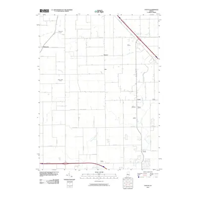
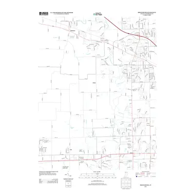
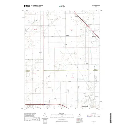
(29)- 1953 Map of Fayette, 1954 Print
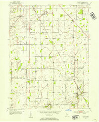 1953 Fayette1954 Print · USGSBoone County farm country is captured here in the early fifties, showing a landscape defined by small townships and traditional drainage. Genealogists can trace family names through numerous rural burial grounds like Mt Union Cem and Howard Cem.
 - 1953 Map of Brownsburg, 1955 Print
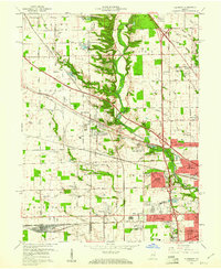
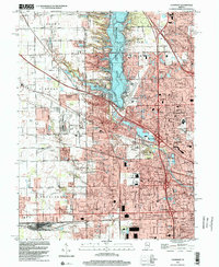
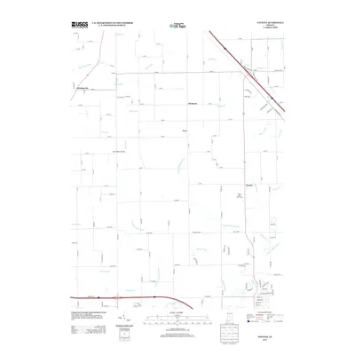
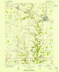 1953 Brownsburg1955 Print · USGSMid-century Hendricks County is captured here as a landscape of established rail towns and rural family cemeteries. Genealogists can trace deep local roots at St Malachys West Cem and White Lick Cem or locate the site of the former Brownsburg Airfield.
 - 1953 Map of Clermont, 1956 Print
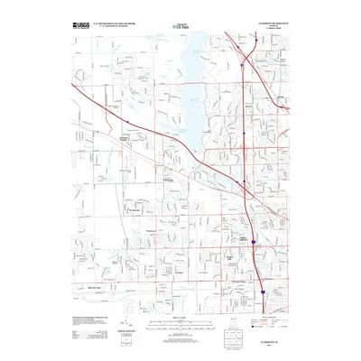
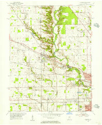 1953 Clermont1956 Print · USGSMid-century Marion County comes into focus as the suburban reach of Speedway meets the rail town of Clermont. Genealogists and local researchers can trace old family sites and institutions like Shiloh Church, Wood Haven Cemetery, and the Indiana Girls School.
 - 1953 Map of Indianapolis, 1965 Print
 1953 Indianapolis1965 Print · USGSCentral Indiana and the Illinois borderlands are captured in the mid-sixties, showing the growth of Indianapolis and its industrial rail corridors. Genealogists and historians can trace the development of outlying towns like Zionsville or Beech Grove and find landmarks such as Atterbury AAF and Turkey Run State Park.4 unique versions available
 - 1956 Map of Indianapolis
 1956 Indianapolis1956 Print · USGSCentral Indiana in the mid-fifties is captured during a period of industrial growth and military presence. Genealogists and historians can trace the rail networks of the New York Central or locate regional landmarks like Fort Benjamin Harrison and Camp Atterbury.
 - 1957 Map of Indianapolis
 1957 Indianapolis1957 Print · USGSCentral Indiana in the mid-fifties is captured here as a crossroads of major rail lines and nascent federal highways. Genealogists and historians can trace family-named ridges like Poplar Ridge or locate strategic sites like Camp Atterbury and Speedway.2 unique versions available
 - 1959 Map of Brownsburg, 1960 Print
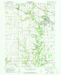
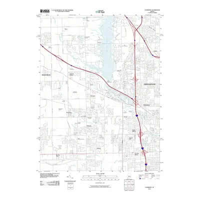
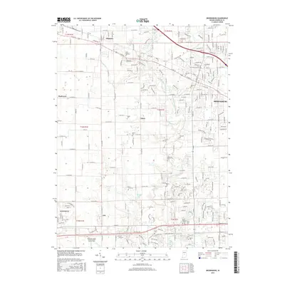
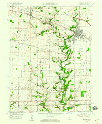 1959 Brownsburg1960 Print · USGSHendricks County at the close of the fifties shows a landscape of established rail towns and rural parishes connected by the New York Central. Genealogy researchers can locate family sites at St Malachy West Cem, Bartlett Chapel, and the community of Tilden.
 - 1959 Map of Clermont, 1961 Print
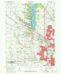
 1959 Clermont1961 Print · USGSMarion County suburbs expand toward the countryside in the late fifties as residential tracks meet rural townships. Genealogists and historians can trace the development of Clermont, find the Bullard Cem, or locate the historic Indiana Girls Sch.
 - 1962 Map of Indianapolis
 1962 Indianapolis1962 Print · USGSCentral Indiana and the Illinois borderlands are captured here in the early sixties, showing the region's dense rail networks and growing urban centers. Genealogists and historians can locate family-named landmarks and institutions like Crown Hill Cem, Indiana University, and the Indianapolis Motor Speedway.
 - 1963 Map of Fayette, 1964 Print
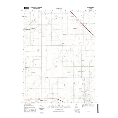
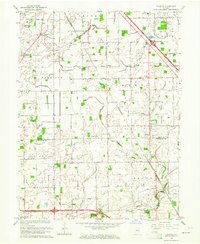 1963 Fayette1964 Print · USGSThe rural borderlands of Boone and Hendricks counties are captured here in the early sixties, showing a landscape of family farms and small crossroad hamlets. Researchers can trace the heritage of Milledgeville and Fayette or locate ancestral sites like Bethesda Cem and Cynthiana Ch.
 - 1967 Map of Clermont, 1969 Print
 1967 Clermont1969 Print · USGSThe western outskirts of Indianapolis are shown in the late sixties as suburban expansion meets established rural landmarks. Trace the development of the Eagle Creek Reservoir and find local history at Jodes Chapel Cem, the Indiana Girls School, and Snacks.3 unique versions available
 - 1970 Map of Brownsburg, 1972 Print
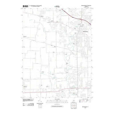
 1970 Brownsburg1972 Print · USGSHendricks County is seen here at a pivotal moment of suburban growth during the early seventies. Genealogists and local historians can trace family roots through numerous burial sites like St Malachy West Cem and Abner Creek Cem or locate long-standing landmarks like Bartlett Chapel.3 unique versions available
 - 1986 Map of Indianapolis
 1986 Indianapolis1986 Print · USGSThe Indiana capital and its surrounding counties are captured here in the mid-1980s, showcasing the height of its orbital highway development and suburban growth. Researchers can trace the legacy of the Fort Benjamin Harrison Military Reservation, follow the Conrail lines, or locate family roots in Beech Grove, Greencastle, and Zionsville.2 unique versions available
 - 1998 Map of Clermont, 2002 Print
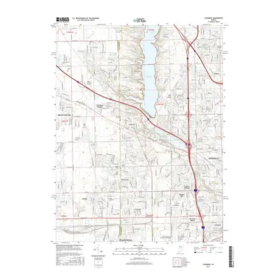
 1998 Clermont2002 Print · USGSMarion County at the close of the century shows a landscape defined by the intersection of suburban growth and major infrastructure. Trace the development of Clermont, Speedway, and the Big Four Yard rail complex alongside Eagle Creek Reservoir.
 - 2010 Map of Clermont, 2010 Print
 2010 Clermont2010 Print · USGSCovers Brownsburg, including Indianapolis, Plainfield, and other nearby areas
 - 2010 Map of Brownsburg, 2010 Print
 2010 Brownsburg2010 Print · USGSCovers Brownsburg, including Avon, Danville, and other nearby areas
 - 2010 Map of Fayette, 2010 Print
 2010 Fayette2010 Print · USGSCovers Brownsburg, including Pittsboro, Milledgeville, and other nearby areas
 - 2013 Map of Brownsburg, 2013 Print
 2013 Brownsburg2013 Print · USGSCovers Brownsburg, including Avon, Danville, and other nearby areas
 - 2013 Map of Fayette, 2013 Print
 2013 Fayette2013 Print · USGSCovers Brownsburg, including Pittsboro, Milledgeville, and other nearby areas
 - 2013 Map of Clermont, 2013 Print
 2013 Clermont2013 Print · USGSCovers Brownsburg, including Indianapolis, Plainfield, and other nearby areas
 - 2016 Map of Brownsburg, 2016 Print
 2016 Brownsburg2016 Print · USGSCovers Brownsburg, including Avon, Danville, and other nearby areas
 - 2016 Map of Fayette, 2016 Print
 2016 Fayette2016 Print · USGSCovers Brownsburg, including Pittsboro, Milledgeville, and other nearby areas
 - 2016 Map of Clermont, 2016 Print
 2016 Clermont2016 Print · USGSCovers Brownsburg, including Indianapolis, Plainfield, and other nearby areas
 - 2019 Map of Fayette, 2019 Print
 2019 Fayette2019 Print · USGSCovers Brownsburg, including Pittsboro, Milledgeville, and other nearby areas
 - 2019 Map of Brownsburg, 2019 Print
 2019 Brownsburg2019 Print · USGSCovers Brownsburg, including Avon, Danville, and other nearby areas
Showing maps 1-25 of 29
Top cities near Brownsburg
- Indianapolis historical maps
- Carmel historical maps
- Greenwood historical maps
- Westfield historical maps
- Plainfield historical maps
- Lebanon historical maps
See more
Top neighborhoods of Brownsburg
Frequently asked questions
- What are the different types of historical maps available for Brownsburg?
- What is the oldest map of Brownsburg?
- Where can I purchase historical maps of Brownsburg for my home or office?
- Where can I download high-res historical maps of Brownsburg?
- Are there historical topographic maps available for Brownsburg?
- Is there historical aerial imagery available for Brownsburg?
- Where are historical maps of Brownsburg sourced from?