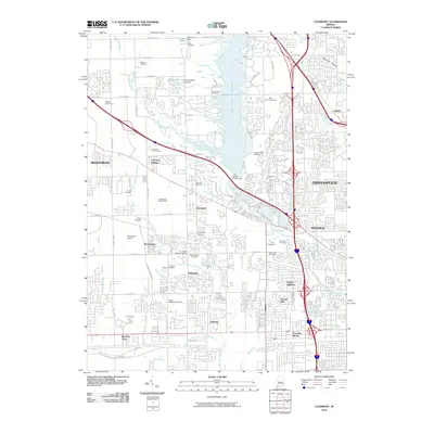
2010 Map of Clermont
USGS Topo · Published 2010About this map
Eagle Creek Reservoir dominates the center of this landscape, its waters held by the Eagle Creek Dam just north of the Clermont settlement. The area reflects a complex transition from suburban residential growth to specialized sports and industrial corridors. Major athletic and racing facilities define the local identity, including the Colts Training Complex and the expansive Indianapolis Raceway Park. To the south, the massive rail infrastructure of the Big Four Yard occupies a significant footprint, illustrating the region's importance as a transportation hub. Pockets of older history remain visible through a dense network of family and community burial grounds such as the Ballard Cemetery, Shiloh Methodist Cemetery, and Old Union Cemetery, which sit adjacent to modern developments like Farleys Addition and Keystone Manor.
Find a feature on this map
110 named features on this map. Tap any name to fly to it.
Don’t see what you’re looking for? This feature index may not catch every label — zoom into the map to look around manually.
Map Details
Editions of this 2010 Clermont Map
This is the sole edition of this map. No revisions or reprints were ever made.
Other maps of this area

1948 · Maywood
USGS Topo · 1:24,000

1948 · Indianapolis West
USGS Topo · 1:24,000

1952 · Carmel
USGS Topo · 1:24,000

1953 · Bridgeport
USGS Topo · 1:24,000

1953 · Fayette
USGS Topo · 1:24,000

1953 · Brownsburg
USGS Topo · 1:24,000

1953 · Zionsville
USGS Topo · 1:24,000

1953 · Plainfield
USGS Topo · 1:24,000

1953 · Clermont
USGS Topo · 1:24,000

1953 · Indianapolis
USGS Topo · 1:250,000