1900s (20th Century) Maps of Mount Summit, Indiana
Explore 9 historic maps of Mount Summit from the 1900s (20th Century). These maps offer a rare glimpse into what life looked like during the 1900s — showing old roads, neighborhoods, homes, and landmarks that have changed or disappeared over time.
Whether you're researching your family's past, planning a metal detecting trip, or studying how Mount Summit's landscape evolved across the 1900s, these high-resolution maps are a powerful tool for exploring the history of this region.
- Focus on a specific era: All maps on this page are from the 1900s, giving you a focused view of this time period.
- See what’s changed: Compare century-old streets, trails, and buildings to today's modern landscape using overlays and satellite layers.
- Research with precision: Use these maps for genealogy, historical research, land use analysis, or educational projects.
- View, download, or print: Maps are fully viewable online in high resolution, and can be downloaded or printed for your own records.
Start exploring Mount Summit's history through authentic maps from the 1900s. This is your window into the past.
Mount Summit, IN maps
(9)- 1949 Map of New Castle West
 1949 New Castle West1949 Print · USGSWestern Henry County is captured here in the late 1940s, showing a landscape of productive farms and burgeoning rail-side villages. Genealogists can locate several rural burial sites and churches including Quaker Cem, Sugar Grove Ch, and the South Mound Cemetery.2 unique versions available
 - 1953 Map of Cincinnati, 1965 Print
 1953 Cincinnati1965 Print · USGSThe Ohio River valley and the industrial heartland of Indiana and Ohio are captured here during the mid-century peak of rail and river commerce. Genealogists and historians can trace connections between Cincinnati and outlying military sites like Camp Atterbury and Bakalar AFB.3 unique versions available
 - 1953 Map of Muncie, 1966 Print
 1953 Muncie1966 Print · USGSIndiana and Ohio borderlands thrive in the early fifties, showing a landscape defined by manufacturing cities and an intensive railroad network. Genealogists can trace family roots across the Indiana-Ohio line through Muncie, Celina, and Portland via the Pennsylvania railroad.5 unique versions available
 - 1956 Map of Muncie
 1956 Muncie1956 Print · USGSEastern Indiana and western Ohio are shown at a peak of rail-driven industry in the mid-fifties. Genealogists and rail historians can trace the paths of the Pennsylvania RR through Muncie or locate landmarks like Lake Saint Marys (Grand Lake Reservoir) and Frances Slocum State Forest.
 - 1957 Map of Cincinnati
 1957 Cincinnati1957 Print · USGSThe Ohio River valley and its surrounding highlands thrived during the mid-fifties industrial peak, centered on the bustling Cincinnati and Dayton metropolitan hubs. Researchers can trace the extensive rail networks and military sites like Wright-Patterson AFB and Camp Atterbury.
 - 1960 Map of New Castle West, 1961 Print
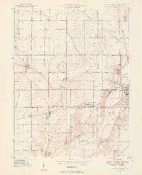
 1960 New Castle West1961 Print · USGSHenry County is captured here at a mid-century peak of rail and road connectivity, centered on the growing city of New Castle. Genealogists and local historians can trace family plots at South Mound Cemetery or locate old landmarks like Sugar Grove Sch and the Drive-In Theater.3 unique versions available
 - 1960 Map of Sulphur Springs, 1961 Print
 1960 Sulphur Springs1961 Print · USGSThe crossroads of Delaware and Henry counties are captured here at the dawn of the 1960s, showing a landscape defined by rail and agriculture. Researchers can trace family roots at Sunderland Cemetery or follow the New York Chicago and St Louis RR through Oakville and Springport.4 unique versions available
 - 1986 Map of Muncie
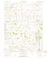
 1986 Muncie1986 Print · USGSEast Central Indiana was a hub of manufacturing and higher education in the mid-eighties. Genealogists and historians can trace the streets of Muncie, locate rural Cem sites, and explore landmarks like Mounds State Park and Taylor Univ.3 unique versions available
 - 1986 Map of New Castle
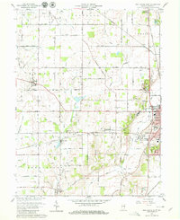
 1986 New Castle1986 Print · USGSEast Central Indiana remains a patchwork of thriving county seats and rail-side hamlets in the mid-eighties. Genealogists and historians can locate family landmarks such as East Hill Cemetery, Little Blue River Church, and the transit lines of the CONRAIL railroad.2 unique versions available
End of results
Showing maps 1-9 of 9
Top cities near Mount Summit
- Muncie historical maps
- Anderson historical maps
- New Castle historical maps
- Yorktown historical maps
- Chesterfield historical maps
- Middletown historical maps
See more
Frequently asked questions
- What are the different types of historical maps available for Mount Summit?
- What is the oldest map of Mount Summit?
- Where can I purchase historical maps of Mount Summit for my home or office?
- Where can I download high-res historical maps of Mount Summit?
- Are there historical topographic maps available for Mount Summit?
- Is there historical aerial imagery available for Mount Summit?
- Where are historical maps of Mount Summit sourced from?