2020s Maps of Jasper County, Indiana
Explore 21 historic maps of Jasper County from the 2020s. These maps offer a rare glimpse into what life looked like during the 2020s — showing old roads, neighborhoods, homes, and landmarks that have changed or disappeared over time.
Whether you're researching your family's past, planning a metal detecting trip, or studying how Jasper County's landscape evolved across the 2020s, these high-resolution maps are a powerful tool for exploring the history of this region.
- Focus on a specific era: All maps on this page are from the 2020s, giving you a focused view of this time period.
- See what’s changed: Compare century-old streets, trails, and buildings to today's modern landscape using overlays and satellite layers.
- Research with precision: Use these maps for genealogy, historical research, land use analysis, or educational projects.
- View, download, or print: Maps are fully viewable online in high resolution, and can be downloaded or printed for your own records.
Start exploring Jasper County's history through authentic maps from the 2020s. This is your window into the past.
Jasper County, IN maps
(21)- 2022 Map of Gifford, 2022 Print
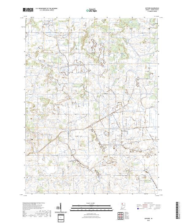 2022 Gifford2022 Print · USGSJasper County agricultural lands appear here in recent years, defined by an extensive network of drainage channels. Researchers can trace family sites near Gifford and Newland, or locate the Prater Cem and the uniquely named Alley Oop Airport.
 - 2022 Map of Wheatfield, 2022 Print
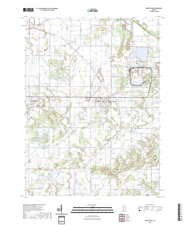 2022 Wheatfield2022 Print · USGSNorthwest Indiana's agricultural heartland is documented here in the early twenty-first century, centered on the Jasper and Porter County line. Researchers can trace family sites near Wheatfield, locate Kniman Cem, and follow the path of the Kankakee River and Marble Ditch.
 - 2022 Map of San Pierre, 2022 Print
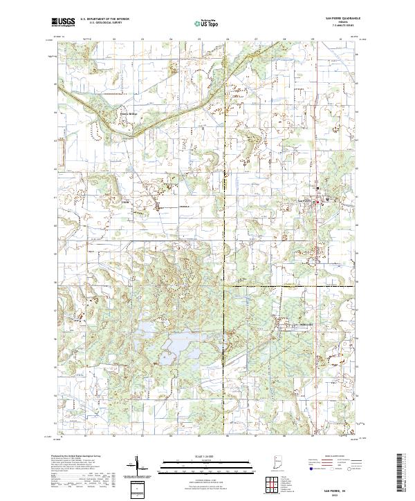 2022 San Pierre2022 Print · USGSNorthwest Indiana at the start of the 2020s shows a landscape deeply shaped by the drainage of the Kankakee Basin. Researchers can trace the heritage of local settlements like San Pierre and Tefft or locate family sites at the San Pierre Public Cem and All Saints Cem.
 - 2022 Map of Parr, 2022 Print
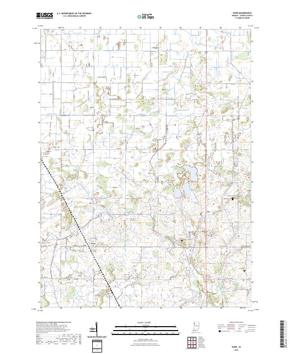 2022 Parr2022 Print · USGSThe rural expanses of Jasper County are shown here in the early twenty-first century, featuring a landscape defined by industrial-scale drainage and family farms. Local historians can trace the sites of Yeoman Cem and Dunkard Cem or follow the Iroquois River past Parr.
 - 2022 Map of Medaryville, 2022 Print
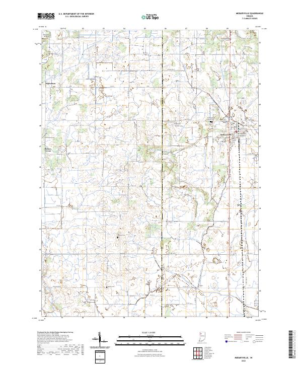 2022 Medaryville2022 Print · USGSThe rural agricultural lands of Pulaski County are shown here in the 2020s, defined by the town of Medaryville and a complex drainage network. Researchers can trace local lineage at Saint Marks Lutheran Cem or locate the small landing strips at Tatertown Airport and Alley Oop Airport.
 - 2022 Map of Kouts, 2022 Print
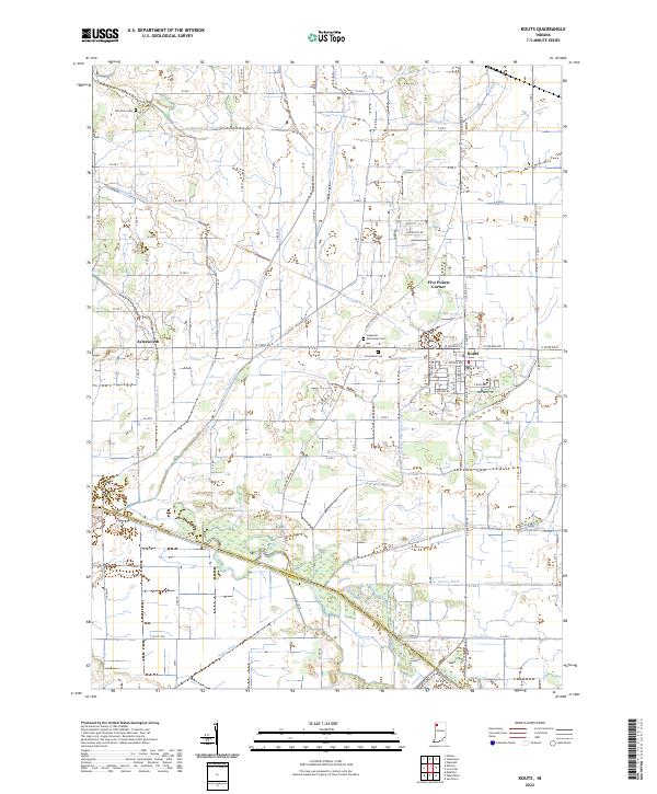 2022 Kouts2022 Print · USGSSouthern Porter County is mapped here in the early 2020s, showing the agricultural landscape near the Kankakee River. Genealogists and local historians can locate the Hopewell Mennonite Cem and trace the old road layouts around Kouts and Aylesworth.
 - 2022 Map of McCoysburg, 2022 Print
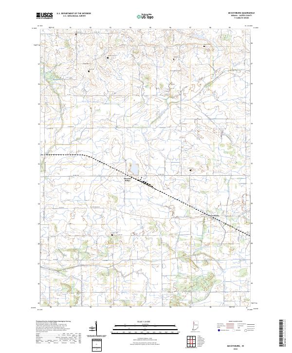 2022 McCoysburg2022 Print · USGSNorthwest Indiana's agricultural heartland is documented here in the early twenty-first century, showcasing the intricate drainage systems and family-named cemeteries of Jasper County. Genealogists can locate small rural burial grounds like Hankie Cem and Rees Cem while tracing watercourses like Slough Creek and Sage Ditch.
 - 2022 Map of Goodland, 2022 Print
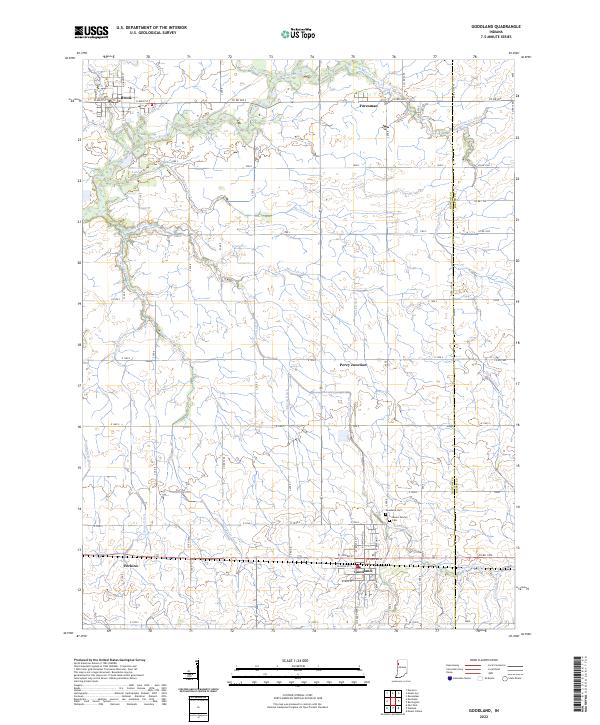 2022 Goodland2022 Print · USGSNewton County's agricultural heartland is captured here in the early 2020s, showing a landscape defined by the Iroquois River and an intricate drainage network. Trace local genealogy and history through landmarks like Mount Calvary Cem, Goodland, and the rail junction at Percy Junction.
 - 2022 Map of Mount Ayr, 2022 Print
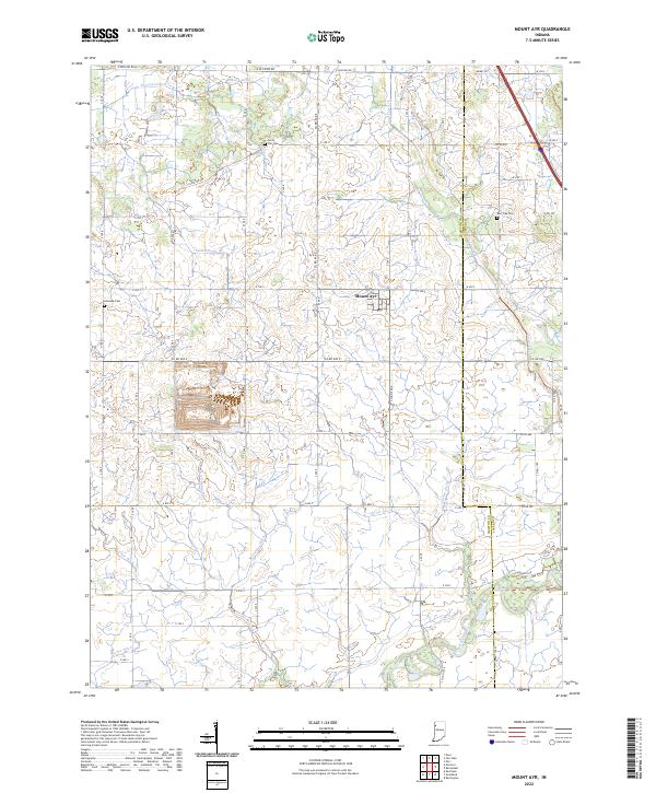 2022 Mount Ayr2022 Print · USGSThe rural landscape around the town of Mount Ayr is captured here in the early twenty-first century, showing the engineered drainage of the Indiana prairie. Family history researchers can locate Burr Oak Cem, Kennedy Cem, and the path of the Iroquois River.
 - 2022 Map of Wadena, 2022 Print
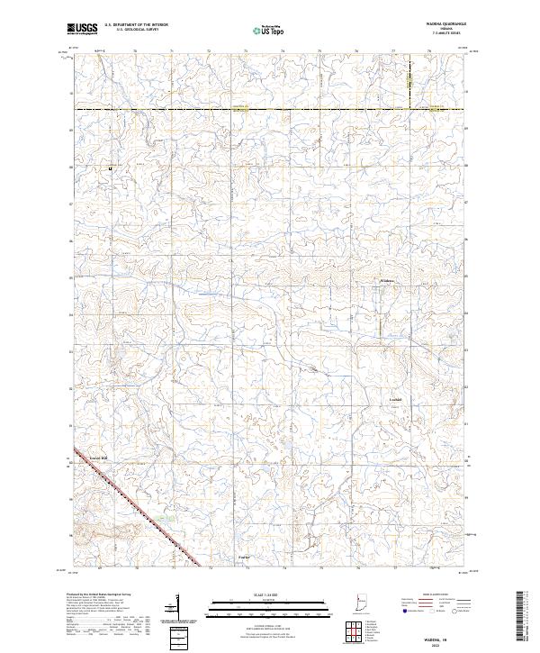 2022 Wadena2022 Print · USGSBenton County farmland is captured here in the modern era, showing the intersection of rural agriculture and traditional crossroads. Genealogists and local historians can trace family land near Lochiel, the Dehner Cem, or the small community of Wadena.
 - 2022 Map of Mount Gilboa, 2022 Print
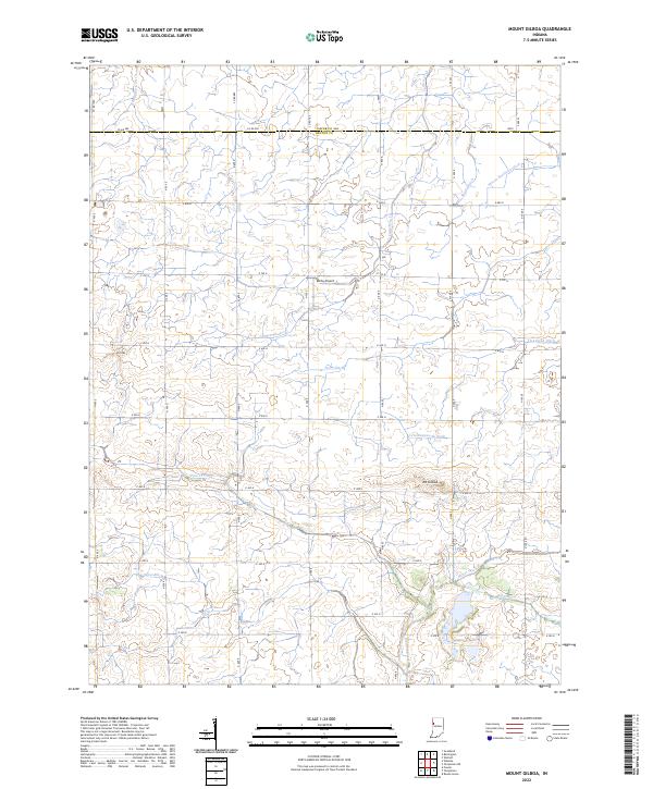 2022 Mount Gilboa2022 Print · USGSBenton and Jasper County farmland is shown in modern detail, where the land is shaped by an extensive network of drainage systems. Researchers can trace the courses of Big Pine Creek and Carpenter Cr or locate landmarks like Mt Gilboa and the Ashby Airport.
 - 2022 Map of Francesville, 2022 Print
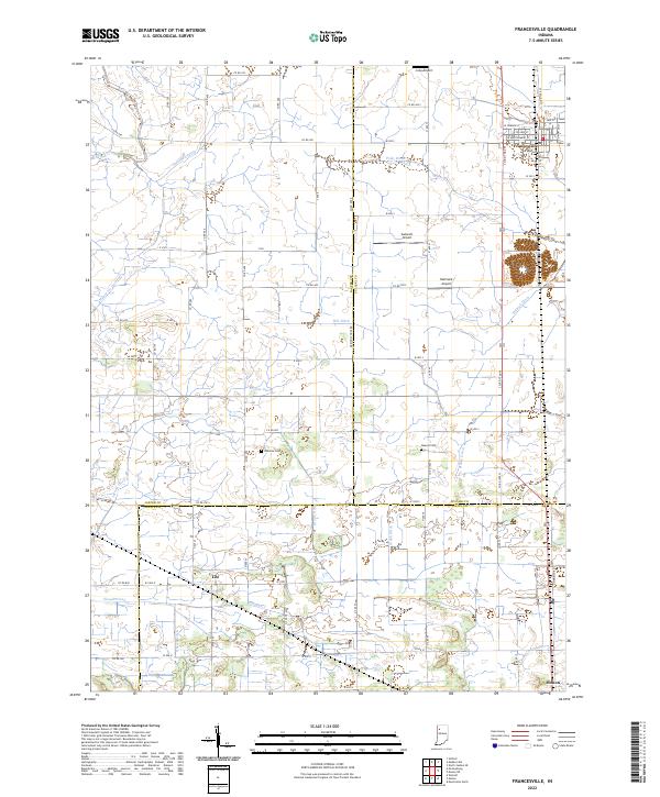 2022 Francesville2022 Print · USGSNorthwest Indiana's prairie farmlands are revealed in this detailed look at the rural landscape where Jasper, Pulaski, and White counties meet. Local researchers can trace family plots at Osborne Cem or explore the drainage history of Slough Creek and Jordan Ditch.
 - 2022 Map of Monon, 2022 Print
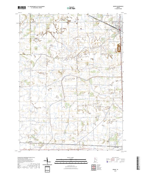 2022 Monon2022 Print · USGSMonon and the surrounding agricultural lands of White County are shown here in the early 2020s, dominated by an extensive drainage network. Researchers can trace rural lineages through sites like Palestine Cemetery, Swisher Cemetery, and the rail-side settlement of Seafield.
 - 2022 Map of Shelby, 2022 Print
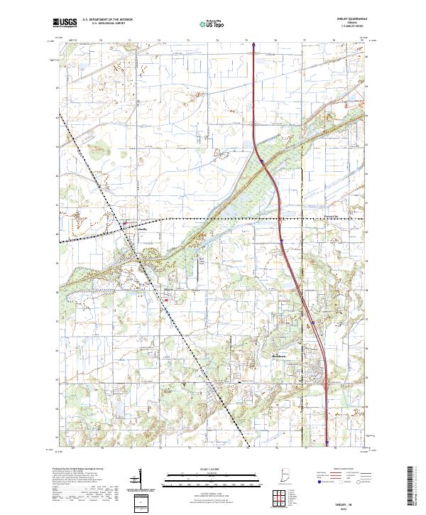 2022 Shelby2022 Print · USGSThe Kankakee River lowlands of Lake and Newton counties appear here in the early twenty-first century, showing a landscape defined by industrial-scale drainage and small-town roots. Researchers can trace the layout of Shelby, locate the Roselawn Cem, or follow the path of the historic Monon Rd.
 - 2022 Map of DeMotte, 2022 Print
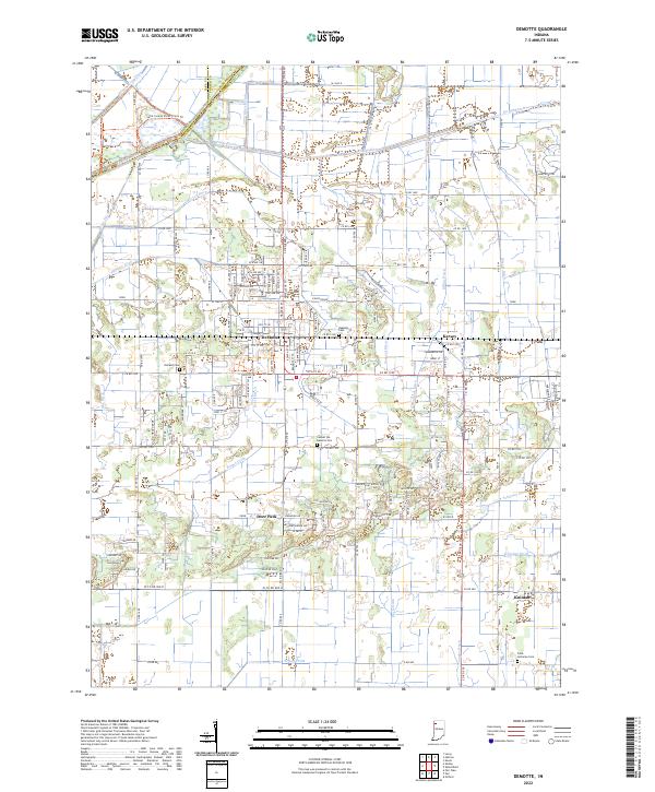 2022 DeMotte2022 Print · USGSJasper County agricultural life and the engineered landscape of the Kankakee Valley are shown here in the early 2020s. Researchers can locate family sites at Holland Cem or Faith Lutheran Cem and trace water management across Hodge Ditch and Wesner Ditch.
 - 2022 Map of Fair Oaks, 2022 Print
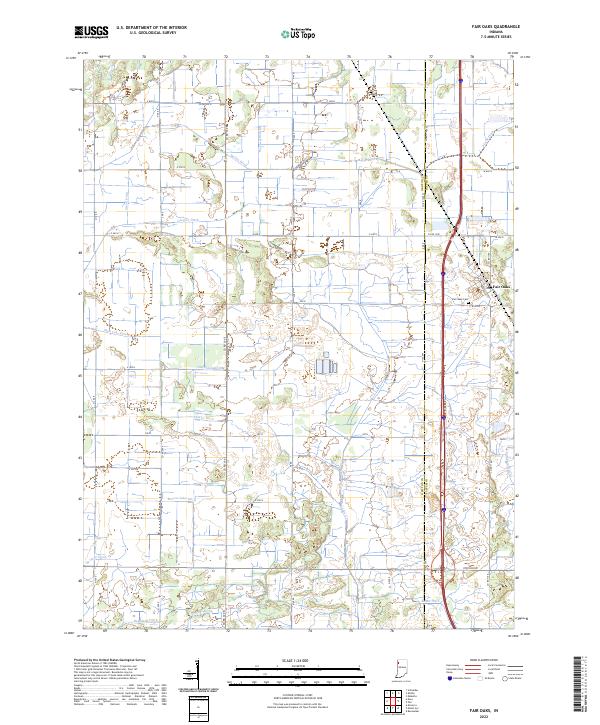 2022 Fair Oaks2022 Print · USGSNewton and Jasper Counties appear in the early 2020s as a landscape defined by its intricate drainage networks and rural settlements. Researchers can trace the legacy of land reclamation through features like Beaver Lake Ditch, Fair Oaks Cemetery, and Fair Oaks.
 - 2022 Map of Hebron, 2022 Print
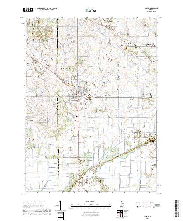 2022 Hebron2022 Print · USGSPorter County's agricultural heartland is documented here in the early 2020s, centered on the historic crossroads of Hebron. Genealogists and local historians can trace family plots at Hebron Cem or explore the intricate drainage networks of Singleton Ditch and the Kankakee River.
 - 2022 Map of Rensselaer, 2022 Print
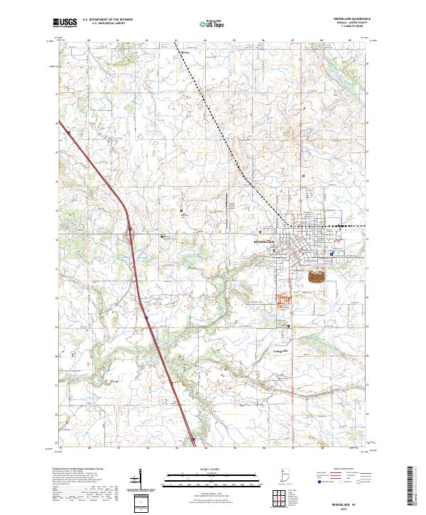 2022 Rensselaer2022 Print · USGSThe Iroquois River valley comes to life in this survey of northern Indiana's agricultural and civic heart. Genealogists and local historians can trace family locations through Sayler Makeever Cem and the streets of Rensselaer and Collegeville.
 - 2022 Map of Remington, 2022 Print
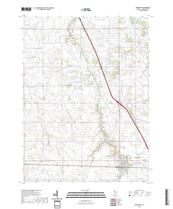 2022 Remington2022 Print · USGSRemington and its surrounding prairie lands are captured here in the early twenty-first century as the agricultural landscape continues its deep reliance on complex drainage. Researchers can trace family sites at the Remington Cem or the smaller Welsh Cem, and locate the community of Fountain Park.
 - 2022 Map of Templeton NE, 2022 Print
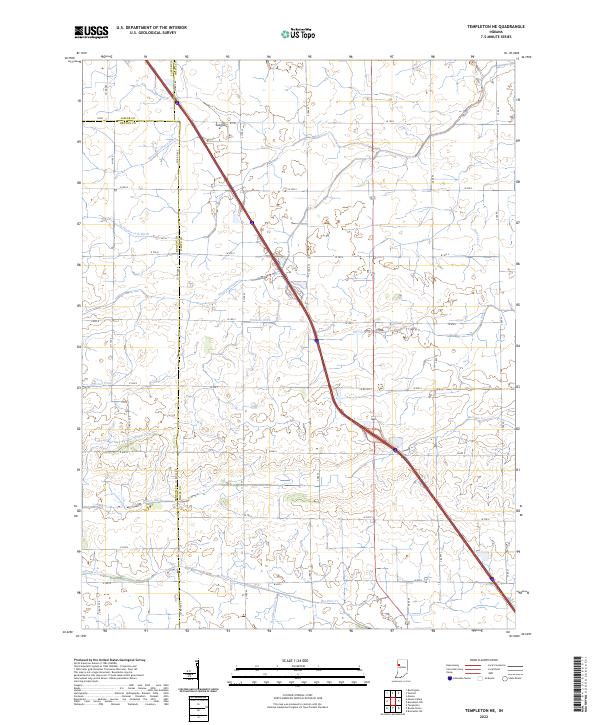 2022 Templeton NE2022 Print · USGSThe tri-county junction of Jasper, White, and Benton counties is seen here in the early 2020s, showing a highly managed agricultural landscape. Researchers can trace the complex drainage networks vital to local farming, such as Mason Eastburn Ditch and Big Pine Creek.
 - 2022 Map of Wolcott, 2022 Print
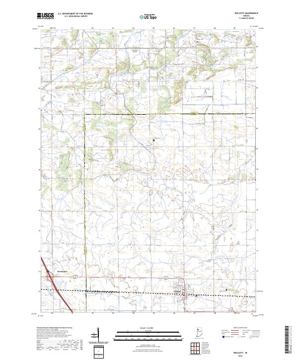 2022 Wolcott2022 Print · USGSIndiana's fertile agricultural borderlands near the start of the 2020s are defined by the grid of Wolcott and Remington. Researchers can trace old family burial sites like Dobbins Cemetery and Milroy Cemetery among the many drainage canals.
End of results
Showing maps 1-21 of 21
Top cities of Jasper County
- Rensselaer historical maps
- Remington historical maps
- Wheatfield historical maps
- Hanging Grove historical maps
Frequently asked questions
- What are the different types of historical maps available for Jasper County?
- What is the oldest map of Jasper County?
- Where can I purchase historical maps of Jasper County for my home or office?
- Where can I download high-res historical maps of Jasper County?
- Are there historical topographic maps available for Jasper County?
- Is there historical aerial imagery available for Jasper County?
- Where are historical maps of Jasper County sourced from?