Old Maps of Jennings County, Indiana for Metal Detecting
Plan your next treasure hunt with 100 historic maps of Jennings County. Find old homesites, ghost towns, trails, and gathering spots that may be lost to time — perfect for identifying promising metal detecting locations.
- Locate forgotten sites: Uncover places like long-lost settlements, abandoned rail lines, or gathering spots.
- Plan better hunts: Use map overlays combined with LiDAR or satellite views to narrow in on historically rich areas.
- Made for detectorists: Thousands of hobbyists use these maps to discover relics, coins, and hidden history.
Use these historic maps to boost your research and find new opportunities beneath the surface of Jennings County.
Jennings County, IN maps
(100)- 1942 Map of Columbus
 1942 Columbus1942 Print · USGSBartholomew and Shelby counties are shown during the early years of the war, as military installations and rail lines reshaped the rural Indiana landscape. Genealogists can trace family-named sites and established communities like St Louis Crossing, Hope, and the sprawling Camp Atterbury.
 - 1953 Map of Cincinnati, 1965 Print
 1953 Cincinnati1965 Print · USGSThe Ohio River valley and the industrial heartland of Indiana and Ohio are captured here during the mid-century peak of rail and river commerce. Genealogists and historians can trace connections between Cincinnati and outlying military sites like Camp Atterbury and Bakalar AFB.3 unique versions available
 - 1956 Map of Volga, 1957 Print
 1956 Volga1957 Print · USGSSouthern Indiana's rural character is preserved in this mid-century survey of the Jennings and Jefferson County border. Genealogists can trace family history through numerous landmarks like College Hill School, the County Infirmary, and Ogden Cemetery.3 unique versions available
 - 1956 Map of Deputy, 1957 Print
 1956 Deputy1957 Print · USGSSouthern Indiana rail and river life are captured here in the mid-fifties, centered on the Baltimore and Ohio line. Genealogists can trace family names through landmarks like Robertson Cem, Alpha Ch, and the settlement of Deputy.
 - 1956 Map of Louisville, 1971 Print
 1956 Louisville1971 Print · USGSThe Ohio River valley and the Kentucky Bluegrass are captured here during a period of rapid mid-century growth and industrial activity. Genealogists and historians can trace rail-centered towns and military land use at Fort Knox and the Jefferson Proving Ground.2 unique versions available
 - 1957 Map of Cincinnati
 1957 Cincinnati1957 Print · USGSThe Ohio River valley and its surrounding highlands thrived during the mid-fifties industrial peak, centered on the bustling Cincinnati and Dayton metropolitan hubs. Researchers can trace the extensive rail networks and military sites like Wright-Patterson AFB and Camp Atterbury.
 - 1957 Map of Butlerville, 1958 Print
 1957 Butlerville1958 Print · USGSJennings County in the late fifties is defined by the convergence of major rail lines and large-scale state institutions. Genealogists and local historians can trace family roots through Day Cemetery and St Anns School, or explore the grounds of the Muscatatuck State School.3 unique versions available
 - 1957 Map of Azalia, 1958 Print
 1957 Azalia1958 Print · USGSIndiana's rural heartland is captured here in the late fifties at the intersection of Bartholomew, Jackson, and Jennings counties. Genealogists can trace family roots at Shed Creek Cem, the Friends Meetinghouse, and the small settlement of Reddington.4 unique versions available
 - 1957 Map of North Vernon, 1958 Print
 1957 North Vernon1958 Print · USGSJennings County during the late fifties reveals a landscape defined by the intersection of major rail lines and quiet rural life. Researchers can trace family heritage at Cave Springs Cem or locate old community landmarks like the Covered Bridge and the Oak Grove Ch.5 unique versions available
 - 1958 Map of Millhousen, 1959 Print
 1958 Millhousen1959 Print · USGSSoutheast Indiana's agricultural and energy landscape comes into focus during the late fifties. Genealogists and researchers can trace local roots through landmarks like Millhousen, St Dennis Ch, and Degenhart Sch, alongside numerous early Gas Wells.3 unique versions available
 - 1958 Map of Westport, 1959 Print
 1958 Westport1959 Print · USGSSouthern Decatur County at the close of the 1950s centers on the bustling rail junction at Westport. Genealogists and historians can trace family locations through numerous rural sites like Mt Aerie Ch, the Covered Bridge over Sand Creek, and the Old Indian Treaty Bdy.4 unique versions available
 - 1958 Map of Grammer, 1959 Print
 1958 Grammer1959 Print · USGSSoutheastern Indiana's agricultural heartland is documented here in the late fifties, centered on the Chicago Milwaukee St Paul and Pacific rail corridor. Genealogists can locate family-named sites such as Parkison Cem, Mt Pisgah Cem, and the community of Grammer.4 unique versions available
 - 1958 Map of Elizabethtown, 1959 Print
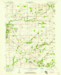 1958 Elizabethtown1959 Print · USGSThe Bartholomew County countryside is captured here in the late fifties as a bustling rail crossroads. Genealogists can trace family names through New Harmony Cemetery and St Paul’s Church or locate the hub where the PENNSYLVANIA railroad meets the Milwaukee line.4 unique versions available
 - 1959 Map of Holton, 1960 Print
 1959 Holton1960 Print · USGSThe Jennings and Ripley county line in the late fifties is defined by the massive footprint of a military proving ground and small railroad towns. Researchers can trace family history at Old Zenas Cem, the grounds of the Muscatatuck State School, or along the Baltimore and Ohio rail line.4 unique versions available
 - 1959 Map of San Jacinto, 1960 Print
 1959 San Jacinto1960 Print · USGSRipley, Jennings, and Jefferson counties appear here in the late fifties, during a period when the massive Jefferson Proving Ground shaped the local geography. Researchers can locate Bethel Cem and trace the winding courses of Big Graham Creek and Lancaster Creek.4 unique versions available
 - 1959 Map of Vernon, 1960 Print
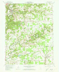 1959 Vernon1960 Print · USGSJennings County at the end of the 1950s shows a landscape shaped by the deep meanders of the Muscatatuck River. Genealogists can trace the paths between Vernon and Dupont, locating rural landmarks like Freedom Ch and the Douchette Cem.5 unique versions available
 - 1959 Map of Hayden, 1960 Print
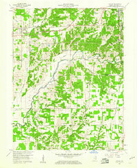 1959 Hayden1960 Print · USGSJennings County at the end of the fifties is a patchwork of river-bottom farms and small rail towns connected by the Baltimore and Ohio Railroad. Genealogists can locate family landmarks like Whitcomb Cem, St Josephs Ch, and the Township Sch near Lovett.3 unique versions available
 - 1959 Map of Crothersville, 1960 Print
 1959 Crothersville1960 Print · USGSSoutheast Indiana's rural landscape is captured here in the late fifties, centered on the growing community of Crothersville. Genealogists and historians can trace family roots through numerous landmarks like Marion Ch, Bethany Cem, and the small siding at Retreat.
 - 1959 Map of Chestnut Ridge, 1962 Print
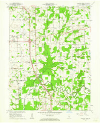 1959 Chestnut Ridge1962 Print · USGSJackson County in the late fifties was a landscape of crossroads and river bends defined by historical markers like the Treaty Boundary. Researchers can trace old family sites at New Farmington, visit New Hope Ch, or follow the rail lines of the Baltimore and Ohio RR.3 unique versions available
 - 1964 Map of Louisville
 1964 Louisville1964 Print · USGSThe Ohio River valley and Kentucky Bluegrass are captured in the mid-1960s, showing a region balanced between industrial growth and its agrarian roots. Genealogists and historians can trace the development of county seats like Shelbyville and Paris, or locate established institutions such as Georgetown College and Bernheim Forest.
 - 1968 Map of Deputy, 1970 Print
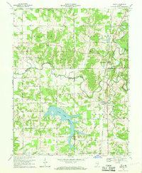 1968 Deputy1970 Print · USGSThe rural landscape around Deputy and Paris Crossing is captured here in the late 1960s, showing the intersection of railroad life and the Muscatatuck River valley. Genealogists can trace family landmarks like Robertson Cem, Mt Zion Ch, and the Baltimore and Ohio rail line.3 unique versions available
 - 1968 Map of Crothersville, 1970 Print
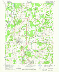 1968 Crothersville1970 Print · USGSSoutheastern Indiana during the late sixties shows a landscape of small towns and rail-connected farms. Genealogists can trace family landmarks like Wesley Chapel, Crothersville Cem, and the old settlement at Uniontown along the Penn Central line.2 unique versions available
 - 1986 Map of Greensburg
 1986 Greensburg1986 Print · USGSSoutheastern Indiana in the mid-eighties shows a balance of growing industrial centers and deeply rooted rural communities. Family historians can trace landmarks like the Highland Center School, South Park Cemetery, and the Bartholomew County Courthouse among the river forks.2 unique versions available
 - 1986 Map of Madison
 1986 Madison1986 Print · USGSSouthern Indiana and Northern Kentucky are shown here in the mid-eighties, centered on the river corridor and the sprawling Jefferson Proving Ground. Genealogists and historians can trace rail lines like the Seaboard System and locate river towns from Madison to Bethlehem.
 - 1990 Map of Madison, 1991 Print
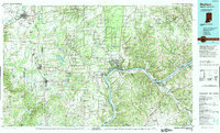 1990 Madison1991 Print · USGSThe Ohio River valley and the southern Indiana plains are documented here in the final decade of the twentieth century. Genealogists and historians can trace family-named crossroads and established rail towns like Dudleytown, Austin, and Crothersville along the P C RR line.
Showing maps 1-25 of 100
Top cities of Jennings County
Frequently asked questions
- What are the different types of historical maps available for Jennings County?
- What is the oldest map of Jennings County?
- Where can I purchase historical maps of Jennings County for my home or office?
- Where can I download high-res historical maps of Jennings County?
- Are there historical topographic maps available for Jennings County?
- Is there historical aerial imagery available for Jennings County?
- Where are historical maps of Jennings County sourced from?