Old Maps of Wheatland, Indiana for Hiking & Exploration
Hike through history with 11 historic maps of Wheatland. Explore old trails, ghost towns, and forgotten backroads — perfect for outdoor adventurers and local explorers.
- Rediscover forgotten places: Map out old mining camps, roads, and footpaths that no longer exist on modern maps.
- Layer with modern tools: Combine with LiDAR or satellite views to plan hikes through historical terrain.
- Made for exploration: Popular among hikers, overlanders, and local history lovers.
Use these maps to find adventure and explore the hidden past of Wheatland.
Wheatland, IN maps
(11)- 1944 Map of Wheatland
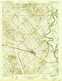 1944 Wheatland1944 Print · USGSMid-century Knox County is defined by coal mining and rail transport at the height of the steam era. Genealogists and industrial historians can trace the Baltimore and Ohio Railroad through Wheatland and locate family-named sites like the Peacock Mine and Asbury Chapel.2 unique versions available
 - 1956 Map of Vincennes, 1967 Print
 1956 Vincennes1967 Print · USGSSouthern Indiana and the Illinois borderlands are captured here in the mid-fifties, showing the region's dense network of river towns and rail lines. Researchers can trace historic river crossings along the Wabash River or locate landmarks like Wyandotte Cave and Lincoln State Park.4 unique versions available
 - 1957 Map of Vincennes
 1957 Vincennes1957 Print · USGSSouthwest Indiana and the Illinois borderlands come alive in the late 1950s, a period of heavy rail traffic and expanding state forests. Genealogists and historians can trace the riverfronts and rail lines of Vincennes, New Harmony, and the vast Crane Naval Ammunition Depot.
 - 1958 Map of Vincennes
 1958 Vincennes1958 Print · USGSSouthern Indiana and the Illinois borderlands are captured during a mid-century period of heavy rail traffic and military activity. Researchers can trace the sprawling bounds of the Crane Naval Ammunition Depot or locate historic settlements like New Harmony and French Lick.2 unique versions available
 - 1958 Map of Wheatland, 1959 Print
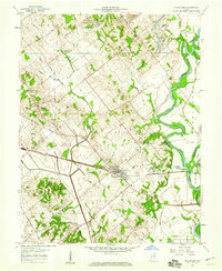 1958 Wheatland1959 Print · USGSThe Knox County countryside was a mix of rail-side industry and quiet settlements in the late fifties. Genealogists and local historians can trace family-named sites like Asbury Cem or follow the Baltimore and Ohio line through Wheatland.3 unique versions available
 - 1986 Map of Vincennes
 1986 Vincennes1986 Print · USGSThe Wabash River valley in the mid-1980s shows a landscape defined by deep-rooted river towns and heavy industry. Researchers can trace the legacy of regional rail lines like the Conrail system or locate landmarks such as Vincennes University and St Francisville Church.2 unique versions available
 - 2011 Map of Wheatland, 2011 Print
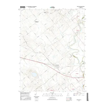
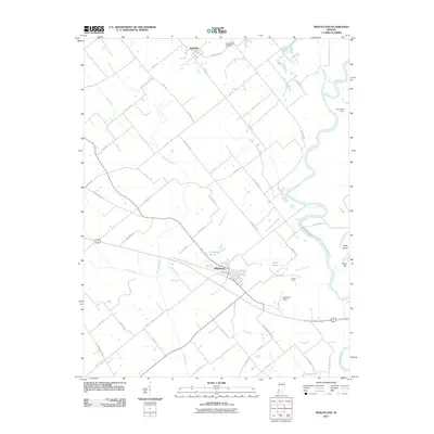 2011 Wheatland2011 Print · USGSCovers Wheatland, including Ragsdale, Indian Creek Settlement, and other nearby areas
 - 2013 Map of Wheatland, 2013 Print
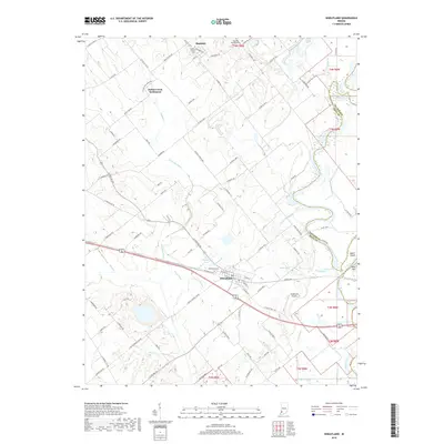
 2013 Wheatland2013 Print · USGSCovers Wheatland, including Ragsdale, Indian Creek Settlement, and other nearby areas
 - 2016 Map of Wheatland, 2016 Print
 2016 Wheatland2016 Print · USGSCovers Wheatland, including Ragsdale, Indian Creek Settlement, and other nearby areas
 - 2019 Map of Wheatland, 2019 Print
 2019 Wheatland2019 Print · USGSCovers Wheatland, including Ragsdale, Indian Creek Settlement, and other nearby areas
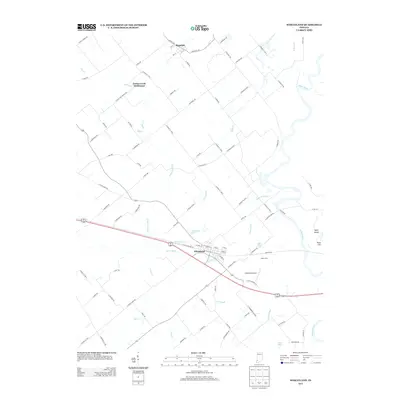
 - 2022 Map of Wheatland, 2022 Print
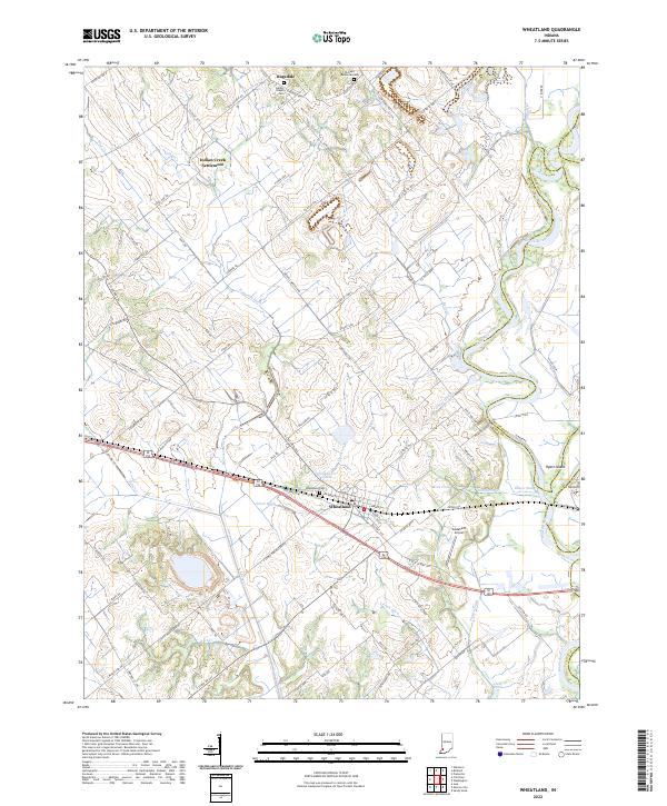 2022 Wheatland2022 Print · USGSWheatland and the surrounding Knox County bottomlands are mapped here during the early twenty-first century as the White River maintains its winding course. Researchers can trace the heritage of local family names and small communities through sites like Indian Creek Settlement, Asbury Chapel Cem, and Ghost Hollow.
End of results
Showing maps 1-11 of 11
Top cities near Wheatland
- Vincennes historical maps
- Washington historical maps
- Bicknell historical maps
- Petersburg historical maps
- Busseron historical maps
- Elnora historical maps
See more
Frequently asked questions
- What are the different types of historical maps available for Wheatland?
- What is the oldest map of Wheatland?
- Where can I purchase historical maps of Wheatland for my home or office?
- Where can I download high-res historical maps of Wheatland?
- Are there historical topographic maps available for Wheatland?
- Is there historical aerial imagery available for Wheatland?
- Where are historical maps of Wheatland sourced from?