
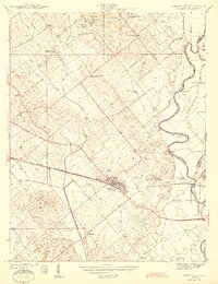
1944 Map of Wheatland
USGS Topo · Published 1944About this map
The railroad junction at Wheatland serves as the focal point of this 1940s landscape, where the Baltimore and Ohio Railroad intersects with local coal mining operations. The surrounding Knox County countryside is marked by industrial activity, including the Knox Consolidated No 1 Shaft near Ragsdale and the Peacock Mine to the south. These sites, along with the Standard Mine, indicate a robust extractive economy integrated with the rail network.
Find a feature on this map
45 named features on this map. Tap any name to fly to it.
Don’t see what you’re looking for? This feature index may not catch every label — zoom into the map to look around manually.
Map Details
Editions of this 1944 Wheatland Map
2 editions found
Other maps of this area

1942 · Fritchton
USGS Topo · 1:24,000

1943 · Oaktown
USGS Topo · 1:24,000

1943 · Bicknell
USGS Topo · 1:24,000

1943 · Plainville
USGS Topo · 1:24,000

1944 · Fritchton
USGS Topo · 1:24,000

1944 · Washington
USGS Topo · 1:24,000

1944 · Monroe City
USGS Topo · 1:24,000

1944 · Iona
USGS Topo · 1:24,000

1945 · Sandy Hook
USGS Topo · 1:24,000

1956 · Vincennes
USGS Topo · 1:250,000