Old Maps of Center Township, Indiana for Metal Detecting
Plan your next treasure hunt with 36 historic maps of Center Township. Find old homesites, ghost towns, trails, and gathering spots that may be lost to time — perfect for identifying promising metal detecting locations.
- Locate forgotten sites: Uncover places like long-lost settlements, abandoned rail lines, or gathering spots.
- Plan better hunts: Use map overlays combined with LiDAR or satellite views to narrow in on historically rich areas.
- Made for detectorists: Thousands of hobbyists use these maps to discover relics, coins, and hidden history.
Use these historic maps to boost your research and find new opportunities beneath the surface of Center Township.
Center Township, IN maps
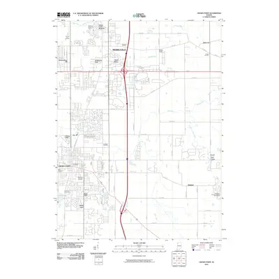
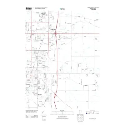
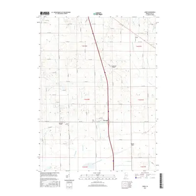
(36)- 1953 Map of Leroy, 1955 Print
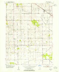 1953 Leroy1955 Print · USGSSouthern Lake County's agricultural heartland is captured here in the early 1950s as a complex system of drainage ditches reclaimed the prairie. Researchers can pinpoint long-standing landmarks including Leroy, the Riley Sch, and Plum Grove Cem.
 - 1953 Map of St. John, 1955 Print
 1953 St. John1955 Print · USGSNorthwest Indiana during the early fifties reveals a landscape where historic rail lines and the Lincoln Highway meet growing lakeside communities. Genealogists and local historians can trace family-named sites like Dutton Cem and Hack Cem, or locate mid-century landmarks such as the Illiana Race Track.
 - 1953 Map of Crown Point, 1955 Print
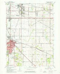
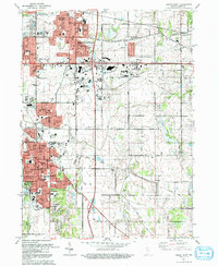
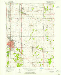 1953 Crown Point1955 Print · USGSLake County is captured in the early fifties as a landscape of established rail hubs and emerging suburbs connected by the historic Lincoln Highway. Researchers can trace local roots at the Bail School, Maplewood Cemetery, and the old County Fairground.
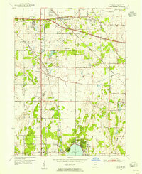
 - 1953 Map of Lowell, 1955 Print
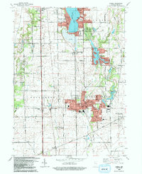
 1953 Lowell1955 Print · USGSSouthern Lake County in the early 1950s is defined by its evolving rail corridors and lakeside settlements. Genealogists can trace rural family life through locations like Sheridan School, St Edwards Cemetery, and the rail stops at North Hayden or Creston.
 - 1953 Map of Chicago, 1964 Print
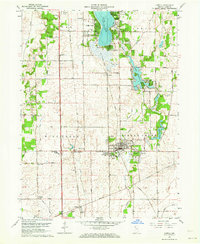
 1953 Chicago1964 Print · USGSThe southern Lake Michigan shoreline was rapidly modernizing in the mid-fifties, balancing heavy industry with its famous academic centers. Researchers can trace the footprints of Notre Dame University or locate vanished sites like the Kingsbury Ordnance Plant and Meigs Field.5 unique versions available
 - 1957 Map of Chicago
 1957 Chicago1957 Print · USGSThe industrial heartland and southern Great Lakes shoreline are captured here during the peak of mid-century growth. Researchers can trace the massive Gary Steel Works, the grounds of the University of Notre Dame, and the early paths of the Tri-State Tollway.
 - 1962 Map of Crown Point, 1964 Print
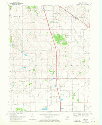
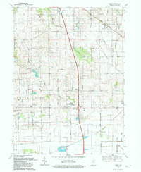
 1962 Crown Point1964 Print · USGSLake County enters a period of post-war growth as suburban subdivisions begin to fill the spaces between established rail lines and historic roads. Genealogists and local historians can trace the foundations of Merrillville, locate the Maplewood Cemetery, and find early landmarks like the Crown Point Airfield.4 unique versions available
 - 1962 Map of Lowell, 1964 Print
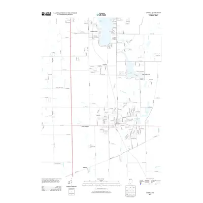
 1962 Lowell1964 Print · USGSLake County at the start of the sixties reveals a landscape shaped by agricultural townships and growing lakeside communities. Genealogists and historians can trace family roots at St Edwards School, German Cemetery, and across the transit corridor of the Monon Railroad.2 unique versions available
 - 1962 Map of St. John, 1964 Print
 1962 St. John1964 Print · USGSLake County, Indiana, is captured here in the early 1960s as suburban subdivisions began to fill the spaces between historic rail corridors and township lines. Researchers can trace local landmarks like Hoosier Boys Town, St Johns Seminary, and the Erie Lackawanna railroad.2 unique versions available
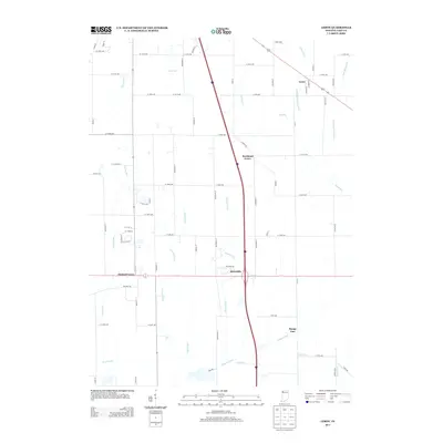
 - 1969 Map of Leroy, 1971 Print
 1969 Leroy1971 Print · USGSSouthern Lake County in the late sixties shows a landscape defined by rail lines and drainage canals. Trace rural ancestry at Plum Grove Cem or locate the old Center Sch and the community of Orchard Grove.2 unique versions available
 - 1984 Map of Kankakee, 1985 Print
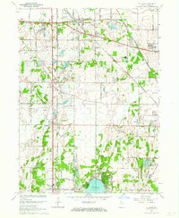
 1984 Kankakee1985 Print · USGSThe Illinois-Indiana borderlands appear here in the early eighties as a landscape of river-centered towns and vast managed wetlands. Genealogists and local historians can trace the grounds of the Kankakee State Hospital, the campus of Olivet Nazarene College, and the sprawling Beaver Lake Wildlife Refuge.
 - 1991 Map of Kankakee
 1991 Kankakee1991 Print · USGSThe Illinois-Indiana borderlands come into focus during the early nineties, centered on the growing Kankakee valley and its sprawling drainage systems. Trace the rail-and-river economy through landmarks like the Wilton Railroad Grade, the Manteno State Hospital, and the historic Old Pioneer Cem.
 - 1992 Map of Crown Point
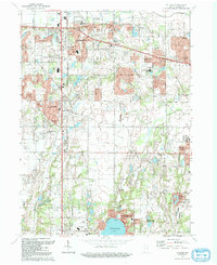
 1992 Crown Point1992 Print · USGSCrown Point and Merrillville are shown in a period of significant suburban growth during the early nineties. Researchers can locate long-standing landmarks like the Lake County Fairground, Calumet Park Cemetery, and the Southlake Speedway.
 - 1992 Map of Lowell
 1992 Lowell1992 Print · USGSSouthern Lake County is captured here in the early nineties, showing a landscape of growing lakeside communities and deep-rooted farmsteads. Genealogists can trace family landmarks and local institutions, including St Edwards Cem, the settlement of North Hayden, and the sprawling Buckley Homestead County Park.
 - 1992 Map of Leroy
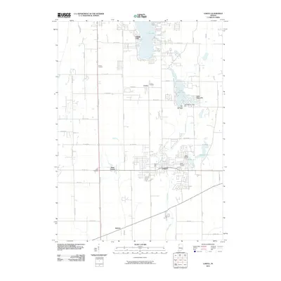
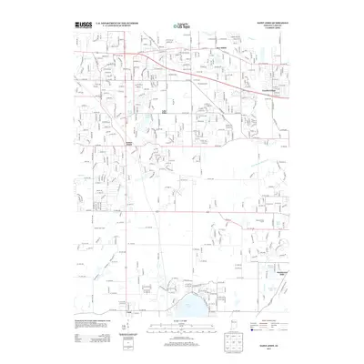
 1992 Leroy1992 Print · USGSLake County agriculture and small-town settlements are captured here in the early nineties, revealing a landscape of managed waterways and historic groves. Genealogists can locate family sites at Plum Grove Cem, the old village of Leroy, and Rangeline Ch.
 - 1992 Map of St. John
 1992 St. John1992 Print · USGSIn the early nineties, northwestern Indiana's suburban landscape was rapidly maturing between Schererville and Cedar Lake. Researchers can trace local school history at Hyles-Anderson College or locate family plots at Pleasant View Cem and Memory Lane Memorial Cem.
 - 2010 Map of Crown Point, 2010 Print
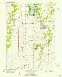
 2010 Crown Point2010 Print · USGSCovers Center Township, including Merrillville, Hobart, and other nearby areas
 - 2010 Map of Lowell, 2010 Print
 2010 Lowell2010 Print · USGSCovers Center Township, including Cedar Lake, Lowell, and other nearby areas
 - 2010 Map of Saint John, 2010 Print
 2010 Saint John2010 Print · USGSCovers Center Township, including Merrillville, Schererville, and other nearby areas
 - 2010 Map of Leroy, 2010 Print
 2010 Leroy2010 Print · USGSCovers Center Township, including Crown Point, Dinwiddie, and other nearby areas
 - 2013 Map of Crown Point, 2013 Print
 2013 Crown Point2013 Print · USGSCovers Center Township, including Merrillville, Hobart, and other nearby areas
 - 2013 Map of Leroy, 2013 Print
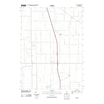
 2013 Leroy2013 Print · USGSCovers Center Township, including Crown Point, Dinwiddie, and other nearby areas
 - 2013 Map of Saint John, 2013 Print
 2013 Saint John2013 Print · USGSCovers Center Township, including Merrillville, Schererville, and other nearby areas
 - 2013 Map of Lowell, 2013 Print
 2013 Lowell2013 Print · USGSCovers Center Township, including Cedar Lake, Lowell, and other nearby areas
 - 2016 Map of Leroy, 2016 Print
 2016 Leroy2016 Print · USGSCovers Center Township, including Crown Point, Dinwiddie, and other nearby areas
Showing maps 1-25 of 36
Top cities near Center Township
- Hammond historical maps
- Gary historical maps
- Portage historical maps
- Calumet City historical maps
- Merrillville historical maps
- Lansing historical maps
See more
Top neighborhoods of Center Township
Frequently asked questions
- What are the different types of historical maps available for Center Township?
- What is the oldest map of Center Township?
- Where can I purchase historical maps of Center Township for my home or office?
- Where can I download high-res historical maps of Center Township?
- Are there historical topographic maps available for Center Township?
- Is there historical aerial imagery available for Center Township?
- Where are historical maps of Center Township sourced from?