Old Maps of Near Eastside, Indianapolis for Academic Research
Study the evolution of Near Eastside with 23 high-resolution historic maps. Whether you're teaching, researching, or modeling changes in land use, these maps provide essential visual documentation of urban, environmental, and geographic change.
- Analyze long-term change: Track patterns in development, transportation, and natural features.
- Ideal for environmental or urban studies: Support academic projects with primary historical map data.
- Use in the classroom or lab: Educators and researchers rely on these maps to bring historical context to life.
These maps are a powerful tool for teaching, research, and visualizing how Near Eastside has changed over the decades.
Near Eastside, Indianapolis maps
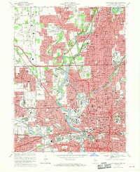
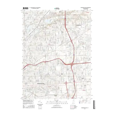
(23)- 1948 Map of Indianapolis East
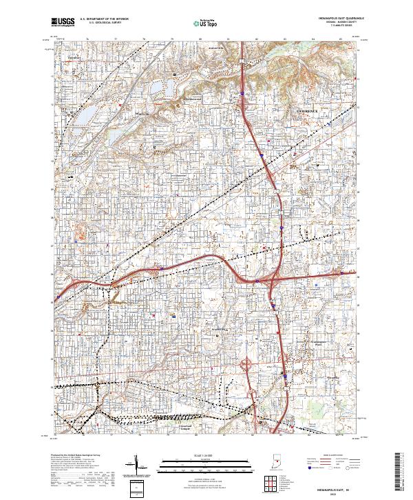
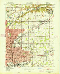 1948 Indianapolis East1948 Print · USGSNortheast Marion County is documented here during the post-war industrial boom, showing the expansion of Indianapolis toward Lawrence. Researchers can locate vanished landmarks like Brightwood Airport, the Naval Ordnance Plant, and numerous local sites like Browning Sch.2 unique versions available
 - 1948 Map of Indianapolis West
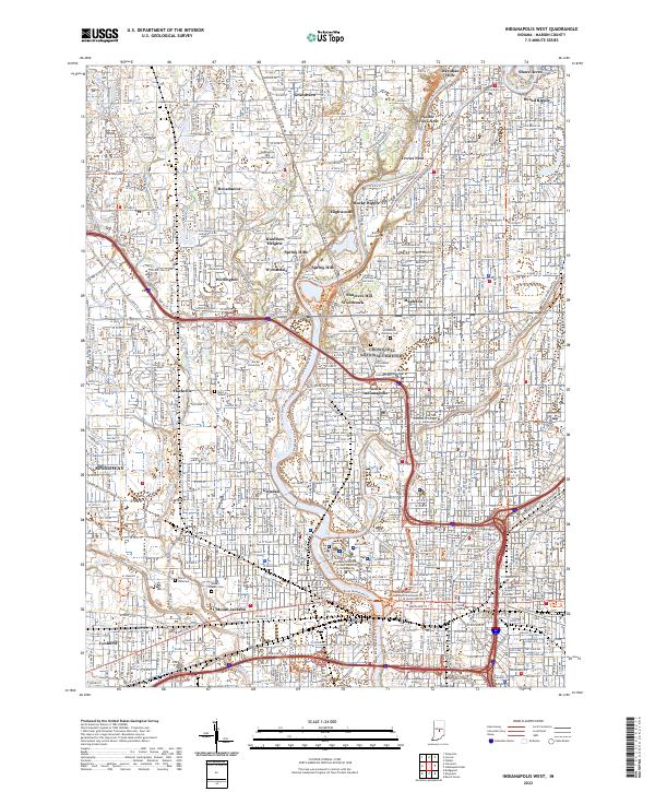
 1948 Indianapolis West1948 Print · USGSIndianapolis and its western suburbs thrive in the late 1940s, revealing a landscape of bustling industry, grand civic centers, and emerging neighborhoods. Trace the early footprints of the Indianapolis Motor Speedway, the historic Crown Hill Cemetery, and the busy Hoosier Airport.2 unique versions available
 - 1953 Map of Indianapolis, 1965 Print
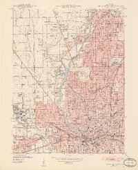
 1953 Indianapolis1965 Print · USGSCentral Indiana and the Illinois borderlands are captured in the mid-sixties, showing the growth of Indianapolis and its industrial rail corridors. Genealogists and historians can trace the development of outlying towns like Zionsville or Beech Grove and find landmarks such as Atterbury AAF and Turkey Run State Park.4 unique versions available
 - 1956 Map of Indianapolis
 1956 Indianapolis1956 Print · USGSCentral Indiana in the mid-fifties is captured during a period of industrial growth and military presence. Genealogists and historians can trace the rail networks of the New York Central or locate regional landmarks like Fort Benjamin Harrison and Camp Atterbury.
 - 1957 Map of Indianapolis
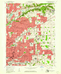
 1957 Indianapolis1957 Print · USGSCentral Indiana in the mid-fifties is captured here as a crossroads of major rail lines and nascent federal highways. Genealogists and historians can trace family-named ridges like Poplar Ridge or locate strategic sites like Camp Atterbury and Speedway.2 unique versions available
 - 1959 Map of Indianapolis West, 1961 Print
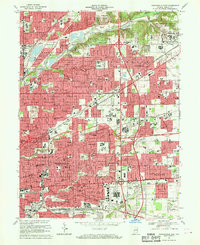
 1959 Indianapolis West1961 Print · USGSMid-century Indianapolis is captured here as suburban growth begins to surround the legendary Indianapolis Motor Speedway. Researchers can trace established neighborhoods like Broad Ripple, locate family plots in Crown Hill Cemetery, or find long-standing institutions such as Butler University.
 - 1959 Map of Indianapolis East, 1961 Print
 1959 Indianapolis East1961 Print · USGSThe eastern suburbs of Indianapolis were rapidly expanding in the late fifties as residential neighborhoods grew around established military and industrial hubs. Researchers can trace local heritage through numerous parochial sites like Holy Spirit Sch & Ch and major landmarks including the Fort Benjamin Harrison Military Reservation.
 - 1962 Map of Indianapolis
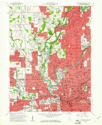
 1962 Indianapolis1962 Print · USGSCentral Indiana and the Illinois borderlands are captured here in the early sixties, showing the region's dense rail networks and growing urban centers. Genealogists and historians can locate family-named landmarks and institutions like Crown Hill Cem, Indiana University, and the Indianapolis Motor Speedway.
 - 1967 Map of Indianapolis West, 1969 Print
 1967 Indianapolis West1969 Print · USGSMid-century Indianapolis comes alive in this survey of the city's west side and the growing western townships. Researchers can trace historic institutions and neighborhoods like Rocky Ripple and Broadmoor, or locate family sites at CROWN HILL CEMETERY and Floral Park Cem.5 unique versions available
 - 1967 Map of Indianapolis East, 1970 Print
 1967 Indianapolis East1970 Print · USGSMarion County's eastern neighborhoods and military grounds are captured here in the late sixties as suburban development expands toward the Lawrence area. Researchers can trace local genealogy through numerous institutions like Scecina High Sch or find industrial roots at the Hawthorne Yards.3 unique versions available
 - 1986 Map of Indianapolis
 1986 Indianapolis1986 Print · USGSThe Indiana capital and its surrounding counties are captured here in the mid-1980s, showcasing the height of its orbital highway development and suburban growth. Researchers can trace the legacy of the Fort Benjamin Harrison Military Reservation, follow the Conrail lines, or locate family roots in Beech Grove, Greencastle, and Zionsville.2 unique versions available
 - 1998 Map of Indianapolis East, 2001 Print
 1998 Indianapolis East2001 Print · USGSMarion County’s eastern suburbs and urban neighborhoods are captured here in the late nineties as a fully realized landscape of industry and community. Researchers can locate dozens of parish schools and historic burial grounds like Fall Creek Cemetery or trace the sprawling U S Naval Reservation.
 - 1998 Map of Indianapolis West, 2002 Print
 1998 Indianapolis West2002 Print · USGSIndianapolis and the town of Speedway are shown at a peak of late-century development, where the river meets the rail lines of CONRAIL. Trace historic school sites like Attucks High Sch and the expansive grounds of Crown Hill Cemetery.
 - 2010 Map of Indianapolis East, 2010 Print
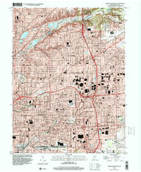
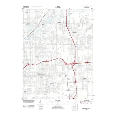 2010 Indianapolis East2010 Print · USGSCovers Near Eastside, including Indianapolis, Lawrence, and other nearby areas
 - 2010 Map of Indianapolis West, 2010 Print
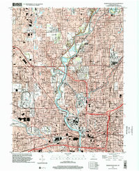
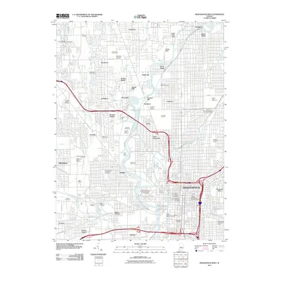 2010 Indianapolis West2010 Print · USGSCovers Near Eastside, including Indianapolis, Speedway, and other nearby areas
 - 2013 Map of Indianapolis East, 2013 Print
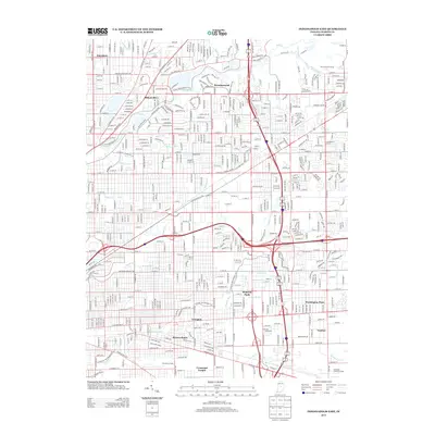 2013 Indianapolis East2013 Print · USGSCovers Near Eastside, including Indianapolis, Lawrence, and other nearby areas
 - 2013 Map of Indianapolis West, 2013 Print
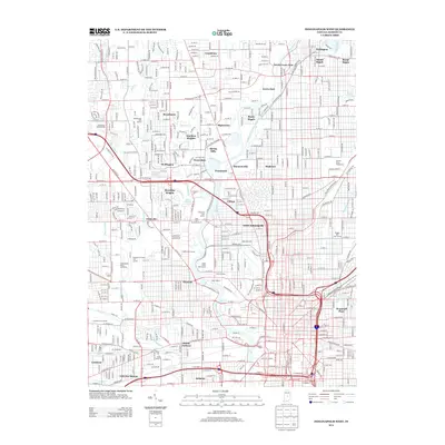 2013 Indianapolis West2013 Print · USGSCovers Near Eastside, including Indianapolis, Speedway, and other nearby areas
 - 2016 Map of Indianapolis East, 2016 Print
 2016 Indianapolis East2016 Print · USGSCovers Near Eastside, including Indianapolis, Lawrence, and other nearby areas
 - 2016 Map of Indianapolis West, 2016 Print
 2016 Indianapolis West2016 Print · USGSCovers Near Eastside, including Indianapolis, Speedway, and other nearby areas
 - 2019 Map of Indianapolis West, 2019 Print
 2019 Indianapolis West2019 Print · USGSCovers Near Eastside, including Indianapolis, Speedway, and other nearby areas
 - 2019 Map of Indianapolis East, 2019 Print
 2019 Indianapolis East2019 Print · USGSCovers Near Eastside, including Indianapolis, Lawrence, and other nearby areas
 - 2022 Map of Indianapolis West, 2022 Print
 2022 Indianapolis West2022 Print · USGSWestern Indianapolis at the start of the 2020s shows a landscape where historic canal infrastructure and riverbanks meet modern academic and civic centers. Genealogists and historians can trace the borders of Crown Hill National Cem or locate the Grave of President Harrison and Floral Park Cem.
 - 2022 Map of Indianapolis East, 2022 Print
 2022 Indianapolis East2022 Print · USGSMarion County's eastern suburbs and historic communities appear here in the early twenty-first century, showing the dense intersection of transit and local life. Trace family roots and local landmarks from Memorial Park Cem to Martin University and Brendonwood.
End of results
Showing maps 1-23 of 23
Top cities near Near Eastside
- Indianapolis historical maps
- Carmel historical maps
- Fishers historical maps
- Noblesville historical maps
- Greenwood historical maps
- Westfield historical maps
See more
Top neighborhoods of Near Eastside
- Rivoli Park historical maps
- Emerson Heights historical maps
- Englewood historical maps
- Grace Tuxedo Park historical maps
- North Brookside historical maps
- Otterbein historical maps
See more
Frequently asked questions
- What are the different types of historical maps available for Near Eastside?
- What is the oldest map of Near Eastside?
- Where can I purchase historical maps of Near Eastside for my home or office?
- Where can I download high-res historical maps of Near Eastside?
- Are there historical topographic maps available for Near Eastside?
- Is there historical aerial imagery available for Near Eastside?
- Where are historical maps of Near Eastside sourced from?