Old Maps of Martin County, Indiana for Hiking & Exploration
Hike through history with 106 historic maps of Martin County. Explore old trails, ghost towns, and forgotten backroads — perfect for outdoor adventurers and local explorers.
- Rediscover forgotten places: Map out old mining camps, roads, and footpaths that no longer exist on modern maps.
- Layer with modern tools: Combine with LiDAR or satellite views to plan hikes through historical terrain.
- Made for exploration: Popular among hikers, overlanders, and local history lovers.
Use these maps to find adventure and explore the hidden past of Martin County.
Martin County, IN maps
(106)- 1935 Map of Oolitic
 1935 Oolitic1935 Print · USGSLawrence and Greene Counties are captured in the mid-1930s during a period of heavy limestone production and rural transition. Local historians can trace family roots through numerous country landmarks like Popcorn Church, Williams Bridge, and the Dark Hollow stone works.6 unique versions available
 - 1942 Map of Oolitic
 1942 Oolitic1942 Print · USGSLawrence County limestone country is seen here in the mid-1930s, documenting the early stone industry and rail networks. Genealogists can trace family landmarks like Popcorn Cem, Bethel Ch, and industrial sites such as Patton Hill Quarry.2 unique versions available
 - 1946 Map of Jasper
 1946 Jasper1946 Print · USGSMid-century Dubois County comes alive in this survey of the Jasper area during the years following the war. Genealogists can locate family landmarks like Sherritt Cem, old rural schoolhouses such as Hope Sch, and the rail-side industry of the Southern line.2 unique versions available
 - 1948 Map of Huron, 1960 Print
 1948 Huron1960 Print · USGSMartin County in the late 1940s is characterized by its deep forest tracts and the busy rail line through the village of Huron. Researchers can trace early rural life through surviving landmarks like Scarlet Chapel, Wiesbach Sch, and the Baltimore and Ohio railroad.
 - 1950 Map of Huron
 1950 Huron1950 Print · USGSSouthern Indiana's timbered hills and rail corridors are captured here in the mid-twentieth century. Genealogists and hikers can trace the Baltimore and Ohio line past Willow Tunnel or find the remote Acre Cem and Wiesbach Sch.
 - 1950 Map of Shoals
 1950 Shoals1950 Print · USGSMartin County’s river-carved landscape is captured here in the mid-twentieth century, centered on the horseshoe bend of the East Fork White River. Genealogists can trace family footprints at Mt Union Ch, Poplar Grove Ch, and schools like Hickory Ridge Sch or Red Sch.2 unique versions available
 - 1950 Map of Odon, 1953 Print
 1950 Odon1953 Print · USGSDaviess and Martin counties are captured here in the early fifties, showing a region of quiet agricultural towns and developing industry. Researchers can find many family landmarks, including Walnut Hill Cem, Union Chapel, and the settlement of Raglesville.2 unique versions available
 - 1951 Map of Hillham
 1951 Hillham1951 Print · USGSSouthern Indiana hills and the winding course of the Lost River define this rural landscape during the early fifties. Genealogists and local historians can locate remote family plots like Wininger Cem and Hawkins Cem alongside the tracks of the Southern railroad.
 - 1956 Map of Alfordsville, 1957 Print
 1956 Alfordsville1957 Print · USGSDaviess and Dubois counties come alive in the mid-1950s as a landscape of surface mines and river-bottom settlements. Genealogists and historians can trace family locations near Alfordsville, Truelove Ch, and the old river crossing at Portersville.2 unique versions available
 - 1956 Map of Loogootee, 1957 Print
 1956 Loogootee1957 Print · USGSLoogootee and Cannelburg sit at the heart of this mid-fifties survey of the Daviess and Martin County border. Researchers can trace ancestral roots at St Johns Cemetery, locate the rail-side industry of a Strip Mine, or follow the banks of the East Fork White River.2 unique versions available
 - 1956 Map of Rusk, 1958 Print
 1956 Rusk1958 Print · USGSSouthern Indiana's hill country is captured here in the mid-1950s, documenting the rural landscape within the Hoosier National Forest. Trace family roots and local landmarks through the records of South Martin Church, Hindustan Falls, and old cemeteries like Holtsclaw Cemetery.
 - 1956 Map of Koleen, 1959 Print
 1956 Koleen1959 Print · USGSGreene County in the mid-fifties is characterized here by the contrast between rural ridge settlements and the massive Crane Naval Ammunition Depot. Researchers can trace family history through numerous landmarks like Clifty Chapel, Howell Cem, and the small community of Koleen.
 - 1956 Map of Indian Springs, 1959 Print
 1956 Indian Springs1959 Print · USGSThe Martin County countryside in the mid-1950s is defined by the intersection of military expansion and rural tradition. Genealogists can trace family roots through several local sites including Trinity Springs, Blankenship Cem, and Little Hickory Ridge.2 unique versions available
 - 1956 Map of Vincennes, 1967 Print
 1956 Vincennes1967 Print · USGSSouthern Indiana and the Illinois borderlands are captured here in the mid-fifties, showing the region's dense network of river towns and rail lines. Researchers can trace historic river crossings along the Wabash River or locate landmarks like Wyandotte Cave and Lincoln State Park.4 unique versions available
 - 1957 Map of Vincennes
 1957 Vincennes1957 Print · USGSSouthwest Indiana and the Illinois borderlands come alive in the late 1950s, a period of heavy rail traffic and expanding state forests. Genealogists and historians can trace the riverfronts and rail lines of Vincennes, New Harmony, and the vast Crane Naval Ammunition Depot.
 - 1957 Map of Williams, 1958 Print
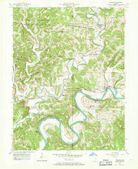 1957 Williams1958 Print · USGSThe East Fork White River winds through Lawrence County in the mid-1950s, a landscape defined by timbered ridges and rural rail lines. Trace family roots at Silverville or locate landmarks like Williams Bridge and the Mountain Spring Cem.2 unique versions available
 - 1957 Map of Owensburg, 1958 Print
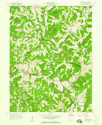 1957 Owensburg1958 Print · USGSSouthern Indiana's rural landscape is captured here in the late fifties, where the hill country of Greene County meets major federal installations. Researchers can locate family cemeteries like Lowder Cem, rural landmarks such as Bridge Ch, and the northern edge of the U S Naval Reservation Crane Ammunition Depot.2 unique versions available
 - 1957 Map of Scotland, 1958 Print
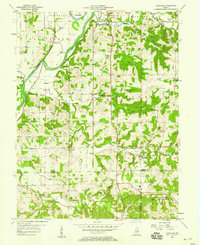 1957 Scotland1958 Print · USGSGreene County townships meet the northern edge of a major naval installation in the late fifties. Genealogists can trace family roots through numerous landmarks like Simpson Chapel, Hicks Cem, and the old settlement of Mineral City.2 unique versions available
 - 1958 Map of Vincennes
 1958 Vincennes1958 Print · USGSSouthern Indiana and the Illinois borderlands are captured during a mid-century period of heavy rail traffic and military activity. Researchers can trace the sprawling bounds of the Crane Naval Ammunition Depot or locate historic settlements like New Harmony and French Lick.2 unique versions available
 - 1960 Map of Shoals
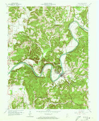 1960 Shoals1960 Print · USGSIn the early 1960s, the East Fork White River dominated this Martin County landscape, winding past the rail hub of Shoals. Genealogists and historians can locate rural landmarks such as Hindostan, the Ship Mine, and country congregations like Poplar Grove Ch.3 unique versions available
 - 1960 Map of Jasper, 1961 Print
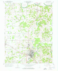 1960 Jasper1961 Print · USGSDubois County centered on Jasper shows a landscape of river-bend settlements and expanding rail infrastructure in the early sixties. Genealogists can locate family landmarks like Shiloh Ch and numerous rural plots including Alexander Cem and Wilhoit Cem.4 unique versions available
 - 1965 Map of Hillham, 1966 Print
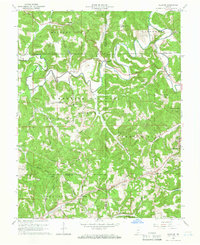 1965 Hillham1966 Print · USGSSouthern Indiana's ridges and valleys are meticulously detailed in the mid-1960s as the Hoosier National Forest surrounds the Lost River. Genealogists and local historians can locate remote family sites like Anderson Cem and Hawkins Cem or trace the path of the Southern railroad through the Burton Tunnel.2 unique versions available
 - 1965 Map of Huron, 1966 Print
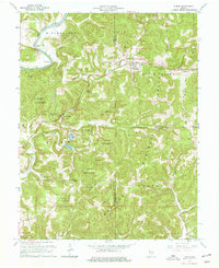 1965 Huron1966 Print · USGSThe hill country of Martin and Lawrence Counties is captured here in the mid-1960s, showing the intersection of heavy rail and deep timberlands. You can trace early family roots through Huron Cem and Baxter Cem or locate the engineering of the Willow Tunnel.3 unique versions available
 - 1974 Map of Odon, 1976 Print
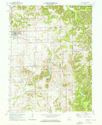 1974 Odon1976 Print · USGSDaviess and Martin counties are captured here in the mid-seventies, showing a rural landscape defined by small farming hamlets and the Chicago Milwaukee St Paul and Pacific line. Researchers can trace family roots through several country sites like Walnut Hill Cem, Shiloh Ch, and the settlement of Raglesville.2 unique versions available
 - 1974 Map of Loogootee, 1976 Print
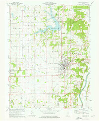 1974 Loogootee1976 Print · USGSLoogootee and the surrounding Indiana countryside are captured here in the mid-seventies as recreation and industry balanced against traditional farming life. Genealogists can locate family sites at St Johns Cemetery or Houghton Cem while tracing the Baltimore and Ohio rail line.2 unique versions available
Showing maps 1-25 of 106
Top cities of Martin County
Frequently asked questions
- What are the different types of historical maps available for Martin County?
- What is the oldest map of Martin County?
- Where can I purchase historical maps of Martin County for my home or office?
- Where can I download high-res historical maps of Martin County?
- Are there historical topographic maps available for Martin County?
- Is there historical aerial imagery available for Martin County?
- Where are historical maps of Martin County sourced from?