1900s (20th Century) Maps of Monroe County, Indiana
Explore 62 historic maps of Monroe County from the 1900s (20th Century). These maps offer a rare glimpse into what life looked like during the 1900s — showing old roads, neighborhoods, homes, and landmarks that have changed or disappeared over time.
Whether you're researching your family's past, planning a metal detecting trip, or studying how Monroe County's landscape evolved across the 1900s, these high-resolution maps are a powerful tool for exploring the history of this region.
- Focus on a specific era: All maps on this page are from the 1900s, giving you a focused view of this time period.
- See what’s changed: Compare century-old streets, trails, and buildings to today's modern landscape using overlays and satellite layers.
- Research with precision: Use these maps for genealogy, historical research, land use analysis, or educational projects.
- View, download, or print: Maps are fully viewable online in high resolution, and can be downloaded or printed for your own records.
Start exploring Monroe County's history through authentic maps from the 1900s. This is your window into the past.
Monroe County, IN maps
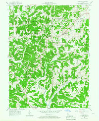
(62)- 1908 Map of Bloomington
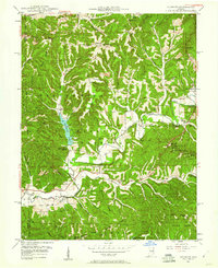
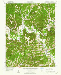
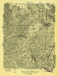 1908 Bloomington1908 Print · USGSMonroe and Greene Counties appear at the height of their early rail-and-quarry era during the first decade of the 1900s. Genealogists can locate family landmarks among dozens of rural schoolhouses like Parks School and old parish sites like Mt Ebal Church.2 unique versions available
 - 1910 Map of Bloomington
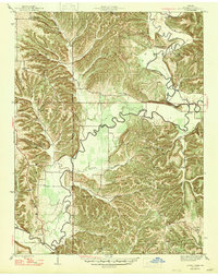
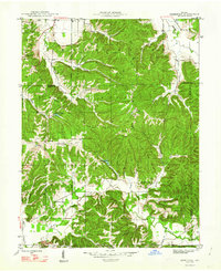
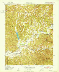
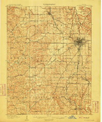 1910 Bloomington1910 Print · USGSMonroe County at the peak of its quarrying era reveals a landscape shaped by education, industry, and rail. Genealogists can trace family roots through Indiana University, Sanders PO, and the Greene County Chapel.6 unique versions available
 - 1934 Map of Bedford
 1934 Bedford1934 Print · USGSLawrence County's limestone district and the winding White River valley are detailed here during the mid-1930s. Genealogists and researchers can trace local families through many rural landmarks, including Sherril Cem, Leesville, and the Peerless Quarry.2 unique versions available
 - 1935 Map of Oolitic
 1935 Oolitic1935 Print · USGSLawrence and Greene Counties are captured in the mid-1930s during a period of heavy limestone production and rural transition. Local historians can trace family roots through numerous country landmarks like Popcorn Church, Williams Bridge, and the Dark Hollow stone works.6 unique versions available
 - 1937 Map of Bedford
 1937 Bedford1937 Print · USGSLawrence County limestone country is seen here in the late 1930s, defined by its massive quarries and river-valley railroads. Genealogists can trace family landmarks and rural life at the County Farm, Leesville, and the United Brethren Ch.2 unique versions available
 - 1942 Map of Franklin
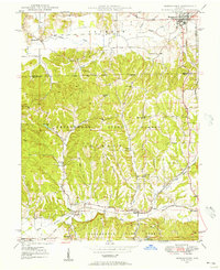
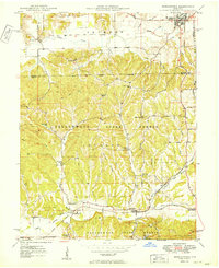
 1942 Franklin1942 Print · USGSCentral Indiana during the early years of the war shows a landscape of established rail towns and growing military installations. Genealogists can trace family names across small settlements like Nineveh, Bean Blossom, and Helmsburg, or locate the Indiana University Observatory.
 - 1942 Map of Oolitic
 1942 Oolitic1942 Print · USGSLawrence County limestone country is seen here in the mid-1930s, documenting the early stone industry and rail networks. Genealogists can trace family landmarks like Popcorn Cem, Bethel Ch, and industrial sites such as Patton Hill Quarry.2 unique versions available
 - 1946 Map of Belmont, 1960 Print
 1946 Belmont1960 Print · USGSMid-century Brown County is captured here at a time when remote ridge-top cemeteries and rural schoolhouses still defined the local geography. Genealogists can locate family sites like Brummet Cem, the T C Steele Memorial, and the West Toll House.2 unique versions available
 - 1947 Map of Allens Creek
 1947 Allens Creek1947 Print · USGSSoutheastern Monroe County is shown here in the late 1940s, before the landscape was transformed by water management projects. Researchers can trace rural life through numerous country schools and churches, including Allens Creek Sch, Blackwell Ch, and the settlement at Fairfax.3 unique versions available
 - 1947 Map of Unionville
 1947 Unionville1947 Print · USGSMonroe County was a landscape of high ridges and rural valley settlements during the late 1940s. Genealogists and local historians can trace family locations near the Illinois Central rail line and sites like Radientown, Fleener Sch, and Friendship Ch.2 unique versions available
 - 1947 Map of Gosport, 1958 Print
 1947 Gosport1958 Print · USGSMid-century Owen and Monroe counties are seen here through their winding river valleys and small railroad towns. Researchers can trace the heritage of rural congregations and family lands near Stinesville, Shiloh Ch, and the Chambersville Cem.
 - 1947 Map of Elkinsville, 1961 Print
 1947 Elkinsville1961 Print · USGSBrown County and Monroe County are captured just after the war, showing the rural way of life along the forks of Salt Creek. Researchers can trace the layout of Elkinsville and Maumee, locating old landmarks like Chambers Bridge and Bethel Ch.
 - 1948 Map of Hindustan
 1948 Hindustan1948 Print · USGSThe Morgan and Monroe county borders were a landscape of deep hollows and high ridges during the late nineteen-forties. Genealogists and hikers can trace old forest homesteads and landmarks like Stepp Cem, Honey Creek Sch, and the Hindustan settlement.3 unique versions available
 - 1948 Map of Morgantown, 1956 Print
 1948 Morgantown1956 Print · USGSThe Morgan and Brown County borderlands come to life in the late 1940s, showing the ridge-and-hollow terrain south of Morgantown. Researchers can trace the Illinois Central railroad through Helmsburg or locate rural landmarks like Mt Zion Ch and Bear Creek Cem.
 - 1950 Map of Gosport
 1950 Gosport1950 Print · USGSMid-century Owen and Monroe Counties center on the winding river valley as the regional rail network and park system flourished. Researchers can trace rural lineages through sites like Old Dutch Ch, Stinesville, and the Chambersville Cem.
 - 1950 Map of Belmont
 1950 Belmont1950 Print · USGSThe Brown County hill country in 1950 shows a landscape of ridge-top roads and secluded valley settlements. Genealogists can trace family names at the T C Steele Memorial, Duncan Ch, and Brummet Cem among the deep hollows.
 - 1950 Map of Morgantown
 1950 Morgantown1950 Print · USGSMid-century Morgan and Brown Counties are shown here at a time when the Illinois Central railroad still linked small rural timber and farming hamlets. Trace family roots and vanished landmarks near Helmsburg, Needmore, and the Bear Creek Cem.2 unique versions available
 - 1950 Map of Elkinsville
 1950 Elkinsville1950 Print · USGSBrown County's rugged ridge-and-hollow terrain is captured here at mid-century, just as the local forest preserves were maturing. Genealogists and hikers can trace old family sites like Elkinsville Cem, Maumee Sch, and the Hickory Ridge Lookout Tower.
 - 1953 Map of Indianapolis, 1965 Print
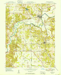
 1953 Indianapolis1965 Print · USGSCentral Indiana and the Illinois borderlands are captured in the mid-sixties, showing the growth of Indianapolis and its industrial rail corridors. Genealogists and historians can trace the development of outlying towns like Zionsville or Beech Grove and find landmarks such as Atterbury AAF and Turkey Run State Park.4 unique versions available
 - 1956 Map of Indianapolis
 1956 Indianapolis1956 Print · USGSCentral Indiana in the mid-fifties is captured during a period of industrial growth and military presence. Genealogists and historians can trace the rail networks of the New York Central or locate regional landmarks like Fort Benjamin Harrison and Camp Atterbury.
 - 1956 Map of Clear Creek, 1957 Print
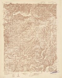
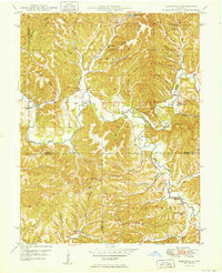
 1956 Clear Creek1957 Print · USGSMonroe County during the mid-fifties reveals a landscape transitioning between its deep-rooted limestone industry and post-war development. Genealogists and historians can trace the foundations of Harrodsburg and Smithville while locating family sites like Ketcham Cem and Walkers Chapel.
 - 1956 Map of Bloomington, 1958 Print
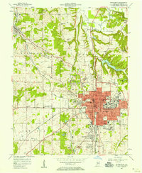 1956 Bloomington1958 Print · USGSBloomington and its limestone quarries are captured here in the mid-fifties during a period of steady post-war expansion. Local researchers can trace family names at Rose Hill Cemetery, locate old rail spurs of the Monon, or find rural landmarks like Stewart Tabernacle and Joint Sch.
 - 1956 Map of Stanford, 1958 Print
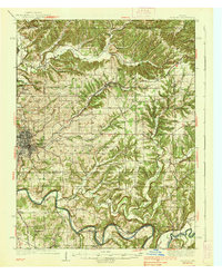
 1956 Stanford1958 Print · USGSMid-century Monroe County comes to life in this survey of the wooded ridges and railroad valleys west of Bloomington. Genealogists and historians can trace family locations near Stanford, Hobbieville, and the Sanbourn Sch or locate the historic Harmony Ch.3 unique versions available
 - 1956 Map of Vincennes, 1967 Print
 1956 Vincennes1967 Print · USGSSouthern Indiana and the Illinois borderlands are captured here in the mid-fifties, showing the region's dense network of river towns and rail lines. Researchers can trace historic river crossings along the Wabash River or locate landmarks like Wyandotte Cave and Lincoln State Park.4 unique versions available
 - 1957 Map of Indianapolis
 1957 Indianapolis1957 Print · USGSCentral Indiana in the mid-fifties is captured here as a crossroads of major rail lines and nascent federal highways. Genealogists and historians can trace family-named ridges like Poplar Ridge or locate strategic sites like Camp Atterbury and Speedway.2 unique versions available
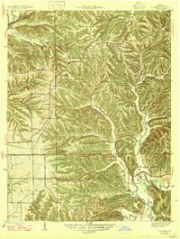
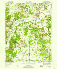
Showing maps 1-25 of 62
Top cities of Monroe County
- Bloomington historical maps
- Ellettsville historical maps
- Clear Creek historical maps
- Stinesville historical maps
Frequently asked questions
- What are the different types of historical maps available for Monroe County?
- What is the oldest map of Monroe County?
- Where can I purchase historical maps of Monroe County for my home or office?
- Where can I download high-res historical maps of Monroe County?
- Are there historical topographic maps available for Monroe County?
- Is there historical aerial imagery available for Monroe County?
- Where are historical maps of Monroe County sourced from?