2020s Maps of Monroe County, Indiana
Explore 16 historic maps of Monroe County from the 2020s. These maps offer a rare glimpse into what life looked like during the 2020s — showing old roads, neighborhoods, homes, and landmarks that have changed or disappeared over time.
Whether you're researching your family's past, planning a metal detecting trip, or studying how Monroe County's landscape evolved across the 2020s, these high-resolution maps are a powerful tool for exploring the history of this region.
- Focus on a specific era: All maps on this page are from the 2020s, giving you a focused view of this time period.
- See what’s changed: Compare century-old streets, trails, and buildings to today's modern landscape using overlays and satellite layers.
- Research with precision: Use these maps for genealogy, historical research, land use analysis, or educational projects.
- View, download, or print: Maps are fully viewable online in high resolution, and can be downloaded or printed for your own records.
Start exploring Monroe County's history through authentic maps from the 2020s. This is your window into the past.
Monroe County, IN maps
(16)- 2022 Map of Stanford, 2022 Print
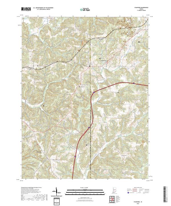 2022 Stanford2022 Print · USGSThe rural boundary of Greene and Monroe Counties comes into sharp focus in this contemporary survey of the Indiana uplands. Genealogists and local historians can trace the positions of several historic burial sites, including Burch Cem, Keller Cem, and Harmony Cem.
 - 2022 Map of Owensburg, 2022 Print
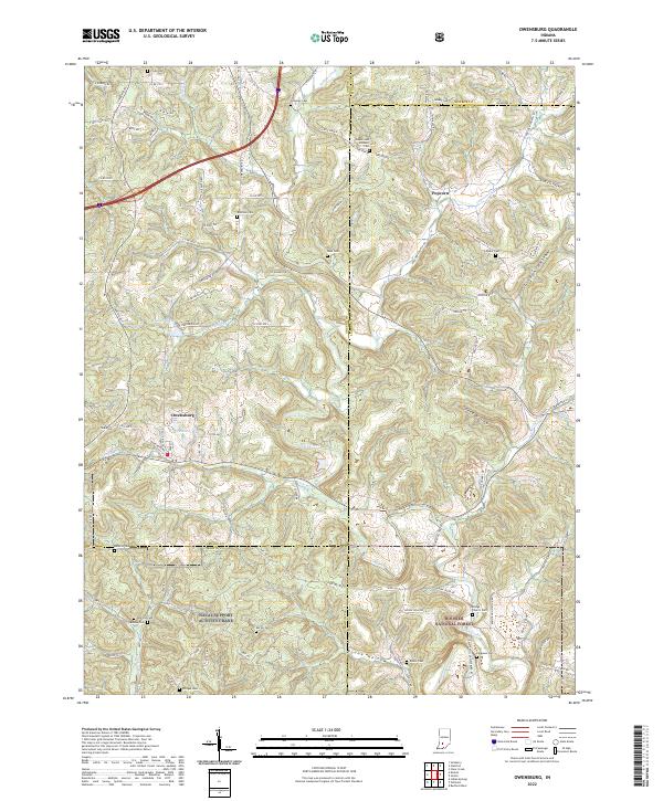 2022 Owensburg2022 Print · USGSThe rolling hills of Greene County and the Hoosier National Forest are captured here in the early 2020s. Genealogists can trace family names across more than a dozen local sites like Beyers and Rainbolt Cem, Dishman Cem, and Bridge Church Cem.
 - 2022 Map of Morgantown, 2022 Print
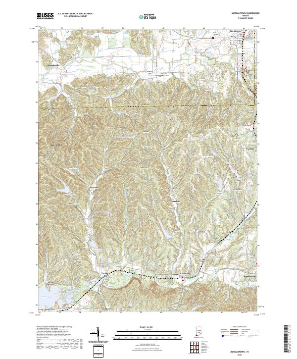 2022 Morgantown2022 Print · USGSSouthern Indiana ridge country comes alive in the early 2020s, showing the intricate landscape where Morgan and Brown counties meet. Researchers can trace historic family landmarks and rural settlements like Beanblossom, Trevlac, and the Boles - Williams Cem.
 - 2022 Map of Whitehall, 2022 Print
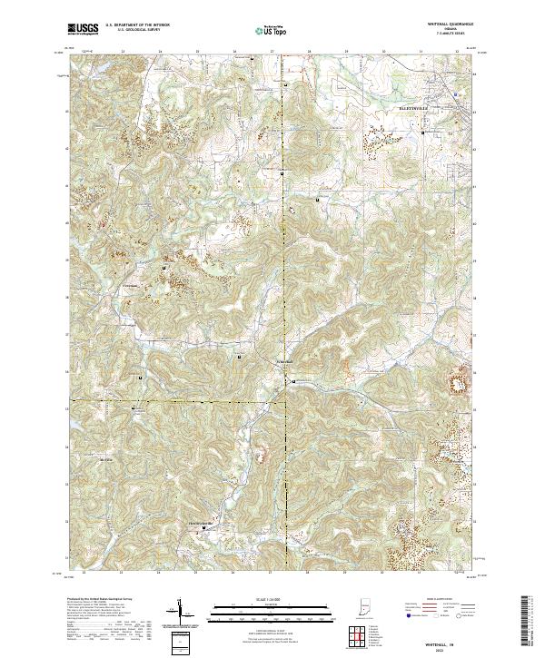 2022 Whitehall2022 Print · USGSSouthern Indiana's rolling landscape is shown in detail during the early 2020s, highlighting the enduring rural character of the Monroe and Owen county lines. Family history researchers can trace locations like Methodist Cem, Hendricksville, and the isolated Livingston Cem.
 - 2022 Map of Unionville, 2022 Print
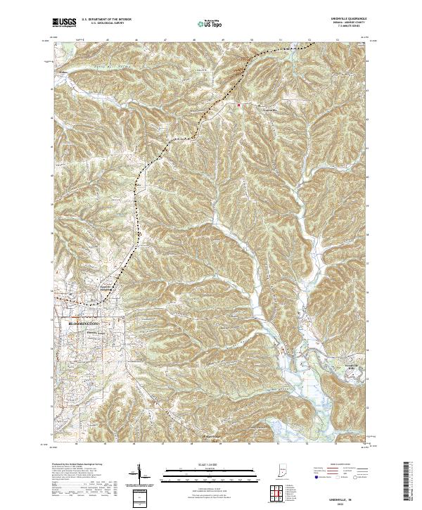 2022 Unionville2022 Print · USGSMonroe County, Indiana, at the start of the 2020s shows the suburban edges of university life transitioning into the ridges of the Hoosier State. Researchers can trace local landmarks like Devils Backbone, the community of Unionville, and the waters of Lake Lemon.
 - 2022 Map of Modesto, 2022 Print
 2022 Modesto2022 Print · USGSMonroe and Morgan Counties are captured here in the early twenty-first century, showing the rural character of the land north of Bloomington. Genealogists and historians can trace family land near Sodom Cem, Modesto, and the banks of Beanblossom Creek.
 - 2022 Map of Bartlettsville, 2022 Print
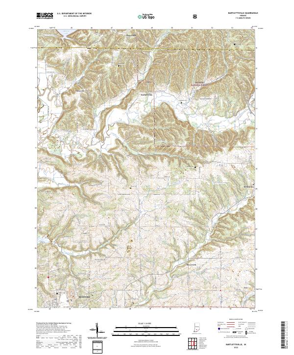 2022 Bartlettsville2022 Print · USGSLawrence County's rural communities and wooded ridges appear in high detail during the early 2020s. Genealogists and local historians can locate many family cemeteries like Bailey Cem and Breckenridge Cem, or trace the path of Little Salt Creek through Bartlettsville.
 - 2022 Map of Oolitic, 2022 Print
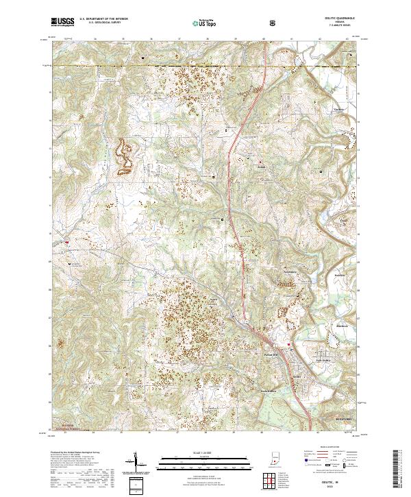 2022 Oolitic2022 Print · USGSLawrence County settlement patterns are on full display in this modern survey of the limestone country north of Bedford. Family historians can trace local roots across a dense network of landmarks including Springville Christian Cem, Mount Zion Cem, and the village of Needmore.
 - 2022 Map of Gosport, 2022 Print
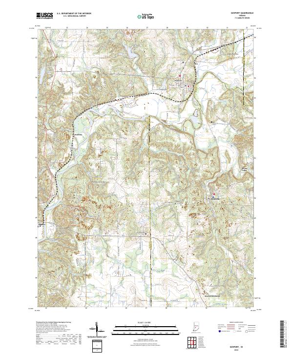 2022 Gosport2022 Print · USGSThe Owen and Monroe County line comes alive in the early 2020s, centered on the river-and-rail corridor of Gosport and Romona. Genealogists and hikers can trace the Indiana Rail Road or locate the Wolf Natural Bridges and Van Buskirk Cem.
 - 2022 Map of Norman, 2022 Print
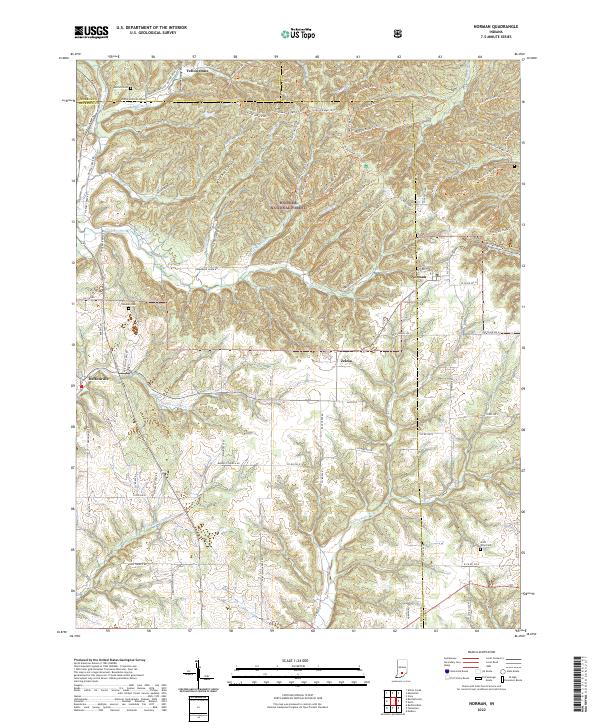 2022 Norman2022 Print · USGSLawrence and Jackson Counties are shown here during the early 2020s, featuring the deeply dissected ridges of the Hoosier National Forest. Family historians can locate several rural burial grounds such as Mitchell Cemetery and Faubion Cemetery near the communities of Norman and Zelma.
 - 2022 Map of Hindustan, 2022 Print
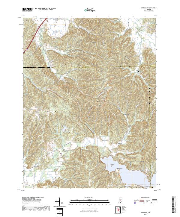 2022 Hindustan2022 Print · USGSThe Morgan and Monroe county lines meet in this heavily forested section of southern Indiana. Genealogists and hikers can trace old family-named terrain like Deadman Hollow and Tincher Ridge, or explore the shores of Lake Lemon near Hindustan.
 - 2022 Map of Allens Creek, 2022 Print
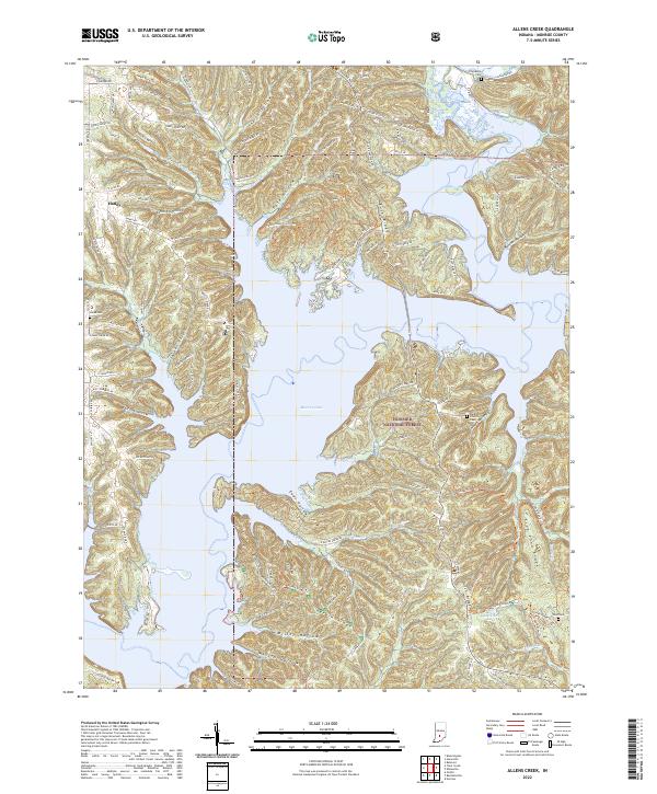 2022 Allens Creek2022 Print · USGSMonroe County, Indiana, is defined by the massive Monroe Lake and the wooded terrain of the Hoosier National Forest in this recent survey. Researchers can locate family landmarks like Friendship Cem, Todd Cem, and the historic Burgoon Church.
 - 2022 Map of Bloomington, 2022 Print
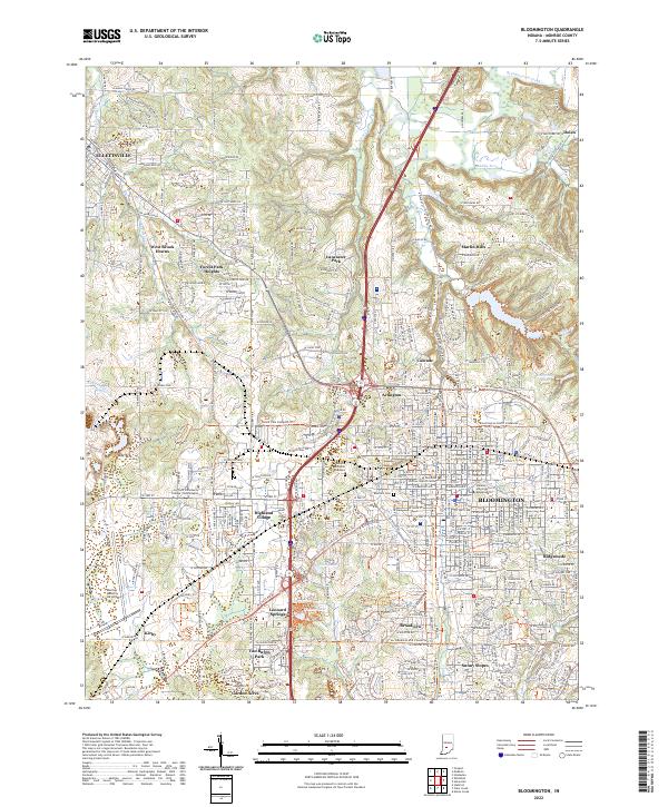 2022 Bloomington2022 Print · USGSThe Indiana university town and surrounding Monroe County countryside are captured here in the early 2020s. Genealogists and historians can trace the development of Bloomington and Ellettsville, alongside landmarks like Rose Hill Cem and the campus of Indiana University Bloomington.
 - 2022 Map of Clear Creek, 2022 Print
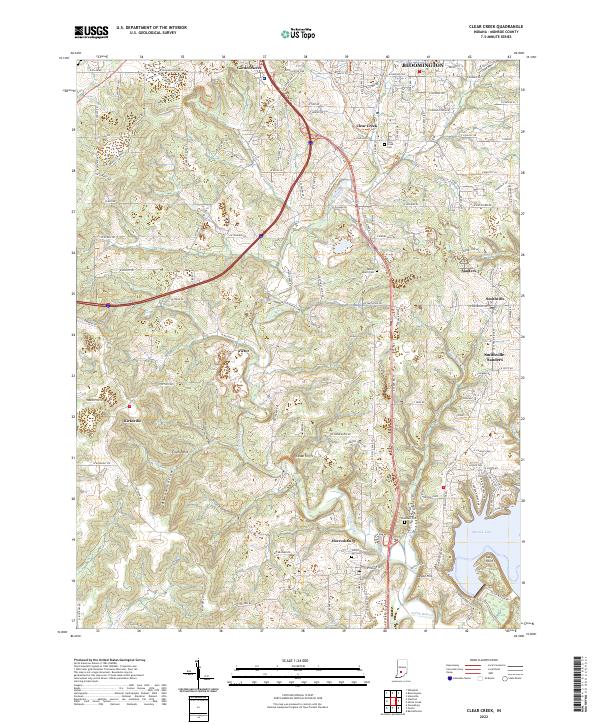 2022 Clear Creek2022 Print · USGSMonroe County south of Bloomington is shown here in the early 2020s, where rural township history meets the waters of the lake. Researchers can trace family roots at Clear Creek Cem or locate the old rail-and-quarry sites of Victor and Sanders.
 - 2022 Map of Elkinsville, 2022 Print
 2022 Elkinsville2022 Print · USGSSouthern Indiana's ridges and valleys are mapped here in the early 2020s, showing the intersection of three counties within the Hoosier National Forest. Researchers can trace old family sites and rural settlements like Maumee and Elkinsville, or locate Terrill Cemetery and Robertson Cemetery.
 - 2022 Map of Belmont, 2022 Print
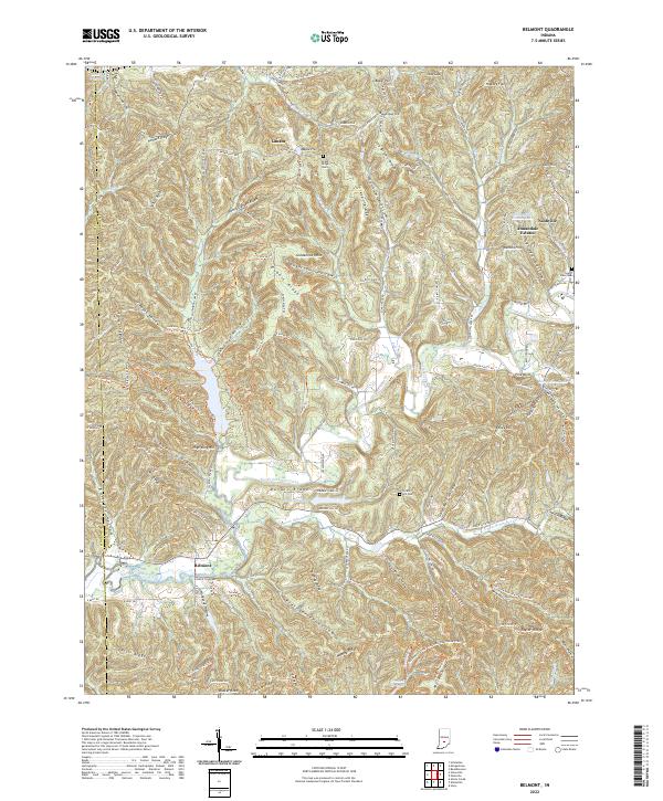 2022 Belmont2022 Print · USGSThe wooded ridges and hollows of Brown County are documented here in the early twenty-first century, centered on the North Fork Salt Creek watershed. Genealogists and historians can locate family landmarks like Lanam Ridge Cem and South View Cem, alongside the small communities of Nashville, Lanam, and Belmont.
End of results
Showing maps 1-16 of 16
Top cities of Monroe County
- Bloomington historical maps
- Ellettsville historical maps
- Clear Creek historical maps
- Stinesville historical maps
Frequently asked questions
- What are the different types of historical maps available for Monroe County?
- What is the oldest map of Monroe County?
- Where can I purchase historical maps of Monroe County for my home or office?
- Where can I download high-res historical maps of Monroe County?
- Are there historical topographic maps available for Monroe County?
- Is there historical aerial imagery available for Monroe County?
- Where are historical maps of Monroe County sourced from?