Old Maps of Beverly Shores, Indiana
Explore 23 old maps of Beverly Shores, spanning from 1934 to today. These high-resolution historic maps reveal how streets, neighborhoods, landmarks, and natural features evolved over time — perfect for genealogy, metal detecting, research, and local history exploration.
What you can do with these maps:
- See how Beverly Shores changed over time: Compare historical maps to modern-day views to trace roads, homesites, rail lines & more.
- View detailed metadata: Each map includes creators, publishers, year, scale, and archive source.
- Overlay maps with satellite & LiDAR: Visualize the past alongside modern tools to explore terrain & human change.
- Trusted historical sources: Maps sourced from the USGS, Library of Congress, and other archives.
- Access maps your way: View online, download high-res files, or order prints for personal or research use.
Start exploring old maps of Beverly Shores to uncover forgotten places, hidden landmarks, and the deep history beneath your feet.
Beverly Shores, IN maps
(23)- 1934 Map of Porter
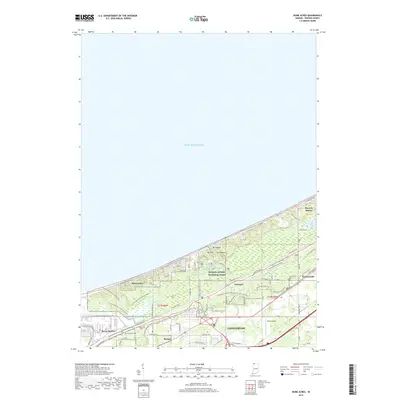
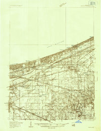 1934 Porter1934 Print · USGSThe Indiana shoreline of the mid-1930s is mapped here in detail, from the sands of Indiana Dunes State Park to the rail hubs of Chesterton. Trace local family history through sites like the Seven Dolors Shrine, Liberty Center Sch, and the Mc Cool Emergency Landing Field.
 - 1940 Map of Porter
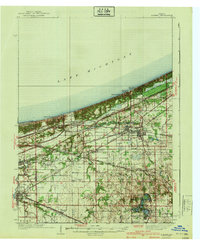 1940 Porter1940 Print · USGSPorter County's industrial and shoreline heritage is captured here in the years before World War II. Researchers can locate early lakefront settlements like Baillytown or trace the routes of the Wabash and Pere Marquette railroads past Tratebas Mill.3 unique versions available
 - 1953 Map of Dune Acres, 1955 Print
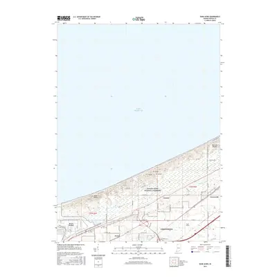
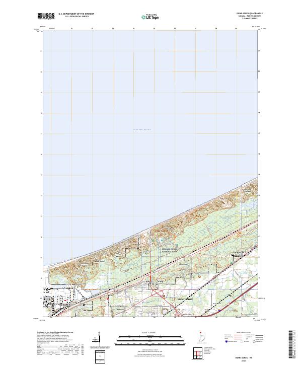
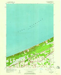 1953 Dune Acres1955 Print · USGSThe Indiana shoreline during the early fifties reveals a landscape where conservation at Indiana Dunes State Park meets a dense rail corridor. Genealogists and researchers can locate Burstrom Cem, Bailey Cem, and the early footprints of Dune Acres and Baileytown.2 unique versions available
 - 1953 Map of Michigan City West, 1955 Print
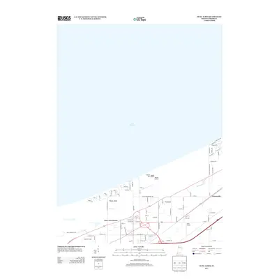
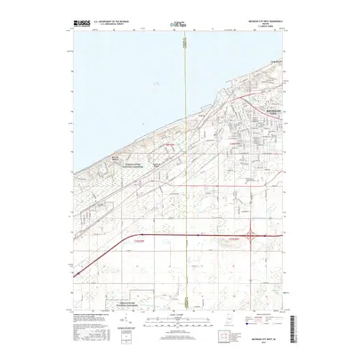
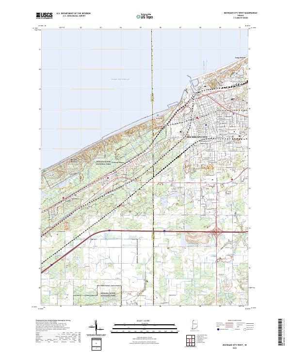
 1953 Michigan City West1955 Print · USGSMichigan City and the Indiana shoreline appear in the early fifties as a bustling hub of rail and industry. Trace the footprints of civic life at State Prison, Greenwood Cemetery, and the Bayles Sch (Abandoned) while exploring the dunes.
 - 1953 Map of Chicago, 1964 Print
 1953 Chicago1964 Print · USGSThe southern Lake Michigan shoreline was rapidly modernizing in the mid-fifties, balancing heavy industry with its famous academic centers. Researchers can trace the footprints of Notre Dame University or locate vanished sites like the Kingsbury Ordnance Plant and Meigs Field.5 unique versions available
 - 1957 Map of Chicago
 1957 Chicago1957 Print · USGSThe industrial heartland and southern Great Lakes shoreline are captured here during the peak of mid-century growth. Researchers can trace the massive Gary Steel Works, the grounds of the University of Notre Dame, and the early paths of the Tri-State Tollway.
 - 1962 Map of Michigan City West, 1964 Print
 1962 Michigan City West1964 Print · USGSCoastal life and heavy industry meet along the Indiana dunes in the early sixties. Genealogists and rail historians can trace the paths of the South Shore Line, local schools like Barker Jr High, and the grounds of the State Prison.
 - 1968 Map of Dune Acres, 1970 Print
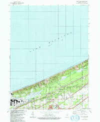
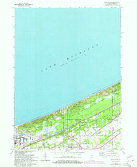 1968 Dune Acres1970 Print · USGSThe Indiana shoreline was undergoing a dramatic evolution in the late sixties as conservation efforts met industrial expansion. Trace family roots at Bailey Cem or explore the early boundaries of Beverly Shores and the peaks of Mt Tom.2 unique versions available
 - 1969 Map of Michigan City West, 1971 Print
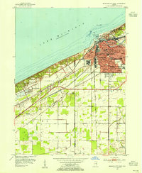
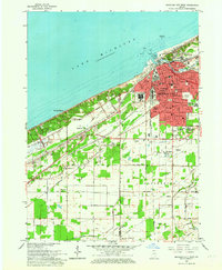
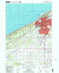
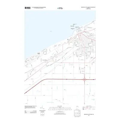
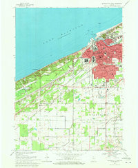 1969 Michigan City West1971 Print · USGSThe Indiana shoreline of Lake Michigan comes into focus here during the late sixties, showing the industrial and residential growth of MICHIGAN CITY. Researchers can trace the massive State Prison, the lakefront Washington Park, and the early layout of Beverly Shores.4 unique versions available
 - 1980 Map of Chicago
 1980 Chicago1980 Print · USGSThe Chicago metropolitan area and the industrial shores of Northwest Indiana are captured here at the start of the 1980s. Genealogists and local historians can trace the vast urban landscape through landmarks like Loyola University, St Casimir Cemetery, and the busy docks of Calumet Harbor.
 - 1983 Map of South Bend, 1984 Print
 1983 South Bend1984 Print · USGSThe Indiana-Michigan borderlands come alive in this early 1980s overview of the Michiana region's industrial and academic hubs. Researchers can trace the rail networks of Conrail and the Grand Trunk Western alongside landmarks like the University of Notre Dame and Indiana Dunes State Park.2 unique versions available
 - 1991 Map of Dune Acres, 1992 Print
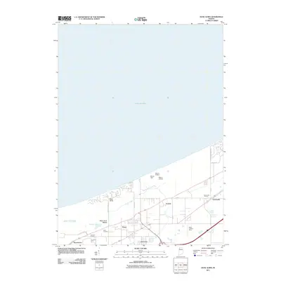
 1991 Dune Acres1992 Print · USGSCoastal Porter County in the early 1990s showcases the intersection of protected lakefront and industrial growth. Genealogists and local historians can locate Baily Cem, the hamlet of Furnessville, and early transport markers like Dune Acres Station.
 - 1994 Map of Michigan City West, 1999 Print
 1994 Michigan City West1999 Print · USGSCoastal Indiana at the end of the century reveals the deep integration of the South Shore Line with the growing residential and industrial lakefront. Researchers can trace local history through landmarks like the State Prison, Greenwood Cemetery, and the schools of Michigan City.
 - 2010 Map of Michigan City West, 2010 Print
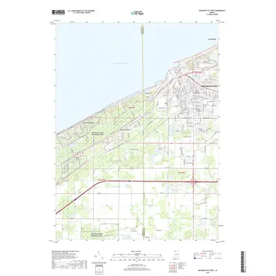
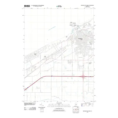 2010 Michigan City West2010 Print · USGSCovers Beverly Shores, including Michigan City, Long Beach, and other nearby areas
 - 2011 Map of Dune Acres, 2011 Print
 2011 Dune Acres2011 Print · USGSCovers Beverly Shores, including Chesterton, Porter, and other nearby areas
 - 2013 Map of Dune Acres, 2013 Print
 2013 Dune Acres2013 Print · USGSCovers Beverly Shores, including Chesterton, Porter, and other nearby areas
 - 2013 Map of Michigan City West, 2013 Print
 2013 Michigan City West2013 Print · USGSCovers Beverly Shores, including Michigan City, Long Beach, and other nearby areas
 - 2016 Map of Dune Acres, 2016 Print
 2016 Dune Acres2016 Print · USGSCovers Beverly Shores, including Chesterton, Porter, and other nearby areas
 - 2016 Map of Michigan City West, 2016 Print
 2016 Michigan City West2016 Print · USGSCovers Beverly Shores, including Michigan City, Long Beach, and other nearby areas
 - 2019 Map of Michigan City West, 2019 Print
 2019 Michigan City West2019 Print · USGSCovers Beverly Shores, including Michigan City, Long Beach, and other nearby areas
 - 2019 Map of Dune Acres, 2019 Print
 2019 Dune Acres2019 Print · USGSCovers Beverly Shores, including Chesterton, Porter, and other nearby areas
 - 2022 Map of Dune Acres, 2022 Print
 2022 Dune Acres2022 Print · USGSThe Indiana shoreline at the start of the 2020s shows the unique meeting of heavy industry and protected wilderness. Trace local history through the Bally Cem and Furnessville Cem, or explore the trails around Cowles Bog and Mt Tom.
 - 2022 Map of Michigan City West, 2022 Print
 2022 Michigan City West2022 Print · USGSThe Indiana shoreline comes into focus during the early 2020s, showing the intersection of industrial Michigan City and preserved dunes. Genealogists and researchers can locate Greenwood Cem, Saint Stanislaus Cem, and the La Porte County Superior Courthouse.
End of results
Showing maps 1-23 of 23
Top cities near Beverly Shores
- Portage historical maps
- Valparaiso historical maps
- Michigan City historical maps
- La Porte historical maps
- Chesterton historical maps
- Porter historical maps
See more
Frequently asked questions
- What are the different types of historical maps available for Beverly Shores?
- What is the oldest map of Beverly Shores?
- Where can I purchase historical maps of Beverly Shores for my home or office?
- Where can I download high-res historical maps of Beverly Shores?
- Are there historical topographic maps available for Beverly Shores?
- Is there historical aerial imagery available for Beverly Shores?
- Where are historical maps of Beverly Shores sourced from?